Safety Score: 3,0 of 5.0 based on data from 9 authorites. Meaning we advice caution when travelling to United Kingdom.
Travel warnings are updated daily. Source: Travel Warning United Kingdom. Last Update: 2024-04-25 08:17:04
Explore Llangattock Lingoed
Llangattock Lingoed in Monmouthshire (Wales) is located in United Kingdom about 123 mi (or 197 km) west of London, the country's capital.
Local time in Llangattock Lingoed is now 01:48 AM (Friday). The local timezone is named Europe / London with an UTC offset of one hour. We know of 10 airports in the wider vicinity of Llangattock Lingoed, of which 5 are larger airports. The closest airport in United Kingdom is Bristol Filton Airport in a distance of 29 mi (or 46 km), South-East. Besides the airports, there are other travel options available (check left side).
There are several Unesco world heritage sites nearby. The closest heritage site in United Kingdom is Blaenavon Industrial Landscape in a distance of 7 mi (or 11 km), South. Also, if you like golfing, there are multiple options in driving distance. If you need a place to sleep, we compiled a list of available hotels close to the map centre further down the page.
Depending on your travel schedule, you might want to pay a visit to some of the following locations: Llancillo, Rowlstone, Grosmont, Longtown and Abbey Dore. To further explore this place, just scroll down and browse the available info.
Local weather forecast
Todays Local Weather Conditions & Forecast: 9°C / 48 °F
| Morning Temperature | 2°C / 36 °F |
| Evening Temperature | 8°C / 46 °F |
| Night Temperature | 5°C / 41 °F |
| Chance of rainfall | 0% |
| Air Humidity | 63% |
| Air Pressure | 1003 hPa |
| Wind Speed | Gentle Breeze with 8 km/h (5 mph) from West |
| Cloud Conditions | Overcast clouds, covering 97% of sky |
| General Conditions | Light rain |
Saturday, 27th of April 2024
4°C (39 °F)
5°C (41 °F)
Light rain, gentle breeze, overcast clouds.
Sunday, 28th of April 2024
11°C (52 °F)
3°C (38 °F)
Light rain, gentle breeze, overcast clouds.
Monday, 29th of April 2024
12°C (53 °F)
5°C (41 °F)
Light rain, moderate breeze, overcast clouds.
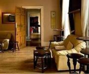
Hotels and Places to Stay
The Park Hotel
Videos from this area
These are videos related to the place based on their proximity to this place.
Tin Plate Toy
This and other tin toys are available in our auction of September 15th 2007. for more information www.nigel-ward.co.uk.
37425 Abergavenny 6M82
With the light drizzle catching out the driver, 425 thrashes through Abergavenny on 16/05/05 with 6M82 1958 Newport ADJ to Crewe BH engineers.
The Oasis Biker's Cafe in Abergavenny
Subscribe for the love of motorcycles and the great outdoors: http://www.youtube.com/subscription_center?add_user=wiltshirebyways Please click 'S H O W M O R E' for route info: ↓↓↓↓↓↓...
Ducati 848 & 998 riding from Abergavenny to Usk
Run back from Abergavenny to Usk, Sunday 02/10/11 taking onboard a Ducati 848 with an 808 camera.
Stephen Terry's Meals in Minutes - Spaghetti with courgettes tomatoes and capers
http://www.thehardwick.co.uk/ Stephen Terry of The Hardwick, Abergavenny shows you how to cook the perfect pasta dish of spaghetti with tomatoes, courgettes and capers.
Brecon Beacons Landscape Photographers Diary...23rd August Hill Forts & High Hopes
Diary of a Brecon Beacons Landscape photographer. A visit to Pen Twyn Bronze age hill fort along the Offas Dyke path on the Hatterrall Hill in the hight of heater season more info visit http://wp.m...
Videos provided by Youtube are under the copyright of their owners.
Attractions and noteworthy things
Distances are based on the centre of the city/town and sightseeing location. This list contains brief abstracts about monuments, holiday activities, national parcs, museums, organisations and more from the area as well as interesting facts about the region itself. Where available, you'll find the corresponding homepage. Otherwise the related wikipedia article.
Ysgyryd Fawr
Ysgyryd Fawr is the most easterly of the Black Mountains in Wales, part of the Brecon Beacons National Park. The name is often anglicised to The Skirrid or Skirrid Fawr, and the mountain is also known as Holy Mountain or Sacred Hill. The spelling Skyrrid is also encountered in older literature. The lower hill of Ysgyryd Fach or 'Little Skirrid' (270m) lies about 4.5 km / 2.5 mi to the south. It is 486 m high and lies just outside Abergavenny http://www. geograph. org.
Llanddewi Skirrid
Llanddewi Skirrid is a village in Monmouthshire, south east Wales, United Kingdom.


