Safety Score: 3,0 of 5.0 based on data from 9 authorites. Meaning we advice caution when travelling to United Kingdom.
Travel warnings are updated daily. Source: Travel Warning United Kingdom. Last Update: 2024-04-26 08:02:42
Touring Llangattock nigh Usk
Llangattock nigh Usk in Monmouthshire (Wales) is a town located in United Kingdom about 123 mi (or 198 km) west of London, the country's capital place.
Time in Llangattock nigh Usk is now 02:35 AM (Saturday). The local timezone is named Europe / London with an UTC offset of one hour. We know of 11 airports nearby Llangattock nigh Usk, of which 5 are larger airports. The closest airport in United Kingdom is Bristol Filton Airport in a distance of 24 mi (or 39 km), South-East. Besides the airports, there are other travel options available (check left side).
There are several Unesco world heritage sites nearby. The closest heritage site in United Kingdom is Blaenavon Industrial Landscape in a distance of 2 mi (or 4 km), East. Also, if you like the game of golf, there are several options within driving distance. We collected 1 points of interest near this location. Need some hints on where to stay? We compiled a list of available hotels close to the map centre further down the page.
Being here already, you might want to pay a visit to some of the following locations: Llanarth, New Inn, Llanbadoc, Pontypool and Llangybi. To further explore this place, just scroll down and browse the available info.
Local weather forecast
Todays Local Weather Conditions & Forecast: 7°C / 44 °F
| Morning Temperature | 3°C / 38 °F |
| Evening Temperature | 6°C / 42 °F |
| Night Temperature | 5°C / 41 °F |
| Chance of rainfall | 1% |
| Air Humidity | 85% |
| Air Pressure | 1004 hPa |
| Wind Speed | Moderate breeze with 11 km/h (7 mph) from South-West |
| Cloud Conditions | Overcast clouds, covering 100% of sky |
| General Conditions | Light rain |
Sunday, 28th of April 2024
6°C (43 °F)
3°C (37 °F)
Heavy intensity rain, fresh breeze, overcast clouds.
Monday, 29th of April 2024
11°C (52 °F)
5°C (41 °F)
Light rain, fresh breeze, broken clouds.
Tuesday, 30th of April 2024
9°C (48 °F)
9°C (49 °F)
Light rain, fresh breeze, overcast clouds.
Hotels and Places to Stay
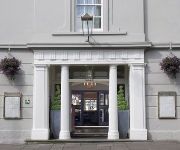
The Angel Hotel Abergavenny
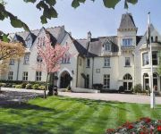
Glen-yr-afon House Hotel
BW PONTYPOOL METRO HOTEL
Pontypool
Videos from this area
These are videos related to the place based on their proximity to this place.
Abergavenny Livestock market, June 2012
Wednesday's are a busy day in Abergavenny at the Livestock market, located in the heart of the town.
Starlings over Abergavenny
These starlings were doing their amazing flying display 'murmuration' over Bailey Park as I walked to town.
A Ride Through Abergavenny in Monmouthshire
Subscribe for the love of motorcycles and the great outdoors: http://www.youtube.com/subscription_center?add_user=wiltshirebyways Please click 'S H O W M O R E' for route info: ↓↓↓↓↓↓...
Abergavenny's Best Bits from 2010 Onwards! Part 1
This video celebrates my 4 year anniversary for my youtube account! Most clips were recorded at Abergavenny Station but some were recorded from the Old Station at Penpergwm. This includes best...
37425 Abergavenny 6M82
With the light drizzle catching out the driver, 425 thrashes through Abergavenny on 16/05/05 with 6M82 1958 Newport ADJ to Crewe BH engineers.
Abergavenny to Cardiff Millenium Stadium
Picking-up the banner to 'Save the QDG, Welsh Cavalry' at Abergavenny on 2nd June 2012 in very poor weather conditions. Then off to the Wales vs Barbarians rugby match at the Cardiff Millennium...
The Oasis Biker's Cafe in Abergavenny
Subscribe for the love of motorcycles and the great outdoors: http://www.youtube.com/subscription_center?add_user=wiltshirebyways Please click 'S H O W M O R E' for route info: ↓↓↓↓↓↓...
Abergavenny To Cwmbran
Cycling along the towpath alongside the Monmouthshire & Brecon Canal, Gwent, South Wales. Sorry for the poor quality video, only the HTC One I used couldnt take all the bouncing up and down....
Videos provided by Youtube are under the copyright of their owners.
Attractions and noteworthy things
Distances are based on the centre of the city/town and sightseeing location. This list contains brief abstracts about monuments, holiday activities, national parcs, museums, organisations and more from the area as well as interesting facts about the region itself. Where available, you'll find the corresponding homepage. Otherwise the related wikipedia article.
Llanddewi Rhydderch
Llanddewi Rhydderch is a village in Monmouthshire, Wales at grid reference SO351130. It is off the B4233 road, roughly five miles from Abergavenny.
Bettws Newydd
Bettws Newydd is a small village in Monmouthshire, in southeast Wales
Llanvihangel Gobion
Llanvihangel Gobion is a village and rural parish of Monmouthshire, Wales.
Llanover
Llanover is a village in Monmouthshire, south east Wales, United Kingdom.
Coed Morgan
Coed Morgan is a village and rural area in Monmouthshire, south east Wales, in the United Kingdom.
Aberffrwd, Monmouthshire
Aberffrwd is a village in Monmouthshire, Wales. It lies on the River Usk just off the A40. {{#invoke:Coordinates|coord}}{{#coordinates:51|46|48|N|2|56|06|W| |primary |name= }}
Ysgyryd Fach
Ysgyryd Fach is a hill one mile east of Abergavenny in the county of Monmouthshire, south Wales. It is often referred to in English as 'Little Skirrid' or sometimes as 'Skirrid Fach'. Its summit height is just over 270m. A conifer plantation extends over much of the hill including its summit thus restricting outward views from it. The hill is considered to be one of the 'seven hills of Abergavenny'.
Castell Arnallt
Castell Arnallt (Castle Arnold), located below Abergavenny and near modern-day Llanover in the Usk Valley of Monmouthshire, Wales, was a fortification believed to have been the site of the palace of the Kings of Over Gwent. The structure there was destroyed in 1175 and as such little is remaining today beyond the natural mound it sat atop and the remnants of two enclosures.


