Safety Score: 3,0 of 5.0 based on data from 9 authorites. Meaning we advice caution when travelling to United Kingdom.
Travel warnings are updated daily. Source: Travel Warning United Kingdom. Last Update: 2024-04-28 08:22:10
Discover Gilwern
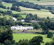
Gilwern in Monmouthshire (Wales) with it's 2,263 citizens is a city in United Kingdom about 129 mi (or 208 km) west of London, the country's capital city.
Local time in Gilwern is now 04:18 AM (Monday). The local timezone is named Europe / London with an UTC offset of one hour. We know of 9 airports in the vicinity of Gilwern, of which 4 are larger airports. The closest airport in United Kingdom is Bristol Filton Airport in a distance of 30 mi (or 49 km), South-East. Besides the airports, there are other travel options available (check left side).
There are several Unesco world heritage sites nearby. The closest heritage site in United Kingdom is Blaenavon Industrial Landscape in a distance of 8 mi (or 14 km), South-East. Also, if you like golfing, there are a few options in driving distance. Looking for a place to stay? we compiled a list of available hotels close to the map centre further down the page.
When in this area, you might want to pay a visit to some of the following locations: Brynmawr, Cwm, Ebbw Vale, Pontypool and Crumlin. To further explore this place, just scroll down and browse the available info.
Local weather forecast
Todays Local Weather Conditions & Forecast: 10°C / 49 °F
| Morning Temperature | 7°C / 45 °F |
| Evening Temperature | 9°C / 48 °F |
| Night Temperature | 9°C / 49 °F |
| Chance of rainfall | 14% |
| Air Humidity | 95% |
| Air Pressure | 1010 hPa |
| Wind Speed | Fresh Breeze with 15 km/h (10 mph) from North |
| Cloud Conditions | Overcast clouds, covering 100% of sky |
| General Conditions | Moderate rain |
Tuesday, 30th of April 2024
12°C (54 °F)
6°C (42 °F)
Moderate rain, fresh breeze, overcast clouds.
Wednesday, 1st of May 2024
10°C (49 °F)
8°C (46 °F)
Moderate rain, light breeze, overcast clouds.
Thursday, 2nd of May 2024
8°C (47 °F)
7°C (44 °F)
Moderate rain, gentle breeze, overcast clouds.
Hotels and Places to Stay
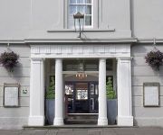
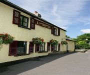
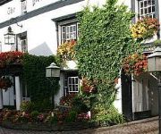
Dragon Inn Crickhowell
The Angel Hotel Abergavenny
Llanwenarth Hotel
Bear Crickhowell
Manor
Videos from this area
These are videos related to the place based on their proximity to this place.
Caving Video: Ogof Craig A Ffynnon
A Dudley Caving Club trip on Saturday 20th November 2010 to the Hall of the Mountain Kings.
Caving Video: Return to Ogof Craig A Ffynnon
It's always a high risk strategy taking a journalist caving, but caving's not without its risks anyway. This is the story of one such journalist's introduction to caving with Dudley Caving...
Paragliding above Abergavenny.
Me with friends, Mark and Martin, enjoying a fly after work above Abergavenny South Wales UK. 30/04/2013 Better than being behind that desk!
Sugar Loaf Microadventure with Jonas
I grabbed my 4-year old boy one Friday afternoon and we blatted over to Sugar Loaf near Abergavenny. It was a brisk round trip of 2 hours with a brief stop to cook dinner on the way down. A...
23rd Brecon Beacon landscape Photography Diary...Quercus Epiphany
The end of November and we leave the ancient deciduous woodland of the Brecon Beacons. more info please visit http://blackmountainsphotography.com/category/diary/
Brecons Beacons Landscape Photography Diary...9th September Dragons Breath and the Holy Mountain
A Brecon Beacons Landscape Photography Diary. High pressure and cold nights are great conditions to find a dawn Dragons Breath and we climb the Sugar Loaf above Abergavenny in search of the...
Transformers Dark of the Moon Extras unlockables and movies - Xbox 360
Transformers Dark of the Moon Extras unlockables and movies - Xbox 360.
GoPro Time Lapse
Timelapse taken with GoPro Hero 3 Black Edition, Canon 30D and iPhone 4S (Lapse It) Taken from Sugar Loaf Mountain, Skirrid, White Castle and my back garden.
Videos provided by Youtube are under the copyright of their owners.
Attractions and noteworthy things
Distances are based on the centre of the city/town and sightseeing location. This list contains brief abstracts about monuments, holiday activities, national parcs, museums, organisations and more from the area as well as interesting facts about the region itself. Where available, you'll find the corresponding homepage. Otherwise the related wikipedia article.
Llanelly
Llanelly is the name of both a village and its respective parish in Monmouthshire principal area, within the historic boundaries of Brecknockshire, south-east Wales.
Ogof Draenen
Ogof Draenen (Welsh for Hawthorn Cave) is, at 66 km (official figure; the true length of passage is still being revised upward, with a rough modern approximation at it being 70 km), the longest cave system in Wales and the second longest in Great Britain behind the Easegill System, Lost Johns and Notts 2 system in North Yorkshire. The cave was known only as a small entrance on a steep hillside until several years of digging broke through into major passage development in October 1994.
Monmouthshire and Brecon Canal
The Monmouthshire and Brecon Canal is a small network of canals in South Wales. For most of its 35-mile length it runs through the Brecon Beacons National Park, and its present rural character and tranquillity belies its original purpose as an industrial corridor for coal and iron, which were brought to the canal by a network of tramways and/or railroads, many of which were built and owned by the canal company.
Gilwern
Gilwern is a village in Monmouthshire, Wales. The name is translated from the Welsh language as "the nook near the alder grove". It is within the Llanelly parish ward of Monmouthshire County Council, 4 miles west of market town of Abergavenny.
Y Graig
Y Graig, three miles west of Abergavenny, is the site of an abandoned settlement, known to have been occupied in the 18th and 19th centuries. It is a Scheduled Ancient Monument in the care of Cadw.
Grwyne Fawr
The Grwyne Fawr is a river in the Brecon Beacons National Park in south Wales. A section of it forms the administrative border between Powys and Monmouthshire and also of the historic counties of Brecon and Monmouth. The river and its major tributary the Grwyne Fechan flow into the River Usk at Glangrwyney. The name probably originates from gweryn or gwerynau and mawr/fawr meaning 'large river at the wet place'.
Gilwern Hill, Monmouthshire
Not to be confused with Gilwern Hill, Powys east of Llandrindod Wells. Gilwern Hill {{#invoke:InfoboxImage|InfoboxImage|image=Downhill towards The Tumble - geograph. org. uk - 470317.
Abergavenny transmitting station
The Abergavenny transmitting station was originally built by the IBA in 1969 as a relay for BBC and ITV VHF 405-line analogue television. It consists of a 46 m guyed lattice mast carrying the aerials at the top. This structure was built on a 440 m hill known as Gilwern Hill overlooking the towns of Gilwern and Abergavenny in Monmouthshire, South Wales. The band III VHF television feeds were provided off-air from St. Hilary and Wenvoe, both near Cardiff.


