Safety Score: 3,0 of 5.0 based on data from 9 authorites. Meaning we advice caution when travelling to United Kingdom.
Travel warnings are updated daily. Source: Travel Warning United Kingdom. Last Update: 2024-04-28 08:22:10
Explore Llangattock
Llangattock in Powys (Wales) with it's 662 inhabitants is a city in United Kingdom about 132 mi (or 212 km) west of London, the country's capital.
Local time in Llangattock is now 01:19 AM (Monday). The local timezone is named Europe / London with an UTC offset of one hour. We know of 8 airports in the vicinity of Llangattock, of which 3 are larger airports. The closest airport in United Kingdom is Cardiff International Airport in a distance of 33 mi (or 52 km), South. Besides the airports, there are other travel options available (check left side).
There are several Unesco world heritage sites nearby. The closest heritage site in United Kingdom is Blaenavon Industrial Landscape in a distance of 11 mi (or 18 km), South-East. Also, if you like golfing, there are multiple options in driving distance. If you need a place to sleep, we compiled a list of available hotels close to the map centre further down the page.
Depending on your travel schedule, you might want to pay a visit to some of the following locations: Brynmawr, Ebbw Vale, Cwm, Crumlin and Pontypool. To further explore this place, just scroll down and browse the available info.
Local weather forecast
Todays Local Weather Conditions & Forecast: 10°C / 49 °F
| Morning Temperature | 7°C / 45 °F |
| Evening Temperature | 9°C / 48 °F |
| Night Temperature | 9°C / 49 °F |
| Chance of rainfall | 14% |
| Air Humidity | 95% |
| Air Pressure | 1010 hPa |
| Wind Speed | Fresh Breeze with 15 km/h (10 mph) from North |
| Cloud Conditions | Overcast clouds, covering 100% of sky |
| General Conditions | Moderate rain |
Tuesday, 30th of April 2024
12°C (54 °F)
6°C (42 °F)
Moderate rain, fresh breeze, overcast clouds.
Wednesday, 1st of May 2024
10°C (49 °F)
8°C (46 °F)
Moderate rain, light breeze, overcast clouds.
Thursday, 2nd of May 2024
8°C (47 °F)
7°C (44 °F)
Moderate rain, gentle breeze, overcast clouds.
Hotels and Places to Stay
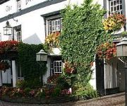
Dragon Inn Crickhowell
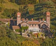
Gliffaes Country House Hotel
Bear Crickhowell
Manor
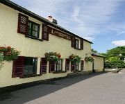
Llanwenarth Hotel
Gliffaes Hotel
Videos from this area
These are videos related to the place based on their proximity to this place.
Caveman of Wales
Caveman of Wales WATCH IN 480 OR 720 HD - CLICK SETTINGS WHEEL BELOW RIGHT OF VIDEO Meeting Jason the 'Caveman of Wales' who was explaining the underground caving system near ...
A trip to Crickhowell -- May 2010 pt. 1
Had a lovely day out visiting Crickhowell. Such a peaceful tranquil setting. Hope you enjoy part 1. Best wishes Timothy.
The Old Rectory Country Hotel & Golf Club Weddings, Llangattock
Wedding Highlights Film http://www.weddingvideowales.com.
A trip to Crickhowell -- May 2010 pt. 2
Had a lovely day out visiting Crickhowell. Such a peaceful tranquil setting. Hope you enjoy part 2. Best wishes Timothy.
SDCC River Usk Kayaking - GoPro HD Hero 3
Swindon and District Canoe Club trip on the Usk from Talybont to Crickhowell. Level was 2.5 on the Brecon gauge.
Videos provided by Youtube are under the copyright of their owners.
Attractions and noteworthy things
Distances are based on the centre of the city/town and sightseeing location. This list contains brief abstracts about monuments, holiday activities, national parcs, museums, organisations and more from the area as well as interesting facts about the region itself. Where available, you'll find the corresponding homepage. Otherwise the related wikipedia article.
Crug Hywel
Crug Hywel is a flat-topped hill at the southern edge of the Black Mountains in south-east Wales. It rises to 451 m above sea level, from the southern flank of Pen Cerrig-calch (701 m), and overlooks the town of Crickhowell, to which it gives its name. The summit of the hill is entirely taken up by an Iron Age hill fort, with a clearly visible earth and stone ditch and rampart.
Glanusk Park
Glanusk Park is an estate in Wales, United Kingdom. It is situated near Crickhowell, Powys. It was established in 1826 by a 'retired' ironmaster, Sir Joseph Bailey. The park features in the hereditary title Baron Glanusk which was given to Sir Joseph's grandson, Sir Joseph Russell Bailey in 1899. At that time Baron Glanusk was the Lord Lieutenant of Brecknockshire. Glanusk Park and Estate is privately owned by the Legge-Bourke family.
Ogof Agen Allwedd
Ogof Agen Allwedd or Agen Allwed, also known as Aggy, is, at 32½ km long, one of the longest cave systems in Wales, and the longest cave system on the Llangattock escarpment, where Ogof y Daren Cilau is also found. There are several round trips that can be followed within the system, but all trips start via the short entrance series and first boulder choke, which is mostly easy caving.
Ogof y Daren Cilau
Ogof y Daren Cilau is one of several cave systems in the Llangattock escarpment near Crickhowell in south Powys, Wales. Its awkward 517m entrance crawl is a natural barrier to any casual visitor and precludes the need for a locked gate to protect it from vandals. Highlights of Daren Cilau include the Time Machine, the largest cave passage in Britain; the White Company, a set of pure white stalactites; and the Bonsai Tree, a branching helictite.
Craig y Cilau
Craig y Cilau is a limestone escarpment in the Brecon Beacons National Park in Powys, Wales. It was declared a National Nature Reserve in 1959 because of its importance for wildlife, particularly plants. It is situated on the north side of Mynydd Llangatwg in Llangattock community, about 2 miles south-west of Crickhowell. The reserve covers 157 acres and has a varied geology with Old Red Sandstone below the cliffs and Millstone Grit above them.
Cwrt y Gollen
Cwrt y Gollen was a British Army training base one mile east of Crickhowell at grid reference SO234169 just north of the A40 road and the River Usk. There are still a small number of military units using the estate. It is close to the location of the bridge where Dickie Valentine died at in a car crash in 1971. The bridge has since been removed and replaced with a new wider and flatter version.
Mynydd Llangatwg
Mynydd Llangatwg or Llangattock Mountain is a hill in the Brecon Beacons National Park in the county of Powys, south Wales. It is named from the village of Llangatwg which sits in the valley of the River Usk to the north of it. It is essentially an undulating plateau rising in the west to a height of 530 metres at grid reference SO171157 and in the east to a height of 529 metres at Hen Dy-aderyn / Twr Pen-cyrn. This spot is marked by a trig point.
Llangattock (Crickhowell)
Llangattock (or Llangatwg in Welsh) is a village in the Brecon Beacons National Park in the south of Powys in south Wales. It lies in the Usk Valley just across the river from the town of Crickhowell. The Monmouthshire and Brecon Canal passes through the village en route between Brecon and Pontypool. To the south of the village is the imposing Llangattock Escarpment whose great limestone cliffs were scarred by extensive quarrying in the nineteenth century.


