Safety Score: 3,0 of 5.0 based on data from 9 authorites. Meaning we advice caution when travelling to United Kingdom.
Travel warnings are updated daily. Source: Travel Warning United Kingdom. Last Update: 2024-05-08 08:04:21
Discover Cathedine
Cathedine in Powys (Wales) is a city in United Kingdom about 137 mi (or 220 km) west of London, the country's capital city.
Local time in Cathedine is now 10:46 AM (Wednesday). The local timezone is named Europe / London with an UTC offset of one hour. We know of 8 airports in the vicinity of Cathedine, of which 3 are larger airports. The closest airport in United Kingdom is Cardiff International Airport in a distance of 36 mi (or 58 km), South. Besides the airports, there are other travel options available (check left side).
There are several Unesco world heritage sites nearby. The closest heritage site in United Kingdom is Blaenavon Industrial Landscape in a distance of 17 mi (or 28 km), South-East. Also, if you like golfing, there is an option about 25 mi (or 41 km). away. Looking for a place to stay? we compiled a list of available hotels close to the map centre further down the page.
When in this area, you might want to pay a visit to some of the following locations: Brynmawr, Ebbw Vale, Cwm, Hay-on-wye and Merthyr Tydfil. To further explore this place, just scroll down and browse the available info.
Local weather forecast
Todays Local Weather Conditions & Forecast: 17°C / 63 °F
| Morning Temperature | 12°C / 53 °F |
| Evening Temperature | 14°C / 57 °F |
| Night Temperature | 10°C / 50 °F |
| Chance of rainfall | 0% |
| Air Humidity | 69% |
| Air Pressure | 1028 hPa |
| Wind Speed | Gentle Breeze with 7 km/h (4 mph) from East |
| Cloud Conditions | Overcast clouds, covering 99% of sky |
| General Conditions | Overcast clouds |
Thursday, 9th of May 2024
17°C (63 °F)
13°C (55 °F)
Overcast clouds, light breeze.
Friday, 10th of May 2024
18°C (65 °F)
13°C (56 °F)
Overcast clouds, light breeze.
Saturday, 11th of May 2024
18°C (65 °F)
14°C (56 °F)
Light rain, gentle breeze, broken clouds.
Hotels and Places to Stay
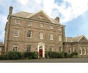
Peterstone Court
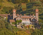
Gliffaes Country House Hotel
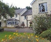
The Usk Inn
Gliffaes Hotel
Videos from this area
These are videos related to the place based on their proximity to this place.
Standard Cirrus sailplane gliding at Talgarth
Soaring the ridge to Hay Bluff on a visit to the Black Mountains Gliding Club from Nympsfield.
BMGC Thermal Soaring presentation March 2013
Thermal Soaring presentation by John Clark and Mike Tomlinson at Black Mountains Gliding Club on 31 March 2013. Finding, entering, centring and leaving thermals efficiently are vital skills...
Timelapse videos at Talgarth.wmv
A series of short timelapse videos taken at Black Mountains Gliding Club at Talgarth in Wales. Shot at 15x or 30x time compression, it shows the formation of clouds that are of interest to...
SDCC River Usk Kayaking - GoPro HD Hero 3
Swindon and District Canoe Club trip on the Usk from Talybont to Crickhowell. Level was 2.5 on the Brecon gauge.
Brecon Beacons Landscape Photographer Diary.. 5th September Crickhowell and the Dragons Breath
A Brecon Beacons landscape photographers diary. Dragons Breath season is developing nicely and we search for the elusive phenomena around the sleepy little welsh village of Crickhowell. more...
Caving Video: Pwll Y Gwynt
Another cave in the series 'We do these caves so that you don't have to'. This cave with little record of visitation provides some sporting caving with its tight squeezes and very muddy passages.
Met een narrowboat over het Monmouthshire & Brecon Canal, deel 2
Deel 2 Een lang gekoesterde wens ging in vervulling; varen met een narrowboat. Wij kozen voor het schitterende Monmouthshire & Brecon Canal in Wales en huurden een mooi, comfortabel scheepje.
Mill Falls July 2009 (after heavy rain)
Running Mill Falls in July 2009 after the heavy rain pushed the river level above the red markers on the Usk gauges and... well actually pushing the river levels well above the gauges!
Videos provided by Youtube are under the copyright of their owners.
Attractions and noteworthy things
Distances are based on the centre of the city/town and sightseeing location. This list contains brief abstracts about monuments, holiday activities, national parcs, museums, organisations and more from the area as well as interesting facts about the region itself. Where available, you'll find the corresponding homepage. Otherwise the related wikipedia article.
Llangorse Lake
Llangorse Lake is the largest natural lake in South Wales, and is situated in the Brecon Beacons National Park, near to the town of Brecon and the village of Llangors. The lake is famous for its coarse fishing, watersports, the afanc (nicknamed 'Gorsey') and the only example of a crannog in Wales. Llangorse lake is also one of the most mentioned sites in Welsh folklore. It is a site of international conservation importance.
Treberfydd
Treberfydd House is a Gothic Revival house, built in 1847-50 just south of Llangorse Lake in the Brecon Beacons National Park in South Wales, to the designs of architect John Loughborough Pearson.
Llygadwy
Llygadwy is a locality near the village of Bwlch in the county of Powys in southeast Wales. The usual meaning of llygad in Welsh is 'eye' but it can signify a spring eg Llygad Llwchwr. The name therefore signifies the source of a stream known traditionally as 'Yw' though which is nowadays known as Ewyn Brook and which flows through a wide, though short, vale known traditionally as Ystradyw. The modern spelling appears to be a corruption of an earlier form Llygadyw.
Blaenllyfni Castle
Blaenllyfni is a ruinous castle near the village of Bwlch in southern Powys, Wales. It was at the centre of the Fitz Herbert barony of Talgarth, which was created as a third part of the Brecon lordship in 1208. The castle was therefore most likely constructed in 1208–1215. It was sacked by Prince Llywelyn ab Iorwerth and Richard Marshall in October 1233.
Allt yr Esgair
Allt yr Esgair is a hill in the Brecon Beacons National Park in the county of Powys, south Wales. It is commonly referred to locally as simply 'The Allt'. The Welsh name signifies 'wooded slope of the ridge'. It takes the form of a northwest-southeast aligned ridge which rises to a height of 393m and which overlooks the valley of the River Usk to the west and south. To the northeast are panoramic views across Llangorse Lake to the Black Mountains.
Mynydd Troed
Mynydd Troed is a hill in the Black Mountains of the Brecon Beacons National Park in Powys, south Wales. It lies 3 miles south of Talgarth and 2 miles northeast of the village of Llangors on the western side of the range. Its summit at the northern end of a northwest to southeast aligned ridge reaches 609m above sea level and is crowned by a trig point.
Mynydd Llangorse
Mynydd Llangorse is a hill on the western edge of the Black Mountains in the Brecon Beacons National Park in Powys, south Wales. It lies two miles east of Llangors and its lake and 5 miles south of Talgarth. Its summit at 515m overtops the location 600m to the south at which a trig point is sited by 9m. The broad spur of Cefn Moel extends south towards the village of Bwlch whilst a spur to the southeast forms Pen Tir which reaches just over 450m above sea level.
Newton, Brecknockshire
Newton of Brecon and the village of Llansantffraed, mid Wales, on the A40 road. It was the birthplace of the poet Henry Vaughan.


