Safety Score: 3,0 of 5.0 based on data from 9 authorites. Meaning we advice caution when travelling to United Kingdom.
Travel warnings are updated daily. Source: Travel Warning United Kingdom. Last Update: 2024-04-29 08:03:39
Discover Spetchley
Spetchley in Worcestershire (England) is a town in United Kingdom about 98 mi (or 158 km) north-west of London, the country's capital city.
Current time in Spetchley is now 08:08 PM (Monday). The local timezone is named Europe / London with an UTC offset of one hour. We know of 10 airports near Spetchley, of which 5 are larger airports. The closest airport in United Kingdom is Gloucestershire Airport in a distance of 20 mi (or 32 km), South. Besides the airports, there are other travel options available (check left side).
There are several Unesco world heritage sites nearby. The closest heritage site in United Kingdom is Blaenavon Industrial Landscape in a distance of 43 mi (or 69 km), South-West. Also, if you like playing golf, there are a few options in driving distance. We discovered 1 points of interest in the vicinity of this place. Looking for a place to stay? we compiled a list of available hotels close to the map centre further down the page.
When in this area, you might want to pay a visit to some of the following locations: Worcester, Bransford, Cotheridge, Leigh and Stourport-on-Severn. To further explore this place, just scroll down and browse the available info.
Local weather forecast
Todays Local Weather Conditions & Forecast: 14°C / 56 °F
| Morning Temperature | 8°C / 46 °F |
| Evening Temperature | 12°C / 53 °F |
| Night Temperature | 10°C / 51 °F |
| Chance of rainfall | 1% |
| Air Humidity | 74% |
| Air Pressure | 1011 hPa |
| Wind Speed | Fresh Breeze with 16 km/h (10 mph) from North |
| Cloud Conditions | Overcast clouds, covering 100% of sky |
| General Conditions | Light rain |
Tuesday, 30th of April 2024
14°C (58 °F)
9°C (48 °F)
Light rain, fresh breeze, overcast clouds.
Wednesday, 1st of May 2024
14°C (57 °F)
12°C (54 °F)
Light rain, gentle breeze, overcast clouds.
Thursday, 2nd of May 2024
14°C (57 °F)
12°C (54 °F)
Moderate rain, moderate breeze, overcast clouds.
Hotels and Places to Stay
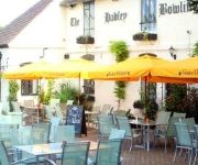
Hadley Bowling Green Inn
Worcester Whitehouse
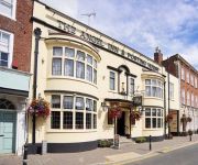
ANGEL INN HOTEL
The Pear Tree Inn
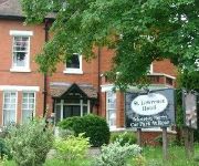
St. Lawrence Hotel
TRAVELODGE WORCESTER
St Andrews Town
Jct6) Worcester (M5
FOWNES HOTEL
Worcester City Centre
Videos from this area
These are videos related to the place based on their proximity to this place.
My General Anaesthetic: What's Going To Happen? Sarah's Journey
A parent and child information video to help explain what happens when a child has a general anaesthetic for an operation or investigation. All people in this video are actors. Produced June...
Driving Along Wadborough Road From Littleworth To Norton, Worcestershire, England 12th April 2012
Driving along Wadborough Road from Littleworth to Norton, Worcestershire, England Videoed on Thursday, 12th April 2012 Playlist: http://www.youtube.com/playlist?list=PL8149EB64670F6A23.
Driving On Woodbury Lane, Church Lane & Crookbarrow Road, Norton, Worcestershire, England
Driving along Woodbury Lane, Church Lane & Crookbarrow Road, (Brockhill Village), Norton, Worcester, Worcestershire, England Videoed on Sunday, 22nd June 2014 Playlist: ...
Driving Along The B4084 Between Whittington & Stoulton, Worcestershire, England 15th October 2010
Driving along Pershore Road (B4084) Between Whittington & Stoulton, Worcester, Worcestershire, England Videoed on Friday, 15th October 2010 Playlist: ...
Driving Along The B4084 & A44 Between Pershore & Worcester, Worcestershire 27th March 2011
Driving along the B4084 & A44 between Pershore & Worcester, Worcestershire, England. Videoed on Sunday, 27th March 2011 Playlist: ...
Driving Along London Road & Whittington Road, Worcester, Worcestershire, UK 23rd August 2013
Driving along London Road (A44) & Whittington Road (A44 & A4440) to the M5 motorway junction 7, Worcester, Worcestershire, England Videoed on Friday, 23rd August 2013 Playlist: ...
Driving Along Temeside Way, Broomhall Way, Crookbarrow Way & Whittington Road, Worcester, England
Driving along Temeside Way A4440, Broomhall Way A4440, Crookbarrow Way A4440 & Whittington Road A44, Worcester, Worcestershire, England Videoed on Wednesday, 13th August 2014 Playlist: ...
Driving Along Broomhall Way, Crookbarrow Way & Whittington Road, Worcester, UK 20th January 2013
Driving along Broomhall Way (A4440), Crookbarrow Way (A4440) & Whittington Road (A44), Worcester, Worcestershire, England Videoed on Sunday, 20th January 2013 Playlist: ...
Driving On The A449 From Claines To Junction 6 M5, Worcester, Worcestershire, England
Driving along the A449 from Claines to Junction 6 M5, Worcester, Worcestershire, England Videoed on Friday,10th February 2012 Playlist:http://www.youtube.com/playlist?list=PL788EBE7EA4DA2E0E.
Alcester and Spetchley Park Garden
4th of June 1993 Alcester is an old market town at the junction of the River Alne and River Arrow in Warwickshire, England. Just three miles east of the city of Worcester and surrounded...
Videos provided by Youtube are under the copyright of their owners.
Attractions and noteworthy things
Distances are based on the centre of the city/town and sightseeing location. This list contains brief abstracts about monuments, holiday activities, national parcs, museums, organisations and more from the area as well as interesting facts about the region itself. Where available, you'll find the corresponding homepage. Otherwise the related wikipedia article.
Worcestershire
Worcestershire is a non-metropolitan county in the West Midlands of England. In 1974, it merged with the neighbouring county of Herefordshire to form Hereford and Worcester. This was divided in 1998, re-establishing Worcestershire as a county. The Malvern Hills forms the east–west border between the two counties, with the exception of West Malvern in Worcestershire.
Warndon
Warndon is a suburb and civil parish of the City of Worcester in Worcestershire, England. The parish, which includes the villages of Trotshill and Warndon was part of Droitwich Rural District until 1974 when it was annexed to Worcester under the Local Government Act 1972. It has a population of 10,237.
Sixways Stadium
Sixways Stadium is a stadium in Worcester, England. It is currently used mostly for rugby union matches and is the home stadium of Worcester Rugby Football Club. The stadium is able to hold 12,068. It opened in 1975 and is located off junction 6 of the M5 motorway, which splits into six directions, hence the name sixways. An additional 321 seats were installed during the summer of 2006.
Spetchley Park
Spetchley Park in the hamlet of Spetchley, near Worcester, England, has belonged to the Berkeley family, who also own Berkeley Castle in Gloucestershire, since it was first built in 1606. The original house was burned down on the eve of the battle of Worcester, 1651, by disgruntled drunk Scottish Presbyterian Royalists to prevent Oliver Cromwell from using the house for his headquarters. All that is left from the Tudor house is part of the moat.
Croome collection
The Croome collection – the archive of the Earls of Coventry – came into public ownership in 2005 as part of the Acceptance in Lieu of Inheritance Tax Scheme, whereby the nation accepts valuable assets to set against tax liabilities. In 2006, after making a case to the Museums, Libraries and Archives Council (MLA) for housing the collection, Worcestershire Record Office was identified as its new permanent home.
Mucknell Abbey
Mucknell Abbey is an Anglican Benedictine monastery in Worcestershire, England. The community, which formerly lived at Burford, has both male and female members.
Spetchley
Spetchley is a hamlet located in the County of Worcestershire, England, and lends its name to the Civil Parish in which the hamlet is located.
Worcestershire Parkway Regional Interchange
Worcestershire Parkway (Regional Interchange) is a proposed new railway station to be built near Norton, Worcester, England. The project is currently enjoying renewed interest, and the business case and technical development work is currently being undertaken by and for Worcestershire County Council. A new station on this site was first suggested in the 1970s, but it was rejected because of cost. The station would be where the Cotswold and Cross Country Lines cross.


