Safety Score: 3,0 of 5.0 based on data from 9 authorites. Meaning we advice caution when travelling to United Kingdom.
Travel warnings are updated daily. Source: Travel Warning United Kingdom. Last Update: 2024-04-24 08:14:40
Discover Donnington
Donnington in Herefordshire (England) is a town in United Kingdom about 104 mi (or 167 km) west of London, the country's capital city.
Current time in Donnington is now 06:08 AM (Thursday). The local timezone is named Europe / London with an UTC offset of one hour. We know of 9 airports near Donnington, of which 5 are larger airports. The closest airport in United Kingdom is Gloucestershire Airport in a distance of 13 mi (or 21 km), South-East. Besides the airports, there are other travel options available (check left side).
There are several Unesco world heritage sites nearby. The closest heritage site in United Kingdom is Blaenavon Industrial Landscape in a distance of 26 mi (or 42 km), South-West. Also, if you like playing golf, there are a few options in driving distance. Looking for a place to stay? we compiled a list of available hotels close to the map centre further down the page.
When in this area, you might want to pay a visit to some of the following locations: Ledbury, Linton, Yatton, Lea and Evesbatch. To further explore this place, just scroll down and browse the available info.
Local weather forecast
Todays Local Weather Conditions & Forecast: 10°C / 50 °F
| Morning Temperature | 2°C / 35 °F |
| Evening Temperature | 8°C / 47 °F |
| Night Temperature | 5°C / 41 °F |
| Chance of rainfall | 0% |
| Air Humidity | 71% |
| Air Pressure | 1004 hPa |
| Wind Speed | Light breeze with 5 km/h (3 mph) from South-East |
| Cloud Conditions | Overcast clouds, covering 99% of sky |
| General Conditions | Light rain |
Friday, 26th of April 2024
8°C (47 °F)
7°C (44 °F)
Overcast clouds, gentle breeze.
Saturday, 27th of April 2024
8°C (47 °F)
6°C (42 °F)
Light rain, moderate breeze, overcast clouds.
Sunday, 28th of April 2024
9°C (49 °F)
8°C (47 °F)
Moderate rain, moderate breeze, overcast clouds.
Hotels and Places to Stay
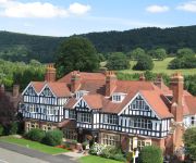
Colwall Park
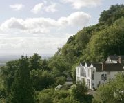
Cottage in the Wood
Videos from this area
These are videos related to the place based on their proximity to this place.
Driving Along The Homend & High Street (A438), Ledbury, Herefordshire, England 27th March 2013
Driving along The Homend & High Street (A438), Ledbury, Herefordshire, England Videoed on Wednesday, 27th March 2013 Playlist: ...
Ledbury Ox Roast 1953
On June 2nd 1953 an ox was roasted in Ledbury's High Street to celebrate the coronation of Her Majesty Queen Elizabeth II.
Ledbury Carnival 2014 Procession from the By Pass (Official)
Video footage of the Ledbury Carnival 2014 Procession from the By Pass on Monday 25 August 2014. Filmed by the Ledbury Carnival Association. Please note, this is the raw video footage and...
Driving On Bromyard Road, The Homend & High Street, Ledbury, Herefordshire, UK 12th September 2014
Driving from Bromyard Road Industrial Estate & along Bromyard Road B4214, The Homend A438 & High Street A438, Ledbury, Herefordshire, England Videoed on Friday, 12th September 2014 ...
Driving On Bromyard Road, The Homend & High Street, Ledbury, Herefordshire, England 4th April 2014
Driving from Bromyard Road Industrial Estate & along Bromyard Road B4214, The Homend A438 & High Street A438, Ledbury, Herefordshire, England Videoed on Friday, 8th August 2014 Playlist: ...
Driving On Bromyard Road, The Homend, High Street & The Southend, Ledbury, Herefordshire, England
Driving from Bromyard Road Industrial Estate & along Bromyard Road (B4214), The Homend (A438), High Street (A438), The Southend (A449), High Street & The Homend (A438), Ledbury, ...
Driving Along Bromyard Road, The Homend, High Street & The Southend, Ledbury, Herefordshire, England
Driving along Bromyard Road (B4214), The Homend (A438), High Street (A438) & The Southend (A449), Ledbury, Herefordshire, England Videoed on Friday, 16th March 2012 Playlist: ...
Driving On The Homend, High Street & The Southend, Ledbury, Herefordshire, England 28th March 2014
Driving along The Homend (A438), High Street (A438), The Southend (A449), High Street & The Homend, Ledbury, Herefordshire, England Videoed on Friday, 28th March 2014 Playlist: http://www.youtube.c...
Ledbury Carnival 2014 Procession from the High Street (Official)
Ledbury Carnival 2014 Procession from the High Street (Official) Video footage of the Ledbury Carnival 2014 Procession from the High Street on Monday 25 August 2014. Filmed by the Ledbury...
Driving Along Lower Road, Bridge Street, Bye Street & High Street, Ledbury, Herefordshire
Driving along Lower Road, Bridge Street, Bye Street & High Street, Ledbury, Herefordshire, England Videoed on Friday, 4th March 2011 Playlist: ...
Videos provided by Youtube are under the copyright of their owners.
Attractions and noteworthy things
Distances are based on the centre of the city/town and sightseeing location. This list contains brief abstracts about monuments, holiday activities, national parcs, museums, organisations and more from the area as well as interesting facts about the region itself. Where available, you'll find the corresponding homepage. Otherwise the related wikipedia article.
Dymock
Dymock is a small village in the Forest of Dean district of Gloucestershire, England about four miles south of Ledbury, with a population of approx. 300 people. It was the eponymous home of the Dymock poets from the period 1911-1914. The homes of Robert Frost and Wilfrid Wilson Gibson can still be seen there.
The Big Chill (music festival)
The Big Chill is an annual festival of alternative, dance and chill-out music and comedy, held in the grounds of Eastnor Castle during early August. The 2011 line up included The Chemical Brothers, Kanye West, Rodrigo Y Gabriela, Jessie J, Robert Plant, Calvin Harris, Aloe Blacc, Chipmunk, Katy B & Example. In January 2012 the organisers, Festival Republic, announced that 2012's festival would be cancelled due to artist availability around the Olympics.
Three Counties
The Three Counties of England are traditionally the three agrarian counties of Gloucestershire, Herefordshire and Worcestershire. Including towns and cities such as Worcester, Gloucester, Cheltenham, Hereford, Leominster, Stourbridge and Kidderminster, they extend from the southern boundaries of Birmingham in the north to Bristol in the south.
Ledbury Town F.C
Ledbury Town F.C. are a football club based in Ledbury, Herefordshire, England. They were established in 1893. The club is affiliated to the Herefordshire County FA. In the 2004–05 season, they reached the 4th round of the FA Vase. For the 2012–13 season, they are members of the West Midlands (Regional) League Division Two after gaining promotion from the Herefordshire Football League Premier Division, at the end of the 2011–12 season.
Parkway, Herefordshire
The hamlet of Parkway is 2 km south of the market town of Ledbury in Herefordshire, England. Parkway is very small and mainly consists of woodland, heathland, farmland and about 30 houses. Parkway Village Hall used to host table tennis matches and local meetings. Hospital Wood is home to wildlife such as pine martens, deer, foxes and a variety of birds.
Greenway Halt railway station (Gloucestershire)
Greenway Halt was a request stop on the former Ledbury and Gloucester Railway. It closed in 1959 when the line was closed to passengers. Preceding station Disused railways Following station Dymock Ledbury and Gloucester Railway Ledbury Town Halt {{#invoke:Coordinates|coord}}{{#coordinates:51.9978|-2.4396|type:railwaystation_region:GB|||||| |primary |name= }}
Dymock railway station
Dymock railway station was a stop on the former Ledbury and Gloucester Railway. It opened in 1885 and served the village of Dymock It was closed for passengers in 1959 but remained open for freight traffic until 1964 when the line was closed. Preceding station Disused railways Following station Four Oaks Halt Ledbury and Gloucester Railway Greenway Halt
John Masefield High School
John Masefield High School is a secondary school with academy status located in Ledbury, Herefordshire.


