Safety Score: 3,0 of 5.0 based on data from 9 authorites. Meaning we advice caution when travelling to United Kingdom.
Travel warnings are updated daily. Source: Travel Warning United Kingdom. Last Update: 2024-05-05 08:24:42
Discover Crowle
Crowle in Worcestershire (England) is a city in United Kingdom about 97 mi (or 157 km) north-west of London, the country's capital city.
Local time in Crowle is now 11:35 AM (Sunday). The local timezone is named Europe / London with an UTC offset of one hour. We know of 10 airports in the vicinity of Crowle, of which 5 are larger airports. The closest airport in United Kingdom is Gloucestershire Airport in a distance of 21 mi (or 34 km), South. Besides the airports, there are other travel options available (check left side).
There are several Unesco world heritage sites nearby. The closest heritage site in United Kingdom is Blaenavon Industrial Landscape in a distance of 45 mi (or 72 km), South-West. Also, if you like golfing, there are a few options in driving distance. We discovered 1 points of interest in the vicinity of this place. Looking for a place to stay? we compiled a list of available hotels close to the map centre further down the page.
When in this area, you might want to pay a visit to some of the following locations: Worcester, Bransford, Cotheridge, Leigh and Stourport-on-Severn. To further explore this place, just scroll down and browse the available info.
Local weather forecast
Todays Local Weather Conditions & Forecast: 16°C / 60 °F
| Morning Temperature | 8°C / 46 °F |
| Evening Temperature | 13°C / 56 °F |
| Night Temperature | 10°C / 49 °F |
| Chance of rainfall | 1% |
| Air Humidity | 62% |
| Air Pressure | 1007 hPa |
| Wind Speed | Gentle Breeze with 8 km/h (5 mph) from North-West |
| Cloud Conditions | Scattered clouds, covering 34% of sky |
| General Conditions | Light rain |
Monday, 6th of May 2024
16°C (60 °F)
11°C (52 °F)
Light rain, light breeze, overcast clouds.
Tuesday, 7th of May 2024
16°C (62 °F)
10°C (50 °F)
Light rain, gentle breeze, broken clouds.
Wednesday, 8th of May 2024
15°C (59 °F)
11°C (52 °F)
Light rain, light breeze, broken clouds.
Hotels and Places to Stay
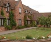
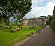
The Pear Tree Inn
St Andrews Town
Jct6) Worcester (M5
TRAVELODGE DROITWICH
Videos from this area
These are videos related to the place based on their proximity to this place.
My General Anaesthetic: What's Going To Happen? Sarah's Journey
A parent and child information video to help explain what happens when a child has a general anaesthetic for an operation or investigation. All people in this video are actors. Produced June...
Driving On Woodbury Lane, Church Lane & Crookbarrow Road, Norton, Worcestershire, England
Driving along Woodbury Lane, Church Lane & Crookbarrow Road, (Brockhill Village), Norton, Worcester, Worcestershire, England Videoed on Sunday, 22nd June 2014 Playlist: ...
Driving Along The B4084 From Worcester To Drakes Broughton, Worcestershire 27th March 2011
Driving along the B4084 from Worcester to Drakes Broughton, Worcestershire, England. Videoed on Sunday, 27th March 2011 Playlist: ...
Night Drive On The B4084 Between Worcester & Pershore, Worcestershire, England 9th March 2012
Driving at night on the B4084 between Worcester & Pershore, Worcestershire, England Videoed on Friday, 9th March 2012 Playlist: http://www.youtube.com/playlist?list=PLD94CA3439A31F519.
Driving On The B4084 Between Worcester & Pershore, Worcestershire, England 12th July 2013
Driving on the B4084 (from junction 7 M5 motorway) between Worcester & Pershore, Worcestershire, England Videoed on Friday, 12th July 2013 Playlist: http://www.youtube.com/playlist?list=PLNhQ1cvxq...
Driving Along The B4084 Between Whittington & Stoulton, Worcestershire, England 15th October 2010
Driving along Pershore Road (B4084) Between Whittington & Stoulton, Worcester, Worcestershire, England Videoed on Friday, 15th October 2010 Playlist: ...
Driving On The B4084 Between Worcester & Pershore, Worcestershire, England 28th April 2013
Driving on the B4084 between Worcester & Pershore, Worcestershire, England Videoed on Sunday, 28th April 2013 Playlist: ...
Driving On The A44 From Pinvin, Pershore To Spetchley, Worcester, Worcestershire, England
Driving along the A44 From Pinvin, Pershore To Spetchley, Worcester, Worcestershire, England Videoed on Saturday, 22nd June 2013 Playlist: ...
Driving On The B4084 Between Worcester & Pershore, Worcestershire, England 12th April 2012
Driving on the B4084 between Worcester & Pershore, Worcestershire, England Videoed on Thursday, 12th April 2012 Playlist: http://www.youtube.com/playlist?list=PL8149EB64670F6A23.
Driving On The B4084 Between Worcester & Pershore, Worcestershire, England 22nd June 2014
Driving on the B4084 (from junction 7 M5 motorway) between Worcester & Pershore, Worcestershire, England Videoed on Sunday, 22nd June 2014 Playlist: ...
Videos provided by Youtube are under the copyright of their owners.
Attractions and noteworthy things
Distances are based on the centre of the city/town and sightseeing location. This list contains brief abstracts about monuments, holiday activities, national parcs, museums, organisations and more from the area as well as interesting facts about the region itself. Where available, you'll find the corresponding homepage. Otherwise the related wikipedia article.
Huddington Court
Huddington Court is a 15th century manor house in Worcestershire, England, six miles east of Worcester. It is surrounded by a moat with a bridge and is painted white on the outside with prominent black beams on all walls. It has been described by Sir Nikolaus Pevsner as 'the most picturesque house in Worcestershire'. Thomas Wintour and his brother Robert Wintour grew up in the house. The house is a private residence and is not open to the public.
Spetchley Park
Spetchley Park in the hamlet of Spetchley, near Worcester, England, has belonged to the Berkeley family, who also own Berkeley Castle in Gloucestershire, since it was first built in 1606. The original house was burned down on the eve of the battle of Worcester, 1651, by disgruntled drunk Scottish Presbyterian Royalists to prevent Oliver Cromwell from using the house for his headquarters. All that is left from the Tudor house is part of the moat.
St Michael's Church, Churchill
St Michael's Church, Churchill, is a redundant Anglican church in the village Churchill, Worcestershire, England. It has been designated by English Heritage as a Grade II* listed building, and is under the care of the Churches Conservation Trust.
All Saints Church, Spetchley
All Saints Church, Spetchley, is a redundant Anglican church adjacent to Spetchley Park, Worcestershire, England. It has been designated by English Heritage as a Grade II* listed building, and is under the care of the Churches Conservation Trust.
Egdon
Egdon is a hamlet located in the County of Worcestershire and falls with the Civil Parish of Stoulton.
Spetchley
Spetchley is a hamlet located in the County of Worcestershire, England, and lends its name to the Civil Parish in which the hamlet is located.
Trench Wood
Trench Wood is a woodland area managed by the Worcestershire Wildlife Trust and Butterfly Conservation. It is located around 6 miles north-east of Worcester near the small villages of Dunhampstead and Sale Green. The Worcester and Birmingham Canal and the main line railway from Birmingham to the south-west of England both pass just to the west of the wood.
Dunhampstead
Dunhampstead is a small village in the English county of Worcestershire. It is located about 6 miles to the north-east of Worcester and around half a mile to the east of the M5. The Worcester and Birmingham Canal passes through the village where there is a boatyard and it passes through Dunhampstead Tunnel. The main railway line between Birmingham and the south-west of England passes just east of the village. The village has a public house called the Fir Tree Inn.


