Safety Score: 3,0 of 5.0 based on data from 9 authorites. Meaning we advice caution when travelling to United Kingdom.
Travel warnings are updated daily. Source: Travel Warning United Kingdom. Last Update: 2024-04-29 08:03:39
Delve into Red Hill
Red Hill in Worcestershire (England) is located in United Kingdom about 100 mi (or 161 km) north-west of London, the country's capital town.
Current time in Red Hill is now 08:59 PM (Monday). The local timezone is named Europe / London with an UTC offset of one hour. We know of 10 airports close to Red Hill, of which 5 are larger airports. The closest airport in United Kingdom is Gloucestershire Airport in a distance of 20 mi (or 32 km), South. Besides the airports, there are other travel options available (check left side).
There are several Unesco world heritage sites nearby. The closest heritage site in United Kingdom is Blaenavon Industrial Landscape in a distance of 41 mi (or 67 km), South-West. Also, if you like playing golf, there are some options within driving distance. We encountered 1 points of interest near this location. If you need a hotel, we compiled a list of available hotels close to the map centre further down the page.
While being here, you might want to pay a visit to some of the following locations: Worcester, Bransford, Cotheridge, Leigh and Stourport-on-Severn. To further explore this place, just scroll down and browse the available info.
Local weather forecast
Todays Local Weather Conditions & Forecast: 13°C / 55 °F
| Morning Temperature | 8°C / 46 °F |
| Evening Temperature | 10°C / 51 °F |
| Night Temperature | 10°C / 50 °F |
| Chance of rainfall | 1% |
| Air Humidity | 76% |
| Air Pressure | 1011 hPa |
| Wind Speed | Fresh Breeze with 16 km/h (10 mph) from North |
| Cloud Conditions | Overcast clouds, covering 100% of sky |
| General Conditions | Light rain |
Tuesday, 30th of April 2024
15°C (59 °F)
10°C (50 °F)
Broken clouds, fresh breeze.
Wednesday, 1st of May 2024
15°C (59 °F)
12°C (54 °F)
Light rain, moderate breeze, broken clouds.
Thursday, 2nd of May 2024
14°C (57 °F)
13°C (55 °F)
Moderate rain, moderate breeze, overcast clouds.
Hotels and Places to Stay
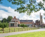
Stanbrook Abbey
Worcester Whitehouse
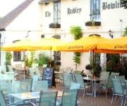
Hadley Bowling Green Inn
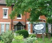
St. Lawrence Hotel
TRAVELODGE WORCESTER
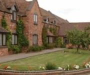
The Pear Tree Inn
St Andrews Town
Jct6) Worcester (M5
FOWNES HOTEL
Worcester City Centre
Videos from this area
These are videos related to the place based on their proximity to this place.
Gloucester Gladiators @ Worcester Royals - 14/11/2010
The BUAFL 2010 Season kicks off for the Worcester Royals with a visit from local rivals the Gloucester Gladiators. After a close 1st Quarter, the Gladiators pull away and gain a lead that is...
150214 at Worcester Shrub Hill
London Midland 150214 moves off the centre stabling road at Worcester Shrub Hill and into Platform 1b, where it formed the 10:47 departure for Kidderminster. 8th March, 2008.
Driving Along London Road (A44), Worcester, Worcestershire, England 1st July 2009
Driving along London Road (A44), Worcester, Worcestershire, England Videoed on Wednesday, 1st July 2009 © Mike Fairman 2009.
Driving Along Church Lane, Norton & Crookbarrow Road, Brockhill Village, Worcestershire, England
Driving along Church Lane from Norton to Brockhill Village & then along Crookbarrow Road, Brockhill Village, Worcester, Worcestershire, England Videoed on Thursday, 12th April 2012 Playlist:...
Driving On Broomhall Way, Crookbarrow Way & Whittington Road, Worcester, UK 21st November 2014
Driving at night along Broomhall Way A4440, Crookbarrow Way A4440 & Whittington Road A44, Worcester, Worcestershire, England Videoed on Friday, 21st November 2014 Playlist: ...
Driving Along London Road & Whittington Road, Worcester, Worcestershire, UK 23rd August 2013
Driving along London Road (A44) & Whittington Road (A44 & A4440) to the M5 motorway junction 7, Worcester, Worcestershire, England Videoed on Friday, 23rd August 2013 Playlist: ...
Driving Along St Peter's Drive, Broomhall Way & Bath Road, Worcester, England
Driving along St Peter's Drive, Broomhall Way A4440 & Bath Road A38, Worcester, Worcestershire, England Videoed on Saturday, 4th October 2014 Playlist: ...
Driving Along Temeside Way, Broomhall Way, Crookbarrow Way & Whittington Road, Worcester, England
Driving along Temeside Way A4440, Broomhall Way A4440, Crookbarrow Way A4440 & Whittington Road A44, Worcester, Worcestershire, England Videoed on Wednesday, 13th August 2014 Playlist: ...
Night Drive Along Whittington Road, Crookbarrow Way & Broomhall Way, Worcester, UK 7th July 2013
Driving at night along Whittington Road (A44), Crookbarrow Way (A4440) & Broomhall Way (A4440), Worcester, Worcestershire, England Videoed on Sunday, 7th July 2013 Playlist: ...
Driving Along Broomhall Way, Crookbarrow Way & Whittington Road, Worcester, UK 20th January 2013
Driving along Broomhall Way (A4440), Crookbarrow Way (A4440) & Whittington Road (A44), Worcester, Worcestershire, England Videoed on Sunday, 20th January 2013 Playlist: ...
Videos provided by Youtube are under the copyright of their owners.
Attractions and noteworthy things
Distances are based on the centre of the city/town and sightseeing location. This list contains brief abstracts about monuments, holiday activities, national parcs, museums, organisations and more from the area as well as interesting facts about the region itself. Where available, you'll find the corresponding homepage. Otherwise the related wikipedia article.
Worcester (UK Parliament constituency)
Worcester is a borough constituency represented in the House of Commons of the Parliament of the United Kingdom. Since 1885 it has elected one Member of Parliament (MP) by the first past the post system of election; from 1295 to 1885 it elected two MPs.
Lea & Perrins
50x40pxThis article needs additional citations for verification. Please help improve this article by adding citations to reliable sources. Unsourced material may be challenged and removed. Lea & Perrins is a United Kingdom based food division of the H.J. Heinz Company, originating in Worcester, England. A subsidiary in the United States manufactures Lea & Perrins (based on authentic Indian recipes) in New Jersey.
St Peter the Great
St Peter the Great is a suburb of the City of Worcester in Worcestershire, England. It is almost due south of the city centre, on the east side of the river Severn, and has a population of 5,620. The parish is named after the church of St Peter the Great. The parish of the church was divided into parts - St Peter the Great City and St Peter the Great County. The former was merged eventually with other Worcester parishes to form a united civil parish St Peter the Great County Parish Council.
Youthcomm Radio
106.7 Youthcomm Radio is a youth community radio station, licensed by Ofcom, broadcasting to Worcester, England, on 106.7FM. The station officially launched on FM on Sunday 13 January 2008 after running online for seven years. Youthcomm was established in 1996 and is operated ‘by Young People for Young People’. Young people are integral in delivering, running and developing the station.
Nunnery Wood High School
Nunnery Wood High School is an academy school in Worcester, Worcestershire, England. It is a co-educational school and a Science College with about 1350 students on roll aged from 11 to 16. In 1983 following a restructuring of schools in Worcestershire the Nunnery Wood Secondary School was renamed Nunnery Wood High School. The school campus is located on the edge of Worcester, surrounded by some 15 acres of gardens and playing fields which it shares with the adjacent Sixth Form College.
Red Hill, Worcester
Red Hill is an area of Worcester, Worcestershire, England. It is in the south-east of the city on the A44. It has historically been used as high ground to attack the city and as a place of execution.
The Commandery
The Commandery is a historic building open to visitors and located in the city of Worcester, England. It opened as a museum in 1977 and was for a while the only museum in England dedicated solely to the Civil Wars. The Commandery ceased to be a Civil War museum when it reopened to the public in May 2007, having undergone a year and a half of refurbishments and reinterpretation jointly funded by the Heritage Lottery Fund and Worcester City Council, who own the building.
Croome collection
The Croome collection – the archive of the Earls of Coventry – came into public ownership in 2005 as part of the Acceptance in Lieu of Inheritance Tax Scheme, whereby the nation accepts valuable assets to set against tax liabilities. In 2006, after making a case to the Museums, Libraries and Archives Council (MLA) for housing the collection, Worcestershire Record Office was identified as its new permanent home.


