Safety Score: 3,0 of 5.0 based on data from 9 authorites. Meaning we advice caution when travelling to United Kingdom.
Travel warnings are updated daily. Source: Travel Warning United Kingdom. Last Update: 2024-04-28 08:22:10
Discover Holt
Holt in Worcestershire (England) is a city in United Kingdom about 104 mi (or 167 km) north-west of London, the country's capital city.
Local time in Holt is now 05:15 PM (Sunday). The local timezone is named Europe / London with an UTC offset of one hour. We know of 9 airports in the vicinity of Holt, of which 5 are larger airports. The closest airport in United Kingdom is Birmingham International Airport in a distance of 25 mi (or 41 km), North-East. Besides the airports, there are other travel options available (check left side).
There are several Unesco world heritage sites nearby. The closest heritage site in United Kingdom is Blaenavon Industrial Landscape in a distance of 43 mi (or 69 km), South-West. Also, if you like golfing, there are a few options in driving distance. We discovered 1 points of interest in the vicinity of this place. Looking for a place to stay? we compiled a list of available hotels close to the map centre further down the page.
When in this area, you might want to pay a visit to some of the following locations: Worcester, Cotheridge, Bransford, Stourport-on-Severn and Leigh. To further explore this place, just scroll down and browse the available info.
Local weather forecast
Todays Local Weather Conditions & Forecast: 11°C / 52 °F
| Morning Temperature | 4°C / 40 °F |
| Evening Temperature | 10°C / 50 °F |
| Night Temperature | 3°C / 38 °F |
| Chance of rainfall | 11% |
| Air Humidity | 68% |
| Air Pressure | 1006 hPa |
| Wind Speed | Moderate breeze with 11 km/h (7 mph) from South-East |
| Cloud Conditions | Overcast clouds, covering 100% of sky |
| General Conditions | Moderate rain |
Monday, 29th of April 2024
12°C (53 °F)
10°C (50 °F)
Light rain, fresh breeze, overcast clouds.
Tuesday, 30th of April 2024
15°C (60 °F)
8°C (47 °F)
Light rain, fresh breeze, broken clouds.
Wednesday, 1st of May 2024
15°C (59 °F)
9°C (49 °F)
Light rain, gentle breeze, overcast clouds.
Hotels and Places to Stay
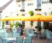
Hadley Bowling Green Inn
Worcester Whitehouse
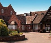
BANK HOUSE HOTEL SPA AND GOLF
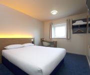
TRAVELODGE WORCESTER
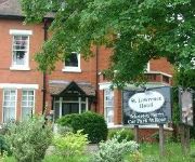
St. Lawrence Hotel
TRAVELODGE HARTLEBURY
Jct6) Worcester (M5
Worcester City Centre
FOWNES HOTEL
Videos from this area
These are videos related to the place based on their proximity to this place.
Driving On Tybridge Street, Hylton Road, Henwick Road & Hallow Road, Worcester, England
Driving along Tybridge Street A44, Hylton Road A443, Henwick Road A443 & Hallow Road A433, Worcester, Worcestershire, England Videoed on Friday, 10th October 2014 Playlist: ...
Driving On The A449 From Claines To Junction 6 M5 Motorway, Worcester, Worcestershire, England
Driving along the A449 from Claines to Junction 6 M5 Motorway, Worcester, Worcestershire, England Videoed on Sunday, 8th September 2013 Playlist: ...
Driving Through Hallow Village Worcester (Towards Holt Heath) A443 16th August 1996
Driving through Hallow Village towards Holt Heath Worcestershire on the A443 Videoed 16th August 1996 Playlist: http://www.youtube.com/playlist?list=PL1499BF8268306D98.
Driving From Holt Heath To Hallow, Worcestershire A443 16th August 1996
Driving from Holt Heath to Hallow village on the A443 in Worcestershire on 16th August 1996 Playlist: http://www.youtube.com/playlist?list=PL1499BF8268306D98.
Driving From Hallow To Holt Heath, Worcestershire A443 16th August 1996
Driving from Hallow village to Holt Heath on the A443 in Worcestershire on 16th August 1996 Playlist: http://www.youtube.com/playlist?list=PL1499BF8268306D98.
Driving On The A443 Between Holt Heath & Worcester, Worcestershire, England 26th August 2013
Driving along the A443 between Holt Heath (through the village of Hallow) to Worcester, Worcestershire, England Videoed on Monday, 26th August 2013 Playlist: http://www.youtube.com/playlist?list=P.
Driving Through Hallow Village Towards Worcester, Worcestershire, England 14th June 2009
Driving through Hallow Village towards Worcester, Worcestershire, England on the A443 Videoed on Sunday, 14th June 2009 Playlist: http://www.youtube.com/playlist?list=PL45CFA0550CFCC485.
Driving On The A443 Through Hallow Village, Worcester, Worcestershire, England 14th June 2009
Driving on the A443 through Hallow, Worcester, Worcestershire, England on the A443 Videoed Sunday, 14th June 2009 Playlist: http://www.youtube.com/playlist?list=PL45CFA0550CFCC485.
Top Barn Activity Centre
An overview of what's available at Top Barn Activity Centre, Holt Heath, Worcester. www.topbarnactivity.com.
Top Barn Business Centre
Find out how your business could benefit from working with Top Barn Business Centre, Holt Heath, Worcester.
Videos provided by Youtube are under the copyright of their owners.
Attractions and noteworthy things
Distances are based on the centre of the city/town and sightseeing location. This list contains brief abstracts about monuments, holiday activities, national parcs, museums, organisations and more from the area as well as interesting facts about the region itself. Where available, you'll find the corresponding homepage. Otherwise the related wikipedia article.
A449 road
The A449 is a major road in the United Kingdom. It runs north from junction 24 of the M4 motorway at Newport in South Wales to Stafford in Staffordshire. The southern section of the road, between Ross on Wye and Newport forms part of the trunk route from the English Midlands to South Wales, avoiding the Severn Bridge
A4133 road
The A4133 is a short (4.6 miles) major road in Worcestershire, England. From a junction with the A443 at Holt Heath, its crosses the River Severn at Holt Bridge and the A449 at Ombersley, and terminates near the western outskirts of Droitwich Spa, where it meets the A38.
River Salwarpe
The River Salwarpe is a river in Worcestershire, England. Rising near Bromsgrove, it passes Stoke Prior, Upton Warren, Wychbold, Droitwich (where the Droitwich Canal starts to run alongside it). After Droitwich, it meets the River Severn, at Hawford, Claines . Andrew Yarranton attempted unsuccessfully to make it navigable in the 1660s.
The Mug House
The Mug House is a traditional public house located in the village of Claines, Worcestershire, England, which dates back to the 15th century.
RGS The Grange
RGS The Grange (Royal Grammar School The Grange) is one of the junior schools of RGS Worcester. It is located at Claines, north of Worcester, United Kingdom. It is approximately 3 miles north of the senior school, and is situated on a 40-acre site. The headmaster of the school is Gareth Hughes. The other RGS Prep School is RGS Springfield.
Holt Fleet Bridge
Holt Fleet Bridge, also known as Holt Bridge, is a cast-iron arch bridge over the River Severn, at Holt in Worcestershire, England. It has a span of 150 feet; it was designed by Thomas Telford and opened in 1828. It is Grade II listed, and is similar to Telford's Galton Bridge, which is a Grade I listed structure that spans his BCN New Main Line canal at Smethwick. The bridge was built with five cast-iron ribs, with X-braced spandrels, as were several of Telford's bridges.
Northwick, Worcestershire
Northwick is a district of Worcester, England, located in the north of the city on the left (east) bank of the River Severn.
1 and 2 Tai Cochin
1 and 2 Tai Cochin consists of a pair of joined cottages in the village of Nannerch, Flintshire, Wales. Each of the cottages is a Grade II listed building. They were built for the railway engineer William Barber Buddicom in 1877–88 and designed by the Chester architect John Douglas. The cottages are built in brick in vernacular revival style with tiled hipped roofs.


