Safety Score: 3,0 of 5.0 based on data from 9 authorites. Meaning we advice caution when travelling to United Kingdom.
Travel warnings are updated daily. Source: Travel Warning United Kingdom. Last Update: 2024-04-27 08:23:39
Delve into Powick
Powick in Worcestershire (England) is a city located in United Kingdom about 101 mi (or 163 km) north-west of London, the country's capital town.
Current time in Powick is now 02:00 AM (Sunday). The local timezone is named Europe / London with an UTC offset of one hour. We know of 9 airports closer to Powick, of which 5 are larger airports. The closest airport in United Kingdom is Gloucestershire Airport in a distance of 19 mi (or 31 km), South. Besides the airports, there are other travel options available (check left side).
There are several Unesco world heritage sites nearby. The closest heritage site in United Kingdom is Blaenavon Industrial Landscape in a distance of 39 mi (or 63 km), South-West. Also, if you like playing golf, there are some options within driving distance. In need of a room? We compiled a list of available hotels close to the map centre further down the page.
Since you are here already, you might want to pay a visit to some of the following locations: Worcester, Bransford, Leigh, Cotheridge and Stourport-on-Severn. To further explore this place, just scroll down and browse the available info.
Local weather forecast
Todays Local Weather Conditions & Forecast: 5°C / 41 °F
| Morning Temperature | 2°C / 36 °F |
| Evening Temperature | 9°C / 47 °F |
| Night Temperature | 4°C / 39 °F |
| Chance of rainfall | 15% |
| Air Humidity | 97% |
| Air Pressure | 1004 hPa |
| Wind Speed | Fresh Breeze with 13 km/h (8 mph) from South-East |
| Cloud Conditions | Overcast clouds, covering 100% of sky |
| General Conditions | Moderate rain |
Monday, 29th of April 2024
13°C (55 °F)
10°C (49 °F)
Light rain, fresh breeze, broken clouds.
Tuesday, 30th of April 2024
15°C (58 °F)
9°C (49 °F)
Light rain, fresh breeze, overcast clouds.
Wednesday, 1st of May 2024
13°C (56 °F)
10°C (51 °F)
Light rain, gentle breeze, overcast clouds.
Hotels and Places to Stay
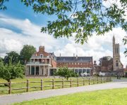
Stanbrook Abbey
Worcester Whitehouse
BANK HOUSE HOTEL SPA AND GOLF
Puddle Lane B&B
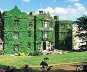
The Abbey Great Malvern
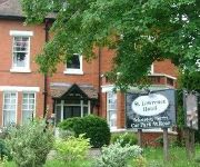
St. Lawrence Hotel
TRAVELODGE WORCESTER
The Mount Pleasant Hotel
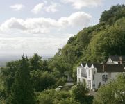
Cottage in the Wood
Jct6) Worcester (M5
Videos from this area
These are videos related to the place based on their proximity to this place.
Driving On Tudor Way, Bromyard Road & Grove Way, Worcester, England 6th April 2015
Driving along Tudor Way, Bromyard Road (A44) & Grove Way (A4440), Worcester, Worcestershire, England Videoed on Monday, 6th April 2015 Playlist: ...
Driving Along Worcester Road & Malvern Road From Great Malvern To Worcester, Worcestershire, England
Driving along Worcester Road (A449), Malvern Road (A449 & B4206) & St John's (B4486) from Great Malvern to Worcester, Worcestershire, England Videoed on Wednesday, 27th March 2013 Playlist:.
Driving On Bromyard Road, Tudor Way & Grenville Road, Worcester, England 28th March 2014
Driving along Bromyard Road A44, Tudor Way & Grenville Road, Worcester, Worcestershire, England Videoed on Friday, 28th March 2014 Playlist: ...
Pete Weber @ Worcester Tenpin Bowling, 7-10 split pickup
This video was shot at Worcester Tenpin Bowling in the UK, on Wednesday 1st October 2008. Pete Weber & James pickup a 7-10 split, bowling a ball each at the same time.
170509 London Midland City Train Comer Road Bridge Worcester 5th February 2009
London Midland City 170509 Train Class 170 Location: Henwick Road Level Crossing, St Johns, Worcester, Worcestershire UK Thursday, 5th February 2009 10.33am Trains Playlist: ...
Driving On A4440 Broomhall Way & Temeside Way, Worcester, Worcestershire, England
Driving along the A4440 Broomhall Way & Temeside Way, Worcester, Worcestershire, England Videoed on Monday, 6th April 2015 Playlist: ...
Driving Through Powick On The A449, Worcester, Worcestershire, England 9th January 2010
Driving through the village of Powick on the A449 (Malvern Road), Worcester, Worcestershire, England Videoed on Saturday, 9th January 2010 Playlist: http://www.youtube.com/view_play_list?p=2F85.
Driving Through Powick B4424 & A449, Worcestershire, England 26th May 2009
Driving through Powick village (B4424 & A449), Worcestershire, England Videoed Tuesday, 26th May 2009.
Driving Along Malvern Road A449, Powick, Worcester, Worcestershire, UK 30th August 2010
Driving along Malvern Road (A449), Powick, Worcestershire, England Videoed on Sunday, 30th August 2010 Playlist: http://www.youtube.com/view_play_list?p=4134F19B44883DB5.
Floods At Powick, Worcester, Worcestershire, UK 22nd July 2007 Video 5 0f 9
Video clip of the receding flood waters at the A449 at Powick, Worcester. 22nd July 2007. Clip 5 of 9 Clip 1: http://uk.youtube.com/watch?v=7sXX2VgKktY Clip 2: http://uk.youtube.com/watch...
Videos provided by Youtube are under the copyright of their owners.
Attractions and noteworthy things
Distances are based on the centre of the city/town and sightseeing location. This list contains brief abstracts about monuments, holiday activities, national parcs, museums, organisations and more from the area as well as interesting facts about the region itself. Where available, you'll find the corresponding homepage. Otherwise the related wikipedia article.
The King's School, Worcester
The King's School, Worcester (also known as King's Worcester or KSW, archaically Worcester Cathedral Grammar School or Worcester Cathedral King's School) is an English independent school refounded by Henry VIII in 1541. It occupies a site adjacent to Worcester Cathedral on the banks of the River Severn in the centre of the city of Worcester. It offers mixed-sex mainstream education that follows the UK National Curriculum to around 1,465 students aged 2 to 18.
New Road, Worcester
New Road, Worcester, England, has been the home cricket ground of Worcestershire County Cricket Club since 1896. Immediately to the northwest is a road called New Road, part of the A44, hence the name.
Battle of Powick Bridge
The Battle of Powick Bridge, fought on 23 September 1642, was the first major cavalry engagement of the English Civil War. It was a Royalist victory. According to Hugh Peters it was "where England's sorrows began". {{#invoke:Footnotes|sfn}}
Stanbrook Abbey
Stanbrook Abbey is an abbey originally built as a contemplative house for Benedictine nuns. It was founded in 1625 in Cambrai, Flanders, then part of the Spanish Netherlands, under the auspices of the English Benedictine Congregation,. The English Benedictine Congregation have now re-located to Wass in the North York Moors National Park. The property is currently operational as an events venue, and is owned by Clarenco LLP.
Powick Hospital
Powick Hospital was a psychiatric facility located on 552 acres outside the village of Powick, Worcestershire. Founded in 1847 as the Worcester County Pauper and Lunatic Asylum, it was designed by architects John R. Hamilton & James Medland of Gloucester and opened in August 1852. Situated between Worcester and Malvern on former farmland known as White Chimneys, the asylum was originally erected for the accommodation of 200 inmates but was later extended and by 1858 had 365 patients.
Diglis Basin
Diglis Basin is a canal basin on the Worcester and Birmingham Canal. It is situated in Diglis in the centre of Worcester, England, near The Commandery (a command post during the English Civil War). To the north is Tibberton (8.41 miles and 14 locks away) and to the west is Diglis Junction (0.25 miles and 2 locks to the west) where the canal meets the River Severn. It is the first basin (with associated amenities) reached after joining the canal from the River Severn.
Rushwick
Rushwick is a village and civil parish in the Malvern Hills District in the county of Worcestershire, England. Situated to the west of the city of Worcester, Rushwick Parish comprises the four villages and hamlets of Broadmore Green, Crown East, Rushwick village and Upper Wick. The Worcester to Hereford railway line passes through the village. Rushwick village has been circumvented by the Western By-pass, reducing through traffic, making it much quieter compared with previous times.
Old Hills
The Old Hills are an area of common land in Worcestershire, England. They are located around 2 miles to the east of Great Malvern and about a mile west of the River Severn near the village of Callow End. They reach a height of 65 metres (considerably lower than the nearby Malvern Hills) but are popular with walkers for their views towards Malvern.


