Safety Score: 3,0 of 5.0 based on data from 9 authorites. Meaning we advice caution when travelling to United Kingdom.
Travel warnings are updated daily. Source: Travel Warning United Kingdom. Last Update: 2024-04-27 08:23:39
Delve into Hanley Swan
Hanley Swan in Worcestershire (England) with it's 627 habitants is located in United Kingdom about 100 mi (or 161 km) north-west of London, the country's capital town.
Current time in Hanley Swan is now 05:50 PM (Saturday). The local timezone is named Europe / London with an UTC offset of one hour. We know of 9 airports close to Hanley Swan, of which 5 are larger airports. The closest airport in United Kingdom is Gloucestershire Airport in a distance of 14 mi (or 22 km), South. Besides the airports, there are other travel options available (check left side).
There are several Unesco world heritage sites nearby. The closest heritage site in United Kingdom is Blaenavon Industrial Landscape in a distance of 34 mi (or 56 km), South-West. Also, if you like playing golf, there are some options within driving distance. If you need a hotel, we compiled a list of available hotels close to the map centre further down the page.
While being here, you might want to pay a visit to some of the following locations: Bransford, Leigh, Cotheridge, Worcester and Ledbury. To further explore this place, just scroll down and browse the available info.
Local weather forecast
Todays Local Weather Conditions & Forecast: 7°C / 44 °F
| Morning Temperature | 3°C / 38 °F |
| Evening Temperature | 6°C / 43 °F |
| Night Temperature | 5°C / 41 °F |
| Chance of rainfall | 6% |
| Air Humidity | 88% |
| Air Pressure | 1003 hPa |
| Wind Speed | Moderate breeze with 11 km/h (7 mph) from South-West |
| Cloud Conditions | Overcast clouds, covering 100% of sky |
| General Conditions | Moderate rain |
Sunday, 28th of April 2024
4°C (40 °F)
3°C (37 °F)
Moderate rain, moderate breeze, overcast clouds.
Monday, 29th of April 2024
12°C (53 °F)
9°C (47 °F)
Light rain, fresh breeze, broken clouds.
Tuesday, 30th of April 2024
13°C (55 °F)
8°C (47 °F)
Light rain, fresh breeze, overcast clouds.
Hotels and Places to Stay
Puddle Lane B&B
The Abbey Great Malvern
Stanbrook Abbey
Gilberts End Farm - B&B
Cottage in the Wood
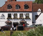
The Swan Hotel
The Mount Pleasant Hotel
Colwall Park
Holdfast Cottage Hotel
Malvern
Videos from this area
These are videos related to the place based on their proximity to this place.
Blackmore The Camping and Caravanning Club Site
Campingplatz Blackmore in der Nähe von Great Malvern, Midlands A day at the camp site in Blackmore near Great Malvern, Midlands 10-06-2012.
Tug of War at the Three Counties Show 2008
Girls Tug of War at the Three Counties Show near Great Malvern 2008.
Driving Along Drake Street & Welland Road A4104 From Welland To Upton Upon Severn, England
Driving along Drake Street (A4104) & Welland Road (A4104) from Welland to Upton Upon Severn, Worcestershire, England Videoed on Friday, 9th March 2012 Playlist: ...
Hanley Swan in Worcestershire 10th of June 2012
Some pictures of the lovely little village between Upton-upon-Severn and Great Malvern. Ein kurzer Film aus dem Dorf zwischen Upton-upon-Severn und Great Mal...
Welland Steam & Country Rally Photos
The photos from the Welland Steam & Country Rally, there was a bit of a queue to get in, as they have a railway steam crane they also have a display of mobile ones. The ploughing section had...
Welland Steam & Country Rally 2013 Steam Power
The various steam engines working at the Welland Steam & Country Rally 2013; 1918 Kerr Stuart 0-4-0WT No.3063 Willy on the Great Welland Railway Smith Rodley Steam Crane 1924 Burrell D Class ...
Hanley Swan Village Pond, Hanley Swan, Worcestershire, England 26th May 2009
Video of the village pond at Hanley Swan, near Malvern, Worcestershire. Filmed on Tuesday, 26th May 2009. The pond is situated near the junction of Malvern Road, Welland Road, Coverfield &...
Welland Steam & Country Rally Steam Engines
The engines moving around the site and in the arena, it was good to see a rally outside of The Great Dorset where there were heavy haulage loads: 1918 Fowler TE2 Class Ploughing Engine No.14950,...
Videos provided by Youtube are under the copyright of their owners.
Attractions and noteworthy things
Distances are based on the centre of the city/town and sightseeing location. This list contains brief abstracts about monuments, holiday activities, national parcs, museums, organisations and more from the area as well as interesting facts about the region itself. Where available, you'll find the corresponding homepage. Otherwise the related wikipedia article.
Royal Radar Establishment
The name Royal Radar Establishment was given to the existing Radar Research Establishment following a visit by Queen Elizabeth II in 1957. Both names were abbreviated to RRE. The establishment had been formed, under its first name, in 1953 by merging the Telecommunications Research Establishment (TRE) and the Radar Research and Development Establishment (RRDE). These had worked on airborne and ground based radar, respectively.
Royal Signals and Radar Establishment
The Royal Signals and Radar Establishment (RSRE) was a scientific research establishment within the Ministry of Defence of the United Kingdom, located primarily at Malvern in Worcestershire. It was formed in 1976 in an amalgamation of earlier research establishments including the Royal Radar Establishment (RRE), itself derived from the World War II-era Telecommunications Research Establishment.
The Chase School
The Chase School, also referred to as The Chase Technology College and The Chase High School, is a secondary school (ages 11–18) in Malvern, Worcestershire, England. It was opened by Lord Cobham on 26 March 1955 as a Secondary Modern. It became a comprehensive with the abolition of selective education in Worcestershire in 1974 and became an academy on 1 November 2011. It is one of the largest schools in Worcestershire, having over 1,600 students and around 200 staff members.
Malvern Town F.C
Malvern Town Football Club is an English football club based in Malvern, Worcestershire. The club's first team play in the West Midlands (Regional) League Premier Division and have twice reached the third qualifying round of the FA Cup.
Madresfield Court
Madresfield Court is a country house in England, in the village of Madresfield near Malvern in Worcestershire. The stately home, near the village centre, has been the ancestral home for several centuries of the Lygon family, whose eldest sons took the title of Earl Beauchamp from 1815 until 1979, when the last Earl died.
Hanley Castle (castle)
Hanley Castle was a Norman castle that stood to the south of the present site of the village of Hanley Castle, which lies 2 km north of Upton-upon-Severn, in the county of Worcestershire, England, United Kingdom..
Malvern Hills Science Park
Malvern Hills Science Park is located in Malvern, Worcestershire, England. It is a partnership between a number of partners including: QinetiQ, Malvern Hills District Council, Worcestershire County Council, and the West Midlands Regional Development Agency.
Malvern Hanley Road railway station
Malvern Hanley Road railway station was a station on the Midland Railway between Great Malvern and Evesham. For most of its existence it was known on timetables as Malvern Wells MR to distinguish it from the nearby Great Western Railway Malvern Wells. It was renamed in 1951 only to close a year later.


