Safety Score: 3,0 of 5.0 based on data from 9 authorites. Meaning we advice caution when travelling to United Kingdom.
Travel warnings are updated daily. Source: Travel Warning United Kingdom. Last Update: 2024-04-28 08:22:10
Touring Upper Colwall
Upper Colwall in Herefordshire (England) is a town located in United Kingdom about 103 mi (or 166 km) west of London, the country's capital place.
Time in Upper Colwall is now 04:49 PM (Sunday). The local timezone is named Europe / London with an UTC offset of one hour. We know of 9 airports nearby Upper Colwall, of which 5 are larger airports. The closest airport in United Kingdom is Gloucestershire Airport in a distance of 16 mi (or 25 km), South-East. Besides the airports, there are other travel options available (check left side).
There are several Unesco world heritage sites nearby. The closest heritage site in United Kingdom is Blaenavon Industrial Landscape in a distance of 32 mi (or 52 km), South-West. Also, if you like the game of golf, there are several options within driving distance. Need some hints on where to stay? We compiled a list of available hotels close to the map centre further down the page.
Being here already, you might want to pay a visit to some of the following locations: Ledbury, Leigh, Bransford, Evesbatch and Donnington. To further explore this place, just scroll down and browse the available info.
Local weather forecast
Todays Local Weather Conditions & Forecast: 9°C / 48 °F
| Morning Temperature | 3°C / 38 °F |
| Evening Temperature | 9°C / 48 °F |
| Night Temperature | 3°C / 37 °F |
| Chance of rainfall | 11% |
| Air Humidity | 75% |
| Air Pressure | 1004 hPa |
| Wind Speed | Moderate breeze with 11 km/h (7 mph) from East |
| Cloud Conditions | Overcast clouds, covering 100% of sky |
| General Conditions | Moderate rain |
Monday, 29th of April 2024
11°C (52 °F)
10°C (49 °F)
Light rain, fresh breeze, overcast clouds.
Tuesday, 30th of April 2024
15°C (59 °F)
7°C (45 °F)
Light rain, fresh breeze, broken clouds.
Wednesday, 1st of May 2024
13°C (55 °F)
8°C (47 °F)
Light rain, gentle breeze, overcast clouds.
Hotels and Places to Stay
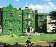
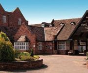
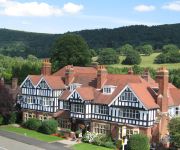
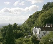
The Abbey Great Malvern
Puddle Lane B&B
BANK HOUSE HOTEL SPA AND GOLF
Colwall Park
Cottage in the Wood
The Mount Pleasant Hotel
Holdfast Cottage Hotel
COTFORD HOTEL
Malvern
Videos from this area
These are videos related to the place based on their proximity to this place.
Driving Along Wells Road A449 From Malvern Wells To Great Malvern, England 27th March 2013
Driving along Wells Road (A449) & Belle Vue Terrace from Malvern Wells to Great Malvern, Worcestershire, England Videoed on Wednesday, 27th March 2013 Playlist: ...
Driving Along Graham Road, Worcester Road & Church Street, Great Malvern, Worcestershire, UK
Driving along Graham Road, Worcester Road (A449), Belle Vue Terrace & Church Street (B4211), Great Malvern, Worcestershire, England Videoed on Friday, 17th December 2010 Playlist: ...
Driving Along Abbey Road, Grange Road & Church Street, Great Malvern, England 10th December 2010
Driving along Abbey Road, Grange Road & Church Street, Great Malvern, Worcestershire, England Videoed on Friday, 10th December 2010 Playlist: ...
Great Malvern Priory Church, Malvern, Worcestershire, England 20th September 2009
Great Malvern Priory Church, Malvern, Worcestershire, England Videoed on Sunday, 20th September 2009 Link: http://www.greatmalvernpriory.org.uk/
Driving Along Wells Road A449, Great Malvern, Worcestershire, UK 30th August 2010
Driving along Wells Road (A449), Great Malvern, Worcestershire, England Videoed on Sunday, 30th August 2010 Playlist: http://www.youtube.com/view_play_list?p=4134F19B44883DB5.
Driving Along Wells Road A449 From Malvern Wells To Great Malvern, England 15th March 2013
Driving along Wells Road (A449) & Belle Vue Terrace from Malvern Wells to Great Malvern, Worcestershire, England Videoed on Friday, 15th March 2013 Playlist: ...
Driving Along Wells Road A449 From Malvern Wells To Great Malvern, Worcestershire 10th February 2012
Driving along Wells Road (A449) & Belle Vue Terrace from Malvern Wells to Great Malvern, Worcestershire, England Videoed on Friday,10th February 2012 Playlist:http://www.youtube.com/playlist?list.
Great Malvern Priory Church, Malvern, Worcestershire 20th May 2007 (Pictures Only)
Photograpths of Great Malvern Priory Church, Malvern, Worcestershire 20th May 2007.
Driving On Wells Road A449 & Church Street B4211, Malvern, Worcestershire, UK 10th December 2010
Driving along the Wells Road (A449), Malvern Wells & Church Street (B4211), Great Malvern, Worcestershire, England Videoed on Friday, 10th December 2010 Playlist: ...
Grey Squirrel, Malvern, Worcestershire, England 20th September 2009
I spotted this grey squirrel while I was out filming at Great Malvern Priory Church. It was not the easiest of animals to film! Videoed on Sunday, 20th September 2009.
Videos provided by Youtube are under the copyright of their owners.
Attractions and noteworthy things
Distances are based on the centre of the city/town and sightseeing location. This list contains brief abstracts about monuments, holiday activities, national parcs, museums, organisations and more from the area as well as interesting facts about the region itself. Where available, you'll find the corresponding homepage. Otherwise the related wikipedia article.
Malvern Hills District
Malvern Hills is a local government district in Worcestershire, England. Its council is based in the town of Malvern, and its area covers most of the western half of the county that borders Herefordshire. It was originally formed in 1974 and was subject to a significant boundary reform in 1998. In the 2001 census the population of the Malvern Hills district was 35,042 males and 37,130 females, totalling 72,172 people. The age profile is slightly skewed to the over 50s.
Colwall railway station
Colwall railway station is a railway station on the Cotswold Line serving the village of Colwall in Herefordshire, England. The station has one platform and seating but no ticket office or self-service machine (tickets being available to purchase once on board the train). The station was opened in 1861, the same year as the Hereford and Worcester Railway Line. Today services are available direct to London Paddington, Birmingham and Hereford.
The Elms School
The Elms School is a co-educational, independent, boarding, prep school located in Colwall, Herefordshire, England, at the foot of the Malvern Hills. Including its pre-prep department, it caters for children from 2½ to 13 years old. The Elms was founded in 1614 by Humphrey Walwyn of the Worshipful Company of Grocers, and is the oldest prep school still on its original site. It maintains close links with the Grocers' Company, and receives financial assistance from the company's charitable arm.
Downs Light Railway
The Downs Light Railway is the world's oldest private miniature railway, with a track gauge of 9½ inches. The Railway is located within the private grounds of The Downs School (Colwall, Malvern, Worcestershire). The railway was built and opened in 1925 by Geoffrey Hoyland (Headmaster) as a 7.25in gauge railway, for the principal purpose of education. The railway was regauged during the 1930s to the larger gauge of 9.5in, to allow for new locos to be used on the line.
Pinnacle Hill
Pinnacle Hill is situated in the range of Malvern Hills that runs approximately 13 kilometres north-south along the Herefordshire-Worcestershire border. It lies between Jubilee Hill and Black Hill and has an elevation of 358 metres . It is the site of two possible Bronze age round barrows.
Jubilee Hill
Jubilee Hill is situated in the range of Malvern Hills that runs approximately 13 kilometres north-south along the Herefordshire-Worcestershire border. It lies between Perseverance Hill and Pinnacle Hill and has an elevation of 327 metres . Jubilee Hill was named by the Malvern Hills Conservators in 2002 in honour of The Queen's Golden Jubilee. The Duke of York unveiled a plaque at the top of the hill, commemorating its new identity, in 2003.
Stowe Lane
Stowe Lane is a cricket ground in Colwall, Herefordshire. The first recorded county match on the ground was in 1974, when the Worcestershire Second XI played the Glamorgan Second XI in the Second XI Championship. The first Minor Counties Championship match played the on the ground was in 1993, and between Herefordshire and Cheshire. From 1993 to present, the ground has hosted 17 Minor Counties Championship matches and 6 MCCA Knockout Trophy matches.
Holy Well, Malvern
The Holy Well is set on the slopes of the Malvern Hills above Malvern Wells. The well is believed to be the site of the oldest bottling plant in the world. The Malvern spring water was first bottled on a commercial scale at the well and the building houses a modern commercial bottling plant.
Colwall Tunnels
The Colwall Tunnels are a pair of railway tunnels that connect Colwall and Malvern Wells on the Cotswold Line, passing under the Malvern Hills in the Welsh Marches region of England. The first tunnel was opened in 1861 by the Worcester and Hereford Railway. Due to its inadequate specification, a replacement tunnel was brought into service in 1926, and remains in use today.


