Safety Score: 3,0 of 5.0 based on data from 9 authorites. Meaning we advice caution when travelling to United Kingdom.
Travel warnings are updated daily. Source: Travel Warning United Kingdom. Last Update: 2024-04-27 08:23:39
Touring Eldersfield
Eldersfield in Worcestershire (England) is a town located in United Kingdom about 98 mi (or 158 km) west of London, the country's capital place.
Time in Eldersfield is now 03:53 PM (Saturday). The local timezone is named Europe / London with an UTC offset of one hour. We know of 9 airports nearby Eldersfield, of which 5 are larger airports. The closest airport in United Kingdom is Gloucestershire Airport in a distance of 8 mi (or 13 km), South-East. Besides the airports, there are other travel options available (check left side).
There are several Unesco world heritage sites nearby. The closest heritage site in United Kingdom is Blaenavon Industrial Landscape in a distance of 30 mi (or 49 km), South-West. Also, if you like the game of golf, there are several options within driving distance. Need some hints on where to stay? We compiled a list of available hotels close to the map centre further down the page.
Being here already, you might want to pay a visit to some of the following locations: Gloucester, Donnington, Ledbury, Churchdown and Uckington. To further explore this place, just scroll down and browse the available info.
Local weather forecast
Todays Local Weather Conditions & Forecast: 8°C / 46 °F
| Morning Temperature | 4°C / 39 °F |
| Evening Temperature | 7°C / 45 °F |
| Night Temperature | 7°C / 44 °F |
| Chance of rainfall | 0% |
| Air Humidity | 85% |
| Air Pressure | 1005 hPa |
| Wind Speed | Moderate breeze with 12 km/h (7 mph) from South-West |
| Cloud Conditions | Overcast clouds, covering 100% of sky |
| General Conditions | Light rain |
Sunday, 28th of April 2024
6°C (43 °F)
6°C (43 °F)
Heavy intensity rain, moderate breeze, overcast clouds.
Monday, 29th of April 2024
13°C (55 °F)
8°C (46 °F)
Light rain, moderate breeze, broken clouds.
Tuesday, 30th of April 2024
15°C (59 °F)
10°C (51 °F)
Light rain, fresh breeze, overcast clouds.
Hotels and Places to Stay
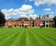
Hatherley Manor
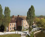
Corse Lawn House Hotel
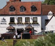
The Swan Hotel
Holdfast Cottage Hotel
Videos from this area
These are videos related to the place based on their proximity to this place.
Driving Along Drake Street & Welland Road A4104 From Welland To Upton Upon Severn, England
Driving along Drake Street (A4104) & Welland Road (A4104) from Welland to Upton Upon Severn, Worcestershire, England Videoed on Friday, 9th March 2012 Playlist: ...
Driving Along The A438 & B4208 From Eastnor To Birtsmorton, Worcestershire, England 9th March 2012
Driving along the A438 & B4208 from Eastnor, Herefordshire to Birtsmorton, Worcestershire, England Videoed on Friday, 9th March 2012 Playlist: ...
Driving Along The B4208 From Birtsmorton To Welland, Worcestershire, England 9th March 2012
Driving along the B4208 from Birtsmorton to Welland, Worcestershire, England Videoed on Friday, 9th March 2012 Playlist: http://www.youtube.com/playlist?list=PLD94CA3439A31F519.
Welland Steam & Country Rally Photos
The photos from the Welland Steam & Country Rally, there was a bit of a queue to get in, as they have a railway steam crane they also have a display of mobile ones. The ploughing section had...
Start of Malvern 10K Race AKA Pheasant Plucker
Start of Malvern 10K Race (AKA Pheasant Plucker) on Castelmorton Common June 2009.
Cottage World the best website to find holiday log cabins, apartments and cottages
Cottage World http://www.cottageworld.com lets you compare thousands of holiday cottages, apartments and log cabins, from many different owners and agencies to find the right one for you. Once...
Tirley Court Gloucestershire Fishing Carp Venue
Tirley Court Gloucestershire Carp Fishing Venue. www.fishing-forum.info carp fishing forum.
Videos provided by Youtube are under the copyright of their owners.
Attractions and noteworthy things
Distances are based on the centre of the city/town and sightseeing location. This list contains brief abstracts about monuments, holiday activities, national parcs, museums, organisations and more from the area as well as interesting facts about the region itself. Where available, you'll find the corresponding homepage. Otherwise the related wikipedia article.
Birtsmorton Court
Birtsmorton Court is a medieval moated manor house near Malvern in Worcestershire, in the former woodlands of Malvern Chase. The English place name element birt-, which often signifies the birches such as grow in this low-lying site, in this particular case may be a transformation of de Brute, holding the manor under Edward I.
South Wales Gas Pipeline
The South Wales Gas Pipeline (also known as the Milford Haven pipeline) is the UK’s largest high-pressure gas pipeline. The 197-mile pipeline passing through Wales was built for the National Grid and links Dragon and South Hook liquid natural gas (LNG) terminals at Milford Haven, Pembrokeshire with the national gas network at Tirley, Gloucestershire.
Gadfield Elm Chapel
The Gadfield Elm Chapel near the village of Pendock in Worcestershire, England, is the oldest extant chapel of The Church of Jesus Christ of Latter-day Saints (LDS Church). The structure was built in 1836 as a religious meetinghouse by the United Brethren, a group of breakaway Primitive Methodists led by Thomas Knighton.
Corse, Gloucestershire
Corse is a village in the English county of Gloucestershire. St Margarets Church is mainly 14th century. Corse Court is mediaeval. The settlement of Snig's End{{#invoke:Coordinates|coord}}{{#coordinates:51.959156|-2.303739|type:city_region:GB|||||| | |name=Snigs End }}, about 1½ miles from the village, was the site of a settlement for industrial workers under the auspices of the National Land Company in 1847.
Pendock Church
Pendock Church is a redundant Anglican church standing to the southeast of the hamlet of Sledge Green in the parish of Pendock, Worcestershire, England. It has been designated by English Heritage as a Grade I listed building, and is under the care of the Churches Conservation Trust. It stands in an isolated position overlooking and to the north of the M50 motorway. To its north are the earthworks of a former medieval village.
RAF Berrow
RAF Berrow is a former Royal Air Force Satellite Landing Ground located near Berrow, Worcestershire, England.


