Safety Score: 3,0 of 5.0 based on data from 9 authorites. Meaning we advice caution when travelling to United Kingdom.
Travel warnings are updated daily. Source: Travel Warning United Kingdom. Last Update: 2024-04-28 08:22:10
Explore Ripple
Ripple in Worcestershire (England) is a city in United Kingdom about 95 mi (or 153 km) west of London, the country's capital.
Local time in Ripple is now 01:14 AM (Monday). The local timezone is named Europe / London with an UTC offset of one hour. We know of 9 airports in the vicinity of Ripple, of which 5 are larger airports. The closest airport in United Kingdom is Gloucestershire Airport in a distance of 10 mi (or 16 km), South. Besides the airports, there are other travel options available (check left side).
There are several Unesco world heritage sites nearby. The closest heritage site in United Kingdom is Blaenavon Industrial Landscape in a distance of 36 mi (or 58 km), South-West. Also, if you like golfing, there are multiple options in driving distance. If you need a place to sleep, we compiled a list of available hotels close to the map centre further down the page.
Depending on your travel schedule, you might want to pay a visit to some of the following locations: Uckington, Swindon Village, Churchdown, Worcester and Gloucester. To further explore this place, just scroll down and browse the available info.
Local weather forecast
Todays Local Weather Conditions & Forecast: 12°C / 54 °F
| Morning Temperature | 7°C / 45 °F |
| Evening Temperature | 10°C / 50 °F |
| Night Temperature | 10°C / 51 °F |
| Chance of rainfall | 2% |
| Air Humidity | 82% |
| Air Pressure | 1011 hPa |
| Wind Speed | Fresh Breeze with 16 km/h (10 mph) from North |
| Cloud Conditions | Overcast clouds, covering 100% of sky |
| General Conditions | Light rain |
Tuesday, 30th of April 2024
15°C (59 °F)
8°C (47 °F)
Light rain, fresh breeze, broken clouds.
Wednesday, 1st of May 2024
14°C (58 °F)
8°C (47 °F)
Light rain, light breeze, overcast clouds.
Thursday, 2nd of May 2024
9°C (48 °F)
8°C (47 °F)
Moderate rain, moderate breeze, overcast clouds.
Hotels and Places to Stay
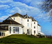
Hilton Puckrup Hall Tewkesbury
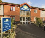
Days Inn Tewkesbury
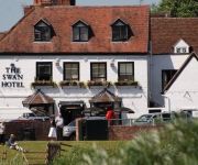
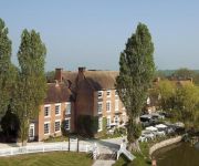
The Swan Hotel
The Tudor House Relaxinnz
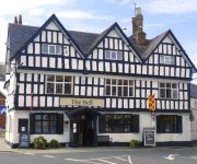
Bell Hotel
Tewkesbury Park
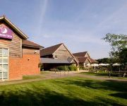
TRAVELODGE TEWKESBURY
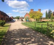
Gilberts End Farm - B&B
Corse Lawn House Hotel
Tewkesbury
Videos from this area
These are videos related to the place based on their proximity to this place.
Joe Averys Piece (Upton Upon Severn Sat-28-2014)
Tom Kincaid's Three Bears with James Evans - Sax Jamie Brownfield - Trumpet Jim Swinerton - Double Bass Tom Kincaid - Piano Jack Cotterill - Drums.
Wonderbrass - Upton-upon-Severn Jazz Festival 28th of June 2014
Wonderbrass of Wales performing at the Jazz Festival in Upton-upon-Severn near Great Malvern.
Driving Along Severn Drive, School Lane & Minge Lane, Upton Upon Severn, England 9th March 2012
Driving along Severn Drive, School Lane & Minge Lane, Upton Upon Severn, Worcestershire, England Videoed on Friday, 9th March 2012 Playlist: ...
Driving Along Old Street, High Street & Church Street, Upton Upon Severn, England 9th March 2012
Driving along Old Street, High Street, Church Street & Upton bridge, Upton Upon Severn, Worcestershire, England Videoed on Friday, 9th March 2012 Playlist: http://www.youtube.com/playlist?list=PL...
Brolly Parade Upton Upon Severn Sat-29-2014)
The street parade passing past Upton Social Club led by Wonderbrass http://www.wonderbrass.org.uk.
Morris Dance in Upton-upon-Severn 04-06-2012
A Performance while there was a Diamond Jubilee Street Party in Upton upon Severn.
Driving Along Minge Lane, Gardens Walk & Hillsfield, Upton Upon Severn, England 9th March 2012
Driving along Minge Lane, Gardens Walk, Hillsfield & Gardens Walk, Upton Upon Severn, Worcestershire, England Videoed on Friday, 9th March 2012 Playlist: ...
The Muggery Upton on Severn Worcestershire
We wondered why it was called the Muggery then we looked up.
Down by the riverside (Upton Upon 7, 2012)
Taken in the Upton Upon Severn Social Club during an informal jam session at the Oliver Cromwell Jazz festival in 2012.
Videos provided by Youtube are under the copyright of their owners.
Attractions and noteworthy things
Distances are based on the centre of the city/town and sightseeing location. This list contains brief abstracts about monuments, holiday activities, national parcs, museums, organisations and more from the area as well as interesting facts about the region itself. Where available, you'll find the corresponding homepage. Otherwise the related wikipedia article.
Upton-upon-Severn
Upton-upon-Severn (or Upton-on-Severn) is a small town and civil parish in the Malvern Hills District of Worcestershire, England, on the River Severn. According to the national census 2001 it had a population of 2,859. Located 5 miles from Malvern, the bridge at Upton is the only one across the river Severn between Worcester and Tewkesbury. The present bridge was built in 1940. Upton was founded in 897.
Tewkesbury Borough
Tewkesbury is a local government district and borough in Gloucestershire, in the West Country of England. It is named after its main town, Tewkesbury. Other places in the borough include Ashchurch, Bishop's Cleeve, Churchdown and Winchcombe. The district was formed on 1 April 1974, under the Local Government Act 1972, from the municipal borough of Tewkesbury, along with Cheltenham Rural District and part of Gloucester Rural District.
The Mythe
The Mythe is a house built on the top of a hill overlooking the town of Tewkesbury, England. There has been a house on the site for nearly a thousand years. The Mythe is the name of the house but it also the name of the surrounding area, about 4 square miles . The main road going through it is the A38 or the "Mythe Road". The house now standing on the plot is an early Georgian house that was built in 1753. This house was later bought by the Marquis de Lis.
Twyning
Twyning is a village on the River Avon in the north of Gloucestershire, near Tewkesbury, England. The name derives from the Old English for "between the rivers"; despite its spelling, it is pronounced "twinning". The village is divided into two parts, the older "Churchend", and "Twyning Green", where the populace are said to have moved to escape the Black Death. It has two pubs, The Fleet at Twyning by the river and the Village Inn overlooking the village green.
Mythe Bridge
Mythe Bridge carries the A438 road across the River Severn at Tewkesbury. It is a cast iron arch bridge spanning 170 feet (52m) and 24 feet (7.3m) wide, designed by Thomas Telford and completed in April 1826. Telford was appointed to design the bridge in 1823, following a dispute between the bridge trustees and their existing architect, who had proposed a bridge with three shorter iron arches.
Mythe Water Treatment Works
The Mythe Water Treatment Works in Tewkesbury, Gloucestershire, England is a facility which treats water drawn from the river Severn. On the 1 March 2002 Severn Trent water worked with local councilors to create an emergency plan, which was supposed to ensure that in the state of emergency their services would not be affected. It came to national attention in July 2007 when it became inundated with water from the River Severn during the Summer 2007 United Kingdom floods.
Upton-on-Severn railway station
Upton-on-Severn railway station was a railway station serving Upton-on-Severn in the English county of Worcestershire. It was opened by the Midland Railway's Tewkesbury and Malvern Railway between Great Malvern and Evesham. At grouping in 1923 it became part of the London Midland and Scottish Railway.
Mythe Chapel
The Mythe Chapel is located at Tewkesbury on the Mythe (off the A38 overlooking Mythe Bridge, between Severn Trent Water and the Tewkesbury Garden Centre). The Mythe Chapel was the only place of worship on the Mythe after the Dissolution. The Chapel was built in 1870 with funds from the Marquis de Lys who had lived in Tewkesbury since 1863.


