Safety Score: 3,0 of 5.0 based on data from 9 authorites. Meaning we advice caution when travelling to United Kingdom.
Travel warnings are updated daily. Source: Travel Warning United Kingdom. Last Update: 2024-05-05 08:24:42
Explore Sedgeberrow
Sedgeberrow in Worcestershire (England) with it's 845 inhabitants is a city in United Kingdom about 87 mi (or 140 km) north-west of London, the country's capital.
Local time in Sedgeberrow is now 04:26 PM (Sunday). The local timezone is named Europe / London with an UTC offset of one hour. We know of 10 airports in the vicinity of Sedgeberrow, of which 5 are larger airports. The closest airport in United Kingdom is Gloucestershire Airport in a distance of 14 mi (or 22 km), South-West. Besides the airports, there are other travel options available (check left side).
There are several Unesco world heritage sites nearby. The closest heritage site in United Kingdom is Blaenavon Industrial Landscape in a distance of 44 mi (or 71 km), South-West. Also, if you like golfing, there are multiple options in driving distance. We found 1 points of interest in the vicinity of this place. If you need a place to sleep, we compiled a list of available hotels close to the map centre further down the page.
Depending on your travel schedule, you might want to pay a visit to some of the following locations: Shipton, Swindon Village, Uckington, Churchdown and Worcester. To further explore this place, just scroll down and browse the available info.
Local weather forecast
Todays Local Weather Conditions & Forecast: 16°C / 61 °F
| Morning Temperature | 9°C / 48 °F |
| Evening Temperature | 14°C / 56 °F |
| Night Temperature | 10°C / 50 °F |
| Chance of rainfall | 2% |
| Air Humidity | 65% |
| Air Pressure | 1006 hPa |
| Wind Speed | Gentle Breeze with 7 km/h (4 mph) from North-West |
| Cloud Conditions | Broken clouds, covering 77% of sky |
| General Conditions | Light rain |
Monday, 6th of May 2024
16°C (62 °F)
10°C (50 °F)
Light rain, gentle breeze, overcast clouds.
Tuesday, 7th of May 2024
15°C (59 °F)
10°C (51 °F)
Light rain, light breeze, overcast clouds.
Wednesday, 8th of May 2024
17°C (63 °F)
13°C (55 °F)
Light rain, light breeze, broken clouds.
Hotels and Places to Stay
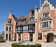
The Wood Norton
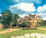
Buckland Manor
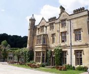
Dumbleton Hall
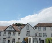
The Northwick Hotel
Evesham
Evesham
BUCKLAND MANOR
Videos from this area
These are videos related to the place based on their proximity to this place.
Driving Along Badsey Road, Elm Road & Broadway Road, Evesham, Worcestershire, England
Driving along Badsey Road (B4035), Elm Road (B4035) & Broadway Road, Evesham, Worcestershire, England Videoed on Saturday, 22nd June 2013 Playlist: ...
Evesham Martial Arts - The Wolf Cubs (Aged 4-7)
The Wolf Cubs programme is Evesham Martial Arts specialist kids programme. We aim to develop Co-ordination, confidence and respect, all whilst learning to defend themselves in a fun environment!
The National Morris Dancing Weekend at Evesham
The National Morris dancing Weekend in Evesham, Worcestershire - June 2014.
Wedding Cupcake Ideas Evesham
Find us on facebook http://facebook.com/JaneLouiseCakes Wedding Cupcake Ideas from Evesham, A selection of wedding cupcakes showing different styles and designs. Browse our many other ...
Spirit House Evesham | Haunted Tours | Ghost Tours | Ghost Campers
We attended the Spirit House in Evesham on Saturday 24/01/2015. What happened that night will stay with the six of us for a long time. Please feel free to like, share and comment. Visit...
Scammell Explorer 1951 YSY250 on the Road & at Evesham
Seen driving to the excellent "Wartime in the Vale" show at Evesham...and then at the Show.
Long Fall Boots - Iron Road, Evesham (30/01/2015)
Long Fall Boots playing in a battle of the bands at the Iron Road rock bar in Evesham 30/01/2015 Facebook: https://www.facebook.com/LongFallBoots Bandcamp: http://longfallboots.bandcamp.com/...
Random quad flight over Evesham, Worcestershire
Just a quick flight of my quad on the field down from my house, next to the river Avon in Evesham, Worcestershire. Skip nearer to the end to see some high shots of the town itself. Some good...
Thunderstorms and lightning over Evesham - normal speed
Thunderstorms over Evesham at original speed. July 19th 2014.
Videos provided by Youtube are under the copyright of their owners.
Attractions and noteworthy things
Distances are based on the centre of the city/town and sightseeing location. This list contains brief abstracts about monuments, holiday activities, national parcs, museums, organisations and more from the area as well as interesting facts about the region itself. Where available, you'll find the corresponding homepage. Otherwise the related wikipedia article.
Dumbleton
Dumbleton is a village in the English county of Gloucestershire. The village is roughly 20 miles from the city of Gloucester. The village is known to have existed in the time of Ethelred I who granted land to Abingdon Abbey, and it is mentioned in the Domesday Book. Dumbleton is situated on the edge of Dumbleton Hill, a foothill of the Cotswolds and is situated within the Cotswolds Area of Outstanding Natural Beauty.
Hinton railway station
Hinton railway station was a station on the Midland Railway between Tewkesbury and Evesham. During WW2 the area surrounding the station was used as a military fuel dump and it was subject to at least one unsuccessful air attack. Following the station's closure in 1963 the area was used by several companies for storage including the local Midlands Electricity Board who used it to store electrical mains equipment.
Ashton-under-Hill railway station
Ashton-under-Hill railway station was a station on the Midland Railway between Great Malvern and Evesham.
Bengeworth railway station
Bengeworth railway station was a station on the Midland Railway between Tewkesbury and Evesham. The precise location of the station was not in the Evesham suburb of Bengeworth itself, but 2 miles away in Hampton. The station was named Bengeworth in order to avoid confusion over other stations in the area that also included Hampton in their names. Following the closure of the line in 1963 some of the land between Hinton on the Green and south of Bengeworth station was given over to housing.
Bredon Hill Middle School
Bredon Hill Middle School is a non-denominational mixed gender middle school in Ashton under Hill, Worcestershire. The school's catchment area encompasses the surrounding villages of Ashton under Hill, Broadway, Bredon, Cropthorne, Eckington, Elmley Castle, Overbury, and Sedgeberrow, with the majority of students continuing their education at Prince Henry's High School in the neighbouring town of Evesham.
South Worcestershire College
South Worcestershire College is a further education college with campuses in Evesham and Malvern and various outreach locations. It was established in September 2000 on the merging of Evesham College and Malvern Hills College and was renamed South Worcestershire College in September 2009 to more accurately reflect its growth and geographical location. The college provides full and part-time vocational education for students aged 14–18 and a variety of courses and activities for adults.


