Safety Score: 3,0 of 5.0 based on data from 9 authorites. Meaning we advice caution when travelling to United Kingdom.
Travel warnings are updated daily. Source: Travel Warning United Kingdom. Last Update: 2024-05-05 08:24:42
Delve into Fladbury
Fladbury in Worcestershire (England) with it's 641 habitants is located in United Kingdom about 91 mi (or 146 km) north-west of London, the country's capital town.
Current time in Fladbury is now 01:49 PM (Sunday). The local timezone is named Europe / London with an UTC offset of one hour. We know of 10 airports close to Fladbury, of which 5 are larger airports. The closest airport in United Kingdom is Gloucestershire Airport in a distance of 17 mi (or 27 km), South-West. Besides the airports, there are other travel options available (check left side).
There are several Unesco world heritage sites nearby. The closest heritage site in United Kingdom is Blaenavon Industrial Landscape in a distance of 45 mi (or 72 km), South-West. Also, if you like playing golf, there are some options within driving distance. We encountered 1 points of interest near this location. If you need a hotel, we compiled a list of available hotels close to the map centre further down the page.
While being here, you might want to pay a visit to some of the following locations: Swindon Village, Uckington, Worcester, Shipton and Churchdown. To further explore this place, just scroll down and browse the available info.
Local weather forecast
Todays Local Weather Conditions & Forecast: 16°C / 60 °F
| Morning Temperature | 9°C / 47 °F |
| Evening Temperature | 13°C / 56 °F |
| Night Temperature | 9°C / 49 °F |
| Chance of rainfall | 1% |
| Air Humidity | 69% |
| Air Pressure | 1007 hPa |
| Wind Speed | Moderate breeze with 9 km/h (6 mph) from North-West |
| Cloud Conditions | Scattered clouds, covering 30% of sky |
| General Conditions | Light rain |
Monday, 6th of May 2024
15°C (60 °F)
11°C (52 °F)
Light rain, gentle breeze, overcast clouds.
Tuesday, 7th of May 2024
17°C (62 °F)
10°C (51 °F)
Light rain, gentle breeze, broken clouds.
Wednesday, 8th of May 2024
15°C (59 °F)
11°C (52 °F)
Light rain, gentle breeze, broken clouds.
Hotels and Places to Stay
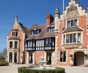
The Wood Norton
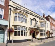
ANGEL INN HOTEL
The Northwick Hotel
Evesham
Evesham
Videos from this area
These are videos related to the place based on their proximity to this place.
Driving Between Bishampton & Throckmorton, Pershore, Worcestershire, England 22nd June 2013
Driving between Bishampton & Throckmorton, Pershore, Worcestershire, England Videoed on Saturday, 22nd June 2013 Playlist: ...
Evesham Martial Arts - The Wolf Cubs (Aged 4-7)
The Wolf Cubs programme is Evesham Martial Arts specialist kids programme. We aim to develop Co-ordination, confidence and respect, all whilst learning to defend themselves in a fun environment!
Steam Tour passing through Evesham
"The Welsh Borders" steam tour hauled by Bulleid Light Pacific West Country class 34046 "Braunton" passed through Evesham. I put on my trainspotter hat and went along to get some photos and a ...
Spirit House Evesham | Haunted Tours | Ghost Tours | Ghost Campers
We attended the Spirit House in Evesham on Saturday 24/01/2015. What happened that night will stay with the six of us for a long time. Please feel free to like, share and comment. Visit...
Driving On The A46 & A44 From Evesham To Fladbury, Worcestershire, England 22nd June 2013
Driving along the A46 & A44 from Evesham to Fladbury, Worcestershire, England Videoed on Saturday, 22nd June 2013 Playlist: ...
Driving Between Church Lench & Lenchwick, Evesham, Worcestershire, England 22nd June 2013
Driving between Church Lench & Lenchwick (along Evesham Road & Hipton Hill), Evesham, Worcestershire, England Videoed on Saturday, 22nd June 2013 Playlist: ...
Skinny Molly, Copperhead Road. At The Iron Road, Evesham
Skinny Molly, Copperhead Road. At The Iron Road, Evesham.
Driving On The A44 From Spetchley, Worcester To Chadbury, Evesham, Worcestershire, England
Driving along the A44 from Spetchley, Worcester To Chadbury, Evesham, Worcestershire, England. Videoed on Friday, 30th November 2012 Playlist: ...
Driving On Chadbury Road, Through Lenchwick & Along Hipton Hill, Evesham, Worcestershire, England
Driving along Chadbury Road, through Lenchwick & along Hipton Hill, Evesham, Worcestershire, England. Videoed on Friday, 30th November 2012 Playlist: ...
Videos provided by Youtube are under the copyright of their owners.
Attractions and noteworthy things
Distances are based on the centre of the city/town and sightseeing location. This list contains brief abstracts about monuments, holiday activities, national parcs, museums, organisations and more from the area as well as interesting facts about the region itself. Where available, you'll find the corresponding homepage. Otherwise the related wikipedia article.
Mid Worcestershire (UK Parliament constituency)
Mid Worcestershire is a constituency represented in the House of Commons of the UK Parliament since 1997 by Peter Luff, a Conservative.
Wood Norton, Worcestershire
Wood Norton Hall is a Grade II listed Victorian stately home near Evesham, Worcestershire, England. It was the last home in England of Prince Philippe, Duke of Orléans, who claimed the throne of France. Used by the British Broadcasting Corporation during World War II as a station for listening to enemy radio broadcasts and an emergency broadcasting centre, it became the accommodation for the BBC's engineering training college that grew up in its grounds.
Hill and Moor
Hill and Moor is a civil parish in the Wychavon district of Worcestershire, England. It includes the village Lower Moor and the hamlets of Upper Moor, Hill and Hill Furze.


