Safety Score: 3,0 of 5.0 based on data from 9 authorites. Meaning we advice caution when travelling to United Kingdom.
Travel warnings are updated daily. Source: Travel Warning United Kingdom. Last Update: 2024-04-26 08:02:42
Touring Northwick
The district Northwick of in Worcestershire (England) is a subburb located in United Kingdom about 102 mi north-west of London, the country's capital place.
Need some hints on where to stay? We compiled a list of available hotels close to the map centre further down the page.
Being here already, you might want to pay a visit to some of the following locations: Worcester, Bransford, Cotheridge, Leigh and Stourport-on-Severn. To further explore this place, just scroll down and browse the available info.
Local weather forecast
Todays Local Weather Conditions & Forecast: 11°C / 51 °F
| Morning Temperature | 2°C / 35 °F |
| Evening Temperature | 10°C / 50 °F |
| Night Temperature | 5°C / 41 °F |
| Chance of rainfall | 0% |
| Air Humidity | 60% |
| Air Pressure | 1005 hPa |
| Wind Speed | Gentle Breeze with 7 km/h (4 mph) from South-West |
| Cloud Conditions | Overcast clouds, covering 99% of sky |
| General Conditions | Overcast clouds |
Saturday, 27th of April 2024
8°C (47 °F)
7°C (45 °F)
Light rain, moderate breeze, overcast clouds.
Sunday, 28th of April 2024
7°C (44 °F)
7°C (44 °F)
Moderate rain, moderate breeze, overcast clouds.
Monday, 29th of April 2024
13°C (55 °F)
7°C (44 °F)
Light rain, moderate breeze, broken clouds.
Hotels and Places to Stay
Worcester Whitehouse
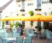
Hadley Bowling Green Inn
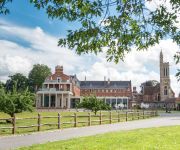
Stanbrook Abbey
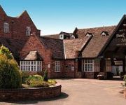
BANK HOUSE HOTEL SPA AND GOLF
TRAVELODGE WORCESTER
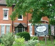
St. Lawrence Hotel
The Pear Tree Inn
St Andrews Town
Jct6) Worcester (M5
Worcester City Centre
Videos from this area
These are videos related to the place based on their proximity to this place.
Worcester City v Oxford City
Worcester City 3 Oxford City 2 Blue Square Bet North Monday 1st April 2013 St George's Lane Worcester.
Box Fitness Worcester 3 level boxing course
Box Fitness ltd boxing and fitness club: 28 The Tything, Worcester, Worcestershire, United Kingdom, WR1 1JL.
Worcester City v Bradford Park Avenue AFC
Worcester City v Bradford Park Avenue AFC Blue Square Bet North St George's Lane Worcester Saturday 15th December 2012.
Driving On Tybridge Street, Hylton Road, Henwick Road & Hallow Road, Worcester, England
Driving along Tybridge Street A44, Hylton Road A443, Henwick Road A443 & Hallow Road A433, Worcester, Worcestershire, England Videoed on Friday, 10th October 2014 Playlist: ...
Driving Along Barbourne Road, Upper Tything, The Tything & Castle Street, Worcester, Worcestershire
Driving along Barbourne Road (A38), Upper Tything (A38), The Tything (A38) & Castle Street (A449), Worcester, Worcestershire, England Videoed on Friday, 24th December 2010 Playlist: http://www.yo ...
Driving In Snow Along The Tything, Upper Tything, Barbourne Road & Sunnyside Road, Worcester
Driving in snow The Tything, Upper Tything, Barbourne Road & Sunnyside Road, Worcester, Worcestershire, England Videoed on Wednesday, 22nd December 2010 Playlist: ...
Driving In Snow Along St George's Walk, St George's Lane North & Flag Meadow Walk, Worcester
Driving in snow along St George's Walk, St George's Lane North & Flag Meadow Walk, Worcester, Worcestershire, England Videoed on Wednesday, 22nd December 2010 Playlist: ...
Driving Along The Tything, Upper Tything & Barbourne Road, Worcester, England 13th April 2013
Driving Along The Tything, Upper Tything & Barbourne Road, Worcester, Worcestershire, England Videoed on Saturday, 13th April 2013 Playlist: ...
Worcester City v Chester FC
Worcester City 0 Chester FC 1 Blue Square Bet North Saturday 27th April 2013 - Att: 4027 The last Worcester City FC match at St George's Lane after 108 years.
Worcester City v Guiseley AFC
Worcester City 0 Guiseley AFC 1 Blue Square Bet North Saturday 23rd February 2013 St George's Lane Worcester.
Videos provided by Youtube are under the copyright of their owners.
Attractions and noteworthy things
Distances are based on the centre of the city/town and sightseeing location. This list contains brief abstracts about monuments, holiday activities, national parcs, museums, organisations and more from the area as well as interesting facts about the region itself. Where available, you'll find the corresponding homepage. Otherwise the related wikipedia article.
Royal Grammar School Worcester
The Royal Grammar School Worcester (also known as RGS Worcester) is an independent coeducational school in Worcester, England. Founded before 1291, it is one of the oldest British independent schools. It began accepting girls in 2002 prior to the merger. In September 2007 it merged with the neighbouring Alice Ottley School and was briefly known as RGS Worcester and The Alice Ottley School before reverting to its original name.
Free Radio Herefordshire & Worcestershire
Free Radio Herefordshire & Worcestershire (formerly Radio Wyvern) is an Independent Local Radio station serving Herefordshire and Worcestershire. The station, owned and operated by Orion Media, broadcasts from studios in Worcester on 96.7, 97.6, and 102.8 FM, and is part of the Free Radio network.
Anglican Diocese of Worcester
The Diocese of Worcester forms part of the Province of Canterbury in England. The diocese was founded in around 679 by St Theodore of Canterbury at Worcester to minister to the kingdom of the Hwicce, one of the many Anglo Saxon petty-kingdoms of that time. The original borders of the diocese are believed to be based on those of that ancient kingdom.
New Road, Worcester
New Road, Worcester, England, has been the home cricket ground of Worcestershire County Cricket Club since 1896. Immediately to the northwest is a road called New Road, part of the A44, hence the name.
A449 road
The A449 is a major road in the United Kingdom. It runs north from junction 24 of the M4 motorway at Newport in South Wales to Stafford in Staffordshire. The southern section of the road, between Ross on Wye and Newport forms part of the trunk route from the English Midlands to South Wales, avoiding the Severn Bridge
River Salwarpe
The River Salwarpe is a river in Worcestershire, England. Rising near Bromsgrove, it passes Stoke Prior, Upton Warren, Wychbold, Droitwich (where the Droitwich Canal starts to run alongside it). After Droitwich, it meets the River Severn, at Hawford, Claines . Andrew Yarranton attempted unsuccessfully to make it navigable in the 1660s.
Gheluvelt Park
Gheluvelt Park is a public park in Worcester, England. The park was opened on the 17 June 1922 to commemorate the Worcestershire Regiment's 2nd Battalion after their part in Battle of Gheluvelt, a World War I battle that took place on 31 October 1914 in Gheluvelt, Belgium. It was opened by Field Marshal John French, 1st Earl of Ypres, who stated, "on that day the 2nd Worcesters saved the British Empire.
Worcester City F.C
Worcester City Football Club is an English football club based in Worcester, Worcestershire. The club participates in the Conference North, the sixth tier of English football. Established in 1902, they have spent the majority of their history in non league football. The team plays at St George's Lane.
The Mug House
The Mug House is a traditional public house located in the village of Claines, Worcestershire, England, which dates back to the 15th century.
Worcester Foregate Street railway station
Worcester Foregate Street railway station, opened by the Great Western Railway in 1860, is situated in the centre of the city of Worcester, in Worcestershire, England. It is physically the smaller of the two stations serving the city, but is more centrally located. The other station is Worcester Shrub Hill situated to the east. The station layout is unusual in that travelling east the two platforms serve different routes, rather than different directions.
The Alice Ottley School
The Alice Ottley School was an independent all-girls school in Worcester that existed under this name - referencing its first headmistress - between 1883 and 2007 before it merged with the Worcester Royal Grammar School.
RGS The Grange
RGS The Grange (Royal Grammar School The Grange) is one of the junior schools of RGS Worcester. It is located at Claines, north of Worcester, United Kingdom. It is approximately 3 miles north of the senior school, and is situated on a 40-acre site. The headmaster of the school is Gareth Hughes. The other RGS Prep School is RGS Springfield.
Worcester Racecourse
Worcester Racecourse is a thoroughbred horse racing venue located in the city of Worcester, Worcestershire, England. The course is laid out as an oval circuit of about 13 furlongs in length and situated by the south side of the River Severn. During the 2007 floods, the racecourse was inundated and all the fixtures after June 30 had to be cancelled. 13 Fur = Approximately 2,615.2meters
Worcester College of Technology
Worcester College of Technology is a Further Education College situated in the city of Worcester in the United Kingdom. It also has a Construction Centre located in the nearby town of Malvern.
RGS Springfield
RGS Springfield (Royal Grammar School Springfield) is a co-ed Junior School of RGS Worcester. It is located in Britannia Square in Worcester, United Kingdom. It is located 100 yards west of the Senior School. After the RGS/AO merger, Springfield became co-educational. The headmistress of the school is Mrs Laura Brown. Its former head is Mrs Marion Lloyd. The other RGS prep School is RGS The Grange.
River School
The River School is an independent Christian School, affiliated with the Christian Schools Trust. The school is located in a large late Georgian Grade 2 listed building with many outbuildings, set in 8.5 acres of attractive wooded and open grassed areas, near the A38 road in the Fernhill Heath suburb of Worcester, England.
Northwick, Worcestershire
Northwick is a district of Worcester, England, located in the north of the city on the left (east) bank of the River Severn.
Glover's Needle
The Glover's Needle (or St Andrews Spire) is a spire-carrying tower in the city of Worcester, England.
1 and 2 Tai Cochin
1 and 2 Tai Cochin consists of a pair of joined cottages in the village of Nannerch, Flintshire, Wales. Each of the cottages is a Grade II listed building. They were built for the railway engineer William Barber Buddicom in 1877–88 and designed by the Chester architect John Douglas. The cottages are built in brick in vernacular revival style with tiled hipped roofs.
Worcester City Art Gallery & Museum
The Worcester City Art Gallery & Museum is an art gallery and local museum in Worcester, the county town of Worcestershire, England. The museum was originally founded in 1833 by members of the Worcestershire Natural History Society. It is located in a Victorian building in central Worcester, which opened in 1896. The gallery has a programme of contemporary art and craft exhibitions.
Greyfriars, Worcester
Greyfriars, Worcester, was a Franciscan friary and school in Worcester, England.
CrownGate Shopping Centre
CrownGate Worcester is a shopping centre in Worcester, England. It contains 60 stores, with a range of both large and smaller units, including anchor tenants House of Fraser, Debenhams and Primark. There are also three restaurants, a large car park with Bus Station and The Huntingdon Hall Theater. The Centre has just undergone an extensive £4million refurbishment and rebranding with new floors, canopies and lights as well as modern street furniture and art.
St Swithun's Church, Worcester
St Swithun's Church, Worcester, is a redundant Anglican church in the city of Worcester, Worcestershire, England. It has been designated by English Heritage as a Grade I listed building, and is under the care of the Churches Conservation Trust. The church is considered to be "one of the best preserved examples of an early Georgian church in England". Clifton-Taylor includes the church in his list of 'best' English parish churches.
RAF Worcester
RAF Worcester was an Royal Air Force relief landing ground (RLG) which was located 1.7 miles north east of Worcester city centre, Worcestershire, England and 4.4 miles south west of Droitwich Spa, Worcestershire.
Worcester Library


