Safety Score: 3,0 of 5.0 based on data from 9 authorites. Meaning we advice caution when travelling to United Kingdom.
Travel warnings are updated daily. Source: Travel Warning United Kingdom. Last Update: 2024-04-28 08:22:10
Explore North Moreton
North Moreton in Oxfordshire (England) with it's 328 inhabitants is located in United Kingdom about 46 mi (or 74 km) west of London, the country's capital.
Local time in North Moreton is now 05:55 PM (Sunday). The local timezone is named Europe / London with an UTC offset of one hour. We know of 11 airports in the wider vicinity of North Moreton, of which 5 are larger airports. The closest airport in United Kingdom is RAF Benson in a distance of 4 mi (or 7 km), East. Besides the airports, there are other travel options available (check left side).
There are several Unesco world heritage sites nearby. The closest heritage site in United Kingdom is City of Bath in a distance of 25 mi (or 40 km), South-West. Also, if you like golfing, there are multiple options in driving distance. If you need a place to sleep, we compiled a list of available hotels close to the map centre further down the page.
Depending on your travel schedule, you might want to pay a visit to some of the following locations: Upper Basildon, Oxford, Frilford, Farnborough and Tilehurst. To further explore this place, just scroll down and browse the available info.
Local weather forecast
Todays Local Weather Conditions & Forecast: 7°C / 45 °F
| Morning Temperature | 5°C / 41 °F |
| Evening Temperature | 9°C / 48 °F |
| Night Temperature | 4°C / 39 °F |
| Chance of rainfall | 25% |
| Air Humidity | 90% |
| Air Pressure | 1012 hPa |
| Wind Speed | Fresh Breeze with 14 km/h (9 mph) from South |
| Cloud Conditions | Overcast clouds, covering 100% of sky |
| General Conditions | Moderate rain |
Monday, 29th of April 2024
13°C (56 °F)
8°C (46 °F)
Broken clouds, fresh breeze.
Tuesday, 30th of April 2024
15°C (59 °F)
10°C (50 °F)
Light rain, fresh breeze, broken clouds.
Wednesday, 1st of May 2024
15°C (60 °F)
9°C (47 °F)
Light rain, gentle breeze, overcast clouds.
Hotels and Places to Stay
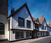
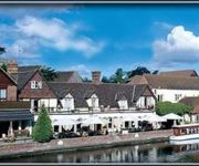
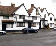
The Miller of Mansfield
GEORGE HOTEL
The Swan at Streatley
The George Relaxinnz
Shillingford Bridge
Oxford South (Didcot)
Videos from this area
These are videos related to the place based on their proximity to this place.
Grob Tutor 115e Over Didcot, Oxfordshire | Flying over England
Geography photography. This is some footage filmed from the cockpit of a Grob Tutor 115e during my air experience flight from RAF Benson. The town in the video is called Didcot and is in Oxfordshir...
Aircraft radio solving buzz and alternator whine.
Fit a capacity in the power circuit near the battery or right next to the radio and this should soak up most of the RF whine noise. Useful for microlights and GA aircraft. Check with your aircraft...
Great Western Mainline Near North Moreton 05.07.2012
Passenger and freight action seen near North Moreton on the Great Western Mainline. Filmed on the 5th July 2012. Class 43 HST's and Class 66's feature in the liveries of First Great Western...
Great Western Mainline Near South Moreton 14.05.2011
On the Great Western Mainline between Reading and Didcot, near South Moreton on the 14th May 2011, various passenger and freight movements are to be seen speeding past at mid morning. Loco's.
Steam Train: 5043 Earl of Mount Edgcumbe, The Moonraker, Solihull to Salisbury, 13 Apr 2013
Preserved ex-GWR Castle Class 4-6-0 no 5043 "Earl of Mount Edgcumbe" hauls "The Moonraker" steam excursion train by Vintage Trains Ltd from Solihull to Salisbury, Wiltshire, on 13th April 2013....
Great Western Mainline Near Cholsey 31.07.2014
A morning visit to Cholsey on the Great Western Mainline, filmed on the 31st July 2014. (See my uploads for footage from Cholsey Station and Lower Basildon filmed in the afternoon). The overhead...
Great Western Mainline Near Cholsey 24.03.2012
A very misty Great Western Mainline, filmed at Cholsey on the 24th March 2012. Class 43 HST's, Class 66's, Class 165 'Network Turbo's' and Class 220 'Voyagers'. From operating company's First...
Wiltshire Air Ambulance lands in Market Lavington
The police air ambulance landed to attend a patient near my house. I went over to see what was going on and the paramedic from the heli said "have you got a car... can you take me to the patient"....
GWML Freight & Passenger @ Cholsey, 2nd July 2014
A few hours spent at Manor Farm, Cholsey, to capture the various freight and passenger workings that pass on a typical weekday - before the OHL masts and wires go up soon! Highlights include...
Videos provided by Youtube are under the copyright of their owners.
Attractions and noteworthy things
Distances are based on the centre of the city/town and sightseeing location. This list contains brief abstracts about monuments, holiday activities, national parcs, museums, organisations and more from the area as well as interesting facts about the region itself. Where available, you'll find the corresponding homepage. Otherwise the related wikipedia article.
Wittenham Clumps
Wittenham Clumps is the commonly used name for a group of small hills in the otherwise flat Thames Valley, in the civil parish of Little Wittenham in the English county of Oxfordshire. They are mostly grassed, but are wooded at the top with ancient beech trees (planted in the 1740s), giving them a distinctive and prominent appearance. However, many of these have died or are dying. The area is a popular beauty spot, with a car park and paths for access on foot.
Day's Lock
Day's Lock is a lock on the River Thames near Dorchester-on-Thames, Oxfordshire, England on the Dorchester side of the river. The pound lock was built in 1789 by the Thames Navigation Commissioner. The lock is across the river from the small village of Little Wittenham and is overlooked from the south by the hills of Wittenham Clumps, with a particularly good view from Round Hill. The weir runs straight across the river from the other side of the lock island.
Brightwell Barrow
Brightwell Barrow is a bronze Age round barrow in the civil parish of Brightwell-cum-Sotwell in the English county of Oxfordshire. It lies just under a kilometre from Wittenham Clumps. Its position is marked by a small clump of trees on its peak. Brightwell Barrow is mentioned in the Domesday Book under the entry for Brightwell-cum-Sotwell.
Brightwell Castle
Brightwell Castle was in the village of Brightwell-cum-Sotwell, between the towns of Didcot and Wallingford, now in Oxfordshire but until 1974 in Berkshire, in England. The castle was built in 1145 by King Stephen. At the time there was civil war between himself and his cousin Matilda, whose headquarters were at nearby Wallingford Castle. In 1153 the castle was destroyed by Matilda's son, who later became Henry II. A manor house now stands on the site.
Project Timescape
Project Timescape is Northmoor Trust's visitor and education centre near the Wittenham Clumps, Little Wittenham, Oxfordshire, England. Project Timescape's aim is to educate and engage people in their local landscape and inspire them to take action to protect it.
Sylva Foundation
The Sylva Foundation is a tree and forestry organisation established in 2008, and registered as a charity in England and Wales in 2009. It is based in a rural location in the small village of Little Wittenham in Oxfordshire, England. It is concerned with the advancement and promotion of sustainable forest management. It was the brain child of Sir Martin Wood and Dr Gabriel Hemery and was formed through the work of the forestry think tank Forestry Horizons, established in 2006.
Bear at Home
The Bear at Home is a 16th-century public house in the South Oxfordshire (England) village of North Moreton, near Wallingford. It retains many original 16th-century features, including timber-framed walls, inglenook fireplace and a well, but was extended sympathetically in 1980 to allow it to serve food. New features include a minstrel's gallery above the bar, which is almost certainly unique.
The Poem Tree
The Poem Tree was a beech tree with a poem carved into it by Joseph Tubb, located on Castle Hill at Wittenham Clumps in Oxfordshire, England. The tree, which was believed to be around 300 years old, collapsed through a combination of long-standing rot and inclement weather in July 2012. The poem was carved in the 1840s. A stone, including a transcription and rubbing of the poem, was erected close to the tree in 1994 to commemorate the 150th anniversary of the carving.


