Safety Score: 3,0 of 5.0 based on data from 9 authorites. Meaning we advice caution when travelling to United Kingdom.
Travel warnings are updated daily. Source: Travel Warning United Kingdom. Last Update: 2024-04-24 08:14:40
Explore Frilford
Frilford in Oxfordshire (England) is located in United Kingdom about 54 mi (or 87 km) west of London, the country's capital.
Local time in Frilford is now 06:57 PM (Wednesday). The local timezone is named Europe / London with an UTC offset of one hour. We know of 11 airports in the wider vicinity of Frilford, of which 5 are larger airports. The closest airport in United Kingdom is RAF Brize Norton in a distance of 11 mi (or 18 km), North-West. Besides the airports, there are other travel options available (check left side).
There are several Unesco world heritage sites nearby. The closest heritage site in United Kingdom is City of Bath in a distance of 23 mi (or 38 km), South-West. Also, if you like golfing, there are multiple options in driving distance. If you need a place to sleep, we compiled a list of available hotels close to the map centre further down the page.
Depending on your travel schedule, you might want to pay a visit to some of the following locations: Oxford, Farnborough, Welford, Winterbourne and Newbury. To further explore this place, just scroll down and browse the available info.
Local weather forecast
Todays Local Weather Conditions & Forecast: 10°C / 50 °F
| Morning Temperature | 5°C / 41 °F |
| Evening Temperature | 7°C / 45 °F |
| Night Temperature | 3°C / 38 °F |
| Chance of rainfall | 0% |
| Air Humidity | 56% |
| Air Pressure | 1017 hPa |
| Wind Speed | Gentle Breeze with 8 km/h (5 mph) from South |
| Cloud Conditions | Broken clouds, covering 75% of sky |
| General Conditions | Broken clouds |
Thursday, 25th of April 2024
7°C (44 °F)
6°C (43 °F)
Light rain, gentle breeze, overcast clouds.
Friday, 26th of April 2024
9°C (48 °F)
6°C (43 °F)
Light rain, gentle breeze, overcast clouds.
Saturday, 27th of April 2024
6°C (43 °F)
9°C (48 °F)
Light rain, moderate breeze, overcast clouds.
Hotels and Places to Stay
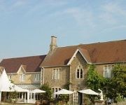
Fallowfields Country House
Oxford Abingdon
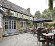
The Rose Revived
Kingswell
Abingdon
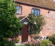
FORT RECOVERY VILLA SUITES HOTEL
Videos from this area
These are videos related to the place based on their proximity to this place.
RNAF F-16AM at Abingdon Air and Country Show 2010
Sorry for the extream shaking in this vid , i was bloody cold after getting soaked to the bone very early on in the day :(
P40 Kittyhawk at Abingdon Air and Country show 09
Peter Teichman displays his Kittyhawk at Abingdon 09 .
Videos provided by Youtube are under the copyright of their owners.
Attractions and noteworthy things
Distances are based on the centre of the city/town and sightseeing location. This list contains brief abstracts about monuments, holiday activities, national parcs, museums, organisations and more from the area as well as interesting facts about the region itself. Where available, you'll find the corresponding homepage. Otherwise the related wikipedia article.
Abingdon Rural District
Abingdon was a rural district in the administrative county of Berkshire from 1894 to 1974. It was formed under the Local Government Act 1894 based on that part of the Abingdon rural sanitary district which was in Berkshire. It nearly entirely surrounded, but did not include, the municipal borough of Abingdon, and in the north was close to Oxford.
Cothill House
Cothill House is a boarding boys' independent school for preparatory pupils in Cothill, Oxfordshire, which houses around 230 boys from the ages 8–13.
Parklands Campus
Parklands Campus is an independent special school for boys and girls aged 11 to 16, near Abingdon, Oxfordshire, England. It is run by children's charity Action for Children. Formerly Bessels Leigh School, it was taken over by children's charity Action for Children and relaunched as Spires School during the summer of 2009. In 2011 it was rebranded as Parklands Campus.
Thames Water Abingdon Reservoir
The Thames Water Abingdon Reservoir was a proposal, made in 2006 by Thames Water, to build a large cleanwater reservoir to the south west of Abingdon, Oxfordshire. In 2007 the Environment Agency noted that need for the reservoir was not proven.
Faringdon Rural District
Faringdon was a rural district in the administrative county of Berkshire from 1894 to 1974. It was formed under the Local Government Act 1894 based on that part of the Faringdon rural sanitary district which was in Berkshire, however it also included for a time Lechlade a small market town in Gloucestershire. It is around the north west region of historic Berkshire now south west Oxfordshire since it was transferred in 1974.
Denman College
Denman College is a residential adult education college centred on Marcham Park at Marcham in the English county of Oxfordshire. The college is owned and operated by the National Federation of Women's Institutes (The WI).
Fyfield and Tubney
Fyfield and Tubney is a civil parish in the The Vale of White Horse district of Oxfordshire, England. It includes the village of Fyfield which is about 4.5 miles west of Abingdon and Tubney, which is about 4 miles west of Abingdon. The parish was part of Berkshire until the 1974 boundary changes transferred it to Oxfordshire.
Frilford Heath Golf Club
Frilford Heath Golf Club is a 54 hole golf club in Frilford, Oxfordshire and is set amongst 500 acres of heathland to the south of Oxford city.


