Safety Score: 3,0 of 5.0 based on data from 9 authorites. Meaning we advice caution when travelling to United Kingdom.
Travel warnings are updated daily. Source: Travel Warning United Kingdom. Last Update: 2024-04-26 08:02:42
Delve into Sotwell
Sotwell in Oxfordshire (England) is a city located in United Kingdom about 45 mi (or 72 km) west of London, the country's capital town.
Current time in Sotwell is now 12:49 PM (Friday). The local timezone is named Europe / London with an UTC offset of one hour. We know of 11 airports closer to Sotwell, of which 5 are larger airports. The closest airport in United Kingdom is RAF Benson in a distance of 3 mi (or 4 km), East. Besides the airports, there are other travel options available (check left side).
There are several Unesco world heritage sites nearby. The closest heritage site in United Kingdom is City of Bath in a distance of 26 mi (or 42 km), South-West. Also, if you like playing golf, there are some options within driving distance. In need of a room? We compiled a list of available hotels close to the map centre further down the page.
Since you are here already, you might want to pay a visit to some of the following locations: Upper Basildon, Oxford, Tilehurst, Frilford and Farnborough. To further explore this place, just scroll down and browse the available info.
Local weather forecast
Todays Local Weather Conditions & Forecast: 10°C / 51 °F
| Morning Temperature | 2°C / 36 °F |
| Evening Temperature | 9°C / 48 °F |
| Night Temperature | 6°C / 43 °F |
| Chance of rainfall | 0% |
| Air Humidity | 59% |
| Air Pressure | 1003 hPa |
| Wind Speed | Gentle Breeze with 7 km/h (4 mph) from West |
| Cloud Conditions | Broken clouds, covering 82% of sky |
| General Conditions | Broken clouds |
Saturday, 27th of April 2024
7°C (45 °F)
6°C (43 °F)
Moderate rain, moderate breeze, overcast clouds.
Sunday, 28th of April 2024
5°C (42 °F)
6°C (44 °F)
Moderate rain, moderate breeze, overcast clouds.
Monday, 29th of April 2024
14°C (56 °F)
6°C (43 °F)
Scattered clouds, moderate breeze, broken clouds.
Hotels and Places to Stay
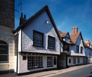
GEORGE HOTEL
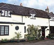
Little Gables Bed and Breakfast
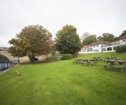
Shillingford Bridge
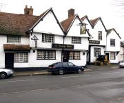
The George Relaxinnz
Videos from this area
These are videos related to the place based on their proximity to this place.
Cholsey & Wallingford Railway (2014)
A compilation of clips shot on a trip on the Northern Gas Board No. 1 locomotive while it was on a visit to the Cholsey & Wallingford Railway. The ride was a birthday present from a workmate...
Steam. Ivor the Engine @ Wallingford level crossing. April 2015.
Ivor crosses the Wallingford level crossing on the A4130 to Didcot. Ivor is a green pannier tank engine running on the Bunk Line from Wallingford to Cholsey. Filmed in April 2015.
Diesel class 14 @ Wallingford Level Crossing (Bunk Line) May 2013
A Class 14 diesel shunter hauls two coaches on the Bunk Line from Cholsey to Wallingford (Oxfordshire,UK). Filmed on 4 May 2013.
Steam. Northern Gas Board 1 @ Wallingford Level Crossing (Bunk Line) May 2014
Steam engine "Northern Gas Board 1" hauls two coaches on the Bunk Line from Cholsey to Wallingford (Oxfordshire,UK). Filmed on 25 May 2014.
WRC J16 girls 8 at Wallingford 4s & 8s head 2014
Wallingford RC Girls J16 8+ racing in Wallingford 4s and 8s head 2014, clip taken as they go past the entrance to Carmel College.
Wallingford Carols - Kat's Chorus - Joy to the World
Kat's Chorus, a Wallingford based A Cappella Choir perform Joy to the World. Sunday 07/12/14.
Aircraft radio solving buzz and alternator whine.
Fit a capacity in the power circuit near the battery or right next to the radio and this should soak up most of the RF whine noise. Useful for microlights and GA aircraft. Check with your aircraft...
Ride Brightwell to Dorchester
Excerpts from 5 miles on and off road biking, Brightwell-cum-Sotwell to Dorchester on Thames, Oxfordshire, England. Filmed with the ION Air Pro. For best picture watch in HD.
Wiltshire Air Ambulance lands in Market Lavington
The police air ambulance landed to attend a patient near my house. I went over to see what was going on and the paramedic from the heli said "have you got a car... can you take me to the patient"....
MATT FLIES OVER BILDERBERG 2013 in microlight aircraft
For the naysayers that say I am a govt agent and a debunker. How many of them do stuff like this?
Videos provided by Youtube are under the copyright of their owners.
Attractions and noteworthy things
Distances are based on the centre of the city/town and sightseeing location. This list contains brief abstracts about monuments, holiday activities, national parcs, museums, organisations and more from the area as well as interesting facts about the region itself. Where available, you'll find the corresponding homepage. Otherwise the related wikipedia article.
A.F.C. Wallingford
AFC Wallingford are an English association football club based in Wallingford. They play in the North Berks Football League.
River Thame
The River Thame /ˈteɪm/ is a river in Southern England. It is a tributary of the larger and better-known River Thames. The general course of the River Thame is north-east to south-west and the distance from its source to the River Thames is about 40 miles (65 km). It flows through the English counties of Buckinghamshire and Oxfordshire. The River Thame's source is several small streams which rise in the Vale of Aylesbury on the north side of the Chiltern Hills.
Wittenham Clumps
Wittenham Clumps is the commonly used name for a group of small hills in the otherwise flat Thames Valley, in the civil parish of Little Wittenham in the English county of Oxfordshire. They are mostly grassed, but are wooded at the top with ancient beech trees (planted in the 1740s), giving them a distinctive and prominent appearance. However, many of these have died or are dying. The area is a popular beauty spot, with a car park and paths for access on foot.
Thame United F.C
Thame United F.C. are a football club based in Thame, Oxfordshire, England. They were established in 1883 and joined the Hellenic League in 1959.
Brightwell Barrow
Brightwell Barrow is a bronze Age round barrow in the civil parish of Brightwell-cum-Sotwell in the English county of Oxfordshire. It lies just under a kilometre from Wittenham Clumps. Its position is marked by a small clump of trees on its peak. Brightwell Barrow is mentioned in the Domesday Book under the entry for Brightwell-cum-Sotwell.
Brightwell Castle
Brightwell Castle was in the village of Brightwell-cum-Sotwell, between the towns of Didcot and Wallingford, now in Oxfordshire but until 1974 in Berkshire, in England. The castle was built in 1145 by King Stephen. At the time there was civil war between himself and his cousin Matilda, whose headquarters were at nearby Wallingford Castle. In 1153 the castle was destroyed by Matilda's son, who later became Henry II. A manor house now stands on the site.
Shillingford Bridge
Shillingford Bridge is Grade II* listed road bridge near Shillingford, Oxfordshire, carrying an unclassified road across the River Thames in England on the reach above Benson Lock. The bridge provides access between Shillingford to the north of the river and Wallingford to the south. Originally the south side was in Berkshire but was transferred from Berkshire to Oxfordshire in 1974. The bridge is single track and vehicular passage is controlled by traffic lights.
The Poem Tree
The Poem Tree was a beech tree with a poem carved into it by Joseph Tubb, located on Castle Hill at Wittenham Clumps in Oxfordshire, England. The tree, which was believed to be around 300 years old, collapsed through a combination of long-standing rot and inclement weather in July 2012. The poem was carved in the 1840s. A stone, including a transcription and rubbing of the poem, was erected close to the tree in 1994 to commemorate the 150th anniversary of the carving.


