Safety Score: 3,0 of 5.0 based on data from 9 authorites. Meaning we advice caution when travelling to United Kingdom.
Travel warnings are updated daily. Source: Travel Warning United Kingdom. Last Update: 2024-04-23 08:18:23
Delve into North Stoke
North Stoke in Oxfordshire (England) with it's 362 habitants is located in United Kingdom about 43 mi (or 69 km) west of London, the country's capital town.
Current time in North Stoke is now 07:40 AM (Wednesday). The local timezone is named Europe / London with an UTC offset of one hour. We know of 11 airports close to North Stoke, of which 5 are larger airports. The closest airport in United Kingdom is RAF Benson in a distance of 3 mi (or 5 km), North. Besides the airports, there are other travel options available (check left side).
There are several Unesco world heritage sites nearby. The closest heritage site in United Kingdom is City of Bath in a distance of 26 mi (or 42 km), South-West. Also, if you like playing golf, there are some options within driving distance. If you need a hotel, we compiled a list of available hotels close to the map centre further down the page.
While being here, you might want to pay a visit to some of the following locations: Upper Basildon, Tilehurst, Reading, Stratfield Mortimer and Oxford. To further explore this place, just scroll down and browse the available info.
Local weather forecast
Todays Local Weather Conditions & Forecast: 9°C / 49 °F
| Morning Temperature | 5°C / 41 °F |
| Evening Temperature | 8°C / 46 °F |
| Night Temperature | 3°C / 37 °F |
| Chance of rainfall | 0% |
| Air Humidity | 57% |
| Air Pressure | 1017 hPa |
| Wind Speed | Gentle Breeze with 8 km/h (5 mph) from South |
| Cloud Conditions | Overcast clouds, covering 86% of sky |
| General Conditions | Overcast clouds |
Thursday, 25th of April 2024
11°C (51 °F)
7°C (44 °F)
Light rain, gentle breeze, overcast clouds.
Friday, 26th of April 2024
10°C (49 °F)
8°C (46 °F)
Light rain, gentle breeze, overcast clouds.
Saturday, 27th of April 2024
14°C (57 °F)
8°C (47 °F)
Light rain, fresh breeze, overcast clouds.
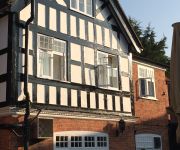
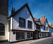
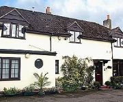
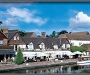
Hotels and Places to Stay
The Miller of Mansfield
GEORGE HOTEL
Little Gables Bed and Breakfast
The Swan at Streatley
Shillingford Bridge
The Chilterns View
The George Relaxinnz
Videos from this area
These are videos related to the place based on their proximity to this place.
Cholsey & Wallingford Railway (2014)
A compilation of clips shot on a trip on the Northern Gas Board No. 1 locomotive while it was on a visit to the Cholsey & Wallingford Railway. The ride was a birthday present from a workmate...
Steam. Ivor the Engine @ Wallingford level crossing. April 2015.
Ivor crosses the Wallingford level crossing on the A4130 to Didcot. Ivor is a green pannier tank engine running on the Bunk Line from Wallingford to Cholsey. Filmed in April 2015.
Baby Jogger City Mini GT pushchair from Pushchairsandcarseats.co.uk
Pushchairs and Car seats, baby jogger city mini GT pushchair product video.
Diesel class 14 @ Wallingford Level Crossing (Bunk Line) May 2013
A Class 14 diesel shunter hauls two coaches on the Bunk Line from Cholsey to Wallingford (Oxfordshire,UK). Filmed on 4 May 2013.
Steam. Northern Gas Board 1 @ Wallingford Level Crossing (Bunk Line) May 2014
Steam engine "Northern Gas Board 1" hauls two coaches on the Bunk Line from Cholsey to Wallingford (Oxfordshire,UK). Filmed on 25 May 2014.
WRC J16 girls 8 at Wallingford 4s & 8s head 2014
Wallingford RC Girls J16 8+ racing in Wallingford 4s and 8s head 2014, clip taken as they go past the entrance to Carmel College.
Wallingford Carols - Kat's Chorus - Joy to the World
Kat's Chorus, a Wallingford based A Cappella Choir perform Joy to the World. Sunday 07/12/14.
Wallingford Sculls
Saturday 27 September. 4000 meters S2 4x- [352] Dart-Totnes - Heming J18 4x- [353] Hampton School - Thomas S2 4x- [350] Hampton School - Provin J18 4x- [355] Pangbourne College - A...
Wallingford Sculls3
Saturday 27 September. 4000 metres J15 4x+ [387] Hinksey SS - Swan J15 4x+ Winner [390] Dulwich College - Kirk WJ16 4x- [383] Haberdashers Monmouth - Poyner J15 4x+ [391] Windsor...
Videos provided by Youtube are under the copyright of their owners.
Attractions and noteworthy things
Distances are based on the centre of the city/town and sightseeing location. This list contains brief abstracts about monuments, holiday activities, national parcs, museums, organisations and more from the area as well as interesting facts about the region itself. Where available, you'll find the corresponding homepage. Otherwise the related wikipedia article.
Carmel College (Oxfordshire)
Carmel College was a predominantly Jewish co-educational boarding school in England operating between 1948 and 1997. It was first situated at Greenham Common near Newbury and then at Mongewell Park near Wallingford, Oxfordshire. It was Europe's only Jewish boarding school. It also had a very small number pupils who were not of Jewish descent as day pupils. Typical boarding fees in 1996 were £10,000 per school term (i.e. £30,000 per year).
Winterbrook Bridge
Winterbrook Bridge, also known as Wallingford By-pass Bridge, was built in 1993 as part of a by-pass around Wallingford, Oxfordshire, relieving the single-lane Wallingford Bridge. It forms part of the A4130, connecting Winterbrook, at the north end of Cholsey, just south of Wallingford, on the west bank to Mongewell on the east bank. It crosses the Thames on the reach between Cleeve Lock and Benson Lock.
Moulsford Railway Bridge
Moulsford Railway Bridge, known locally as "Four Arches" bridge is a pair of parallel bridges located a little to the north of Moulsford and South Stoke in Oxfordshire, UK. It carries the Great Western Main Line from Paddington, London to Wales and the West across the River Thames. It lies between the stations at Goring & Streatley and Cholsey, and crosses the Thames at an oblique angle on the reach between Cleeve Lock and Benson Lock.
Winterbrook
Winterbrook is a small settlement in the English county of Oxfordshire, which adjoins the south end of Wallingford and sits on the west bank of the Thames. In 1974 it was transferred from Berkshire. It appears in records from the time of King Henry III. It is connected to the east bank by Winterbrook Bridge. Its most famous resident was the novelist, Agatha Christie, who lived at Winterbrook House and died there in 1976.
Moulsford railway station
Moulsford railway station was on the original route of the Great Western Railway, being one of three intermediate stations provided when the line was extended from Reading to Steventon in 1840.
Chalmore Lock
Chalmore Lock was a lock and weir which operated between 1838 and 1883 on the River Thames in England near Wallingford, Oxfordshire.
St John the Baptist's Church, Mongewell
St John the Baptist's Church, Mongewell, is a redundant Church of England parish church, now partly in ruins, in the hamlet of Mongewell, Oxfordshire, England. English Heritage has designated it a Grade II listed building, and is under the care of the Churches Conservation Trust. The ruins stand on the east bank of the River Thames, next to the former Carmel College, to the north of Mongewell Park, 2.5 miles south of Wallingford, and near The Ridgeway long-distance path.
St Mary's Church, Newnham Murren
St Mary's Church, Newnham Murren, is a redundant Anglican church in the hamlet of Newnham Murren, Oxfordshire, England. It has been designated by English Heritage as a Grade II* listed building, and is under the care of the Churches Conservation Trust. The church stands at the end of a farm track, overlooking the River Thames, near the The Ridgeway long-distance path.


