Safety Score: 3,0 of 5.0 based on data from 9 authorites. Meaning we advice caution when travelling to United Kingdom.
Travel warnings are updated daily. Source: Travel Warning United Kingdom. Last Update: 2024-05-07 07:59:51
Touring Elston
Elston in Nottinghamshire (England) with it's 631 residents is a town located in United Kingdom about 109 mi (or 176 km) north of London, the country's capital place.
Time in Elston is now 01:17 AM (Wednesday). The local timezone is named Europe / London with an UTC offset of one hour. We know of 11 airports nearby Elston, of which 5 are larger airports. The closest airport in United Kingdom is Nottingham Airport in a distance of 11 mi (or 18 km), South-West. Besides the airports, there are other travel options available (check left side).
There are several Unesco world heritage sites nearby. The closest heritage site in United Kingdom is Derwent Valley Mills in a distance of 15 mi (or 24 km), East. Also, if you like the game of golf, there are several options within driving distance. Need some hints on where to stay? We compiled a list of available hotels close to the map centre further down the page.
Being here already, you might want to pay a visit to some of the following locations: Nottingham, Market Overton, Ashwell, Langham and Cottesmore. To further explore this place, just scroll down and browse the available info.
Local weather forecast
Todays Local Weather Conditions & Forecast: 16°C / 61 °F
| Morning Temperature | 7°C / 45 °F |
| Evening Temperature | 18°C / 64 °F |
| Night Temperature | 13°C / 56 °F |
| Chance of rainfall | 0% |
| Air Humidity | 69% |
| Air Pressure | 1029 hPa |
| Wind Speed | Light breeze with 5 km/h (3 mph) from North |
| Cloud Conditions | Overcast clouds, covering 99% of sky |
| General Conditions | Light rain |
Thursday, 9th of May 2024
16°C (60 °F)
13°C (56 °F)
Light rain, light breeze, overcast clouds.
Friday, 10th of May 2024
18°C (65 °F)
13°C (56 °F)
Light rain, light breeze, overcast clouds.
Saturday, 11th of May 2024
19°C (67 °F)
12°C (54 °F)
Few clouds, gentle breeze.
Hotels and Places to Stay
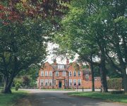
Kelham House Country Manor Hotel
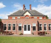
Millgate House Hotel
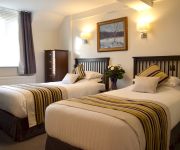
BEST WESTERN DEINCOURT HOTEL
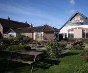
The Bingham Townhouse
Newark
Videos from this area
These are videos related to the place based on their proximity to this place.
Newark ParkRun Course
Newark ParkRun takes place every Saturday at 9:00am Sconce and Devon Park, Boundary Road, Newark, Nottinghamshire, NG24 4AU How fast do I have to be? We all run for our own enjoyment.
Pirates Canoe Club at the Newark Weir Play Wave - 30th June & 1st July 2012
Search for us on facebook under Pirates Canoe Club. Pirates Canoe Club is a warm and friendly club with a safe, relaxed atmosphere. We have around 80 members of all ages, sexes and backgrounds ...
Hobie Kayak River Trent at Farndon, Newark, Notts ... NO WIND
Hobie Kayak on the River Trent at Farndon....Sadly ....NO WIND.
Newark Engineering Society visit to Cotham Solar Farm
One of the largest Solar farms in the UK. Roger Pykett. Lark Energy.
Videos provided by Youtube are under the copyright of their owners.
Attractions and noteworthy things
Distances are based on the centre of the city/town and sightseeing location. This list contains brief abstracts about monuments, holiday activities, national parcs, museums, organisations and more from the area as well as interesting facts about the region itself. Where available, you'll find the corresponding homepage. Otherwise the related wikipedia article.
Battle of Stoke Field
The Battle of Stoke Field (16 June 1487) may be considered the last battle of the Wars of the Roses, since it was the last engagement in which a Lancastrian king faced an army of Yorkist supporters, under the pretender Lambert Simnel. (Many historians, however, consider the Battle of Bosworth, two years previously, as the last real battle in the Wars of the Roses.
Farndon, Nottinghamshire
Farndon is a small village on the Fosse Way or A46 Roman road, 2.5 miles (4 km) south-west of Newark-on-Trent, on the banks of the River Trent. The name Farndon means "Fern Hill". It is thought to be the site of the Roman fort Ad Pontem or "the place by the bridges. " The parish church of St. Peter was built in Elizabethan times, and thought to be the third such church built on the same site since Saxon times.
Elston
Elston is a small village in Nottinghamshire to the southwest of Newark, and a mile from the A46 Fosse Way. The parish of Elston lies between the rivers Trent and Devon, with "the village itself set amongst trees and farmland less than a mile from the A46. The historic market town of Newark is just five miles to the north, with the cities of Lincoln and Nottingham some eighteen miles north and southwest respectively.
Hawton
Hawton is an English civil parish of some 70 inhabitants. It is situated to the south of Newark-on-Trent in Nottinghamshire, near the River Devon. It played an important part in the English Civil War as a Roundhead encampment against the Royalist stonghold in Newark, and a redoubt earthworks are still visible within the village. It is most famed for the parish church of All Saints, built in the 14th and 15th centuries.
St. Lawrence's Church, Thorpe
St. Lawrence's Church, Thorpe is a parish church in the Church of England in Thorpe, Nottinghamshire. The church is Grade II listed by the Department for Culture, Media & Sport as it is a building of special architectural or historic interest.
St. Peter's Church, Farndon
St. Peter's Church, Farndon is a parish church in the Church of England in Farndon, Nottinghamshire. The church is Grade I listed by the Department for Culture, Media & Sport as a building of outstanding architectural or historic interest.
Church of St. Mary and All Saints, Hawksworth
The Church of St. Mary and All Saints, Hawksworth is a parish church in the Church of England in Hawksworth, Nottinghamshire. The church is Grade II* listed by the Department for Culture, Media & Sport as it is a particularly significant building of more than local interest.
Elston Chapel
Elston Chapel is a redundant Anglican church to the northeast of the village of Elston, Nottinghamshire, England. It has been designated by English Heritage as a Grade I listed building, and is under the care of the Churches Conservation Trust. It stands in a field and is described as a "solitary barn-like chapel".


