
Address & Contact
Contact Information:
Airport homepage
Airport homepage
Wikipedia page
Telefonnummer: +44 1526 342581
Street address:
RAF Coningsby
Baxter Cl
Coningsby
Lincoln LN4 4TG
Vereinigtes Königreich
GPS Coordinates:
Longitude: -0,166°
Latitude: 53,093°
Summary
RAF Coningsby is a medium sized airport in United Kingdom, serving the region of Coningsby, Lincolnshire, England. The longest runway is 9.003 feet or 2.744 meters long.
Facts:
Local name: "Coningsby" Airport size: medium airport Serving area: Coningsby, Lincolnshire, England Longest runway: 9003 (ft)
Codes:
IATA: QCY,
ICAO: EGXC
Flight information:
Departure times (FlightStats)
Flight times (FlightRadar24)
Location on map
Show bigger map on Openstreetmap
About the airport
RAF Coningsby, with the IATA code QCY and the ICAO code EGXC, is a military airport located in the United Kingdom. Situated in Lincolnshire, it serves as the main operating base for the Royal Air Force's Typhoon aircraft. While primarily a military facility, it also accommodates civilian flights on a limited basis.
The airport boasts modern facilities and excellent infrastructure, ensuring a smooth travel experience for passengers. However, it is important to note that RAF Coningsby is primarily used for military operations, and civilian flights are subject to restrictions and availability.
Travellers planning their trip to RAF Coningsby should be aware that it is not a commercial airport with regular scheduled flights. Therefore, it is crucial to check with airlines or charter companies for any available civilian flight options. Additionally, access to certain areas of the airport may be restricted due to military operations.
Overall, RAF Coningsby offers a unique aviation experience, but travellers should plan accordingly and be aware of the airport's military-focused nature.
Hotels and places to stay

Woodhall Spa Manor

The Inn at Woodhall Spa

The Railway Hotel

Petwood House
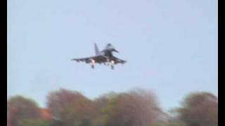
Videos from the area of the airport

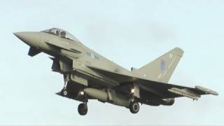
RAF Coningsby 6th Dec 2011
My footage of my trip to Coningsby with Hihonyr8811 [ http://www.youtube.com/user/Hihonyr8811 ] .
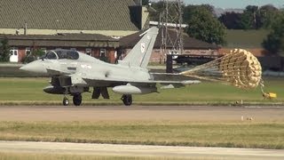
RAF Coningsby 31st August 2012
My highlights of a quiet day spotting with Hihonyr8811 [http://www.youtube.com/user/Hihonyr8811] . Shame the Lanc went U/S [it eventually departed an hour after we had given up and left] , oh well .
RAF Coningsby 22nd April 2009
A lovely [if quiet] day in Lincolnshire spotting with great friends from VTTSC and Iconic Aircraft Forums . http://www.vulcantothesky.org/forums/ http://www.iconicaircraft.co.uk/forum/index.php.

BBMF - Wings & Wheels HD
Behind The Scenes At BBMF, Watch in 1080p for best quality..

3 EURO FIGHTER TYPHOON S TAKE OFF RAF UK !

RAF King Air at RAF Coningsby 17/02/14
Videos provided by Youtube are under the copyright of their owners. 
 RAF Waddington
Medium airport - 16 mi (26 km)
RAF ScamptonMedium airport - 22 mi (36 km)
RAF CottesmoreMedium airport - 32 mi (52 km)
Humberside AirportMedium airport - 34 mi (55 km)
RAF MarhamMedium airport - 43 mi (69 km)
Robin Hood Doncaster Sheffield AirportLarge airport - 44 mi (71 km)
RAF WytonMedium airport - 51 mi (82 km)
East Midlands AirportLarge airport - 52 mi (84 km)
RAF LakenheathLarge airport - 56 mi (91 km)
RAF MildenhallLarge airport - 57 mi (93 km)
London Luton AirportLarge airport - 85 mi (137 km)
Bigger and popular cities in the wider vicinity are these:
- Ailsworth
- Barnack
- Bradley
- Clipsham
- Croxton
- Essendine
- Eye
- Glinton
- Great Coates
- Grimbsy
- Grimsby
- Helpston
- Hibaldstow
- Lincoln
- Marholm
- Newborough
- Northborough
- Peakirk
- Peterborough
- Pickworth
- Redbourne
- Ryhall
- Southorpe
- Thimbleby
- Thorney
- Ufford
- Ulceby
- Upton
- Waltham
- Wold Newton
These are some smaller cities that might be interesting. They are all rather close.
- Amber Hill
- Billinghay
- Brothertoft
- Bunkers Hill
- Carrington
- Coningsby
- Dogdyke
- Horncastle
- Horsington
- Hubberts Bridge
- Kirkby on Bain
- Kirkstead
- Langrick
- Langton
- Mareham le Fen
- Mareham on the Hill
- Martin
- Moorby
- New Bolingbroke
- New York
- North Kyme
- Revesby
- Scrivelsby
- South Kyme
- Stixwould
- Tattershall
- Tattershall Thorpe
- Thornton le Fen
- Tumby
- Woodhall Spa