Safety Score: 3,0 of 5.0 based on data from 9 authorites. Meaning we advice caution when travelling to United Kingdom.
Travel warnings are updated daily. Source: Travel Warning United Kingdom. Last Update: 2024-04-15 07:59:01
Explore Tickencote
Tickencote in District of Rutland (England) is located in United Kingdom about 82 mi (or 133 km) north of London, the country's capital.
Local time in Tickencote is now 05:57 AM (Tuesday). The local timezone is named Europe / London with an UTC offset of one hour. We know of 12 airports in the wider vicinity of Tickencote, of which 5 are larger airports. The closest airport in United Kingdom is RAF Cottesmore in a distance of 6 mi (or 10 km), North-West. Besides the airports, there are other travel options available (check left side).
There are several Unesco world heritage sites nearby. The closest heritage site in United Kingdom is Derwent Valley Mills in a distance of 24 mi (or 39 km), North. Also, if you like golfing, there are multiple options in driving distance. If you need a place to sleep, we compiled a list of available hotels close to the map centre further down the page.
Depending on your travel schedule, you might want to pay a visit to some of the following locations: Tinwell, Pickworth, Ketton, Empingham and Clipsham. To further explore this place, just scroll down and browse the available info.
Local weather forecast
Todays Local Weather Conditions & Forecast: 10°C / 50 °F
| Morning Temperature | 7°C / 45 °F |
| Evening Temperature | 7°C / 45 °F |
| Night Temperature | 3°C / 38 °F |
| Chance of rainfall | 0% |
| Air Humidity | 53% |
| Air Pressure | 1014 hPa |
| Wind Speed | Strong breeze with 18 km/h (11 mph) from South-East |
| Cloud Conditions | Scattered clouds, covering 36% of sky |
| General Conditions | Light rain |
Wednesday, 17th of April 2024
8°C (47 °F)
2°C (35 °F)
Light rain, moderate breeze, scattered clouds.
Thursday, 18th of April 2024
11°C (52 °F)
5°C (41 °F)
Light rain, gentle breeze, clear sky.
Friday, 19th of April 2024
11°C (53 °F)
7°C (45 °F)
Light rain, fresh breeze, overcast clouds.
Hotels and Places to Stay
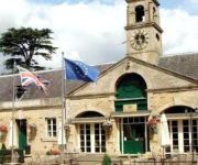
William Cecil
Rectory Farm Annexe
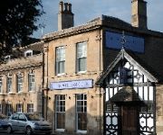
BEST WESTERN Normanton Park Hotel
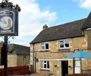
Boot and Shoe
Videos from this area
These are videos related to the place based on their proximity to this place.
Daniels TV - Episode 1
Stamford manager Graham Drury, midfielder Danny Brooks and first-team coach Dean West look ahead of the trip to Brigg Town in the pilot episode of Daniels TV. Let us know what you think via...
Riverside Cafe Stamford
Cafe, French Patisserie serving Light lunches and pastries from 10 am to 5pm everyday. Relaxing and friendly premises to enjoy homemade cakes, quality teas and coffee, or lunches around a...
Bees 01 Jun 2014 Stamford Lincs UK
Bees in an old bird box. They're tricky little blighters to film as they move so fast! "If you find a bumblebee nest, consider yourself very lucky! They aren...
Stamford Festival of Floats Saturday 2nd June 2012
Organised by the Stamford & District Kiwanis and the Stamford Float Festival Committee. Filmed with the amazing Canon Powershot SX230HS at 1080p/24.
Meet Rapunzel!
Here's a selection of clips from your favourite long haired princess! She's a big bundle of fun, happiness, creativity and love! Invite her to your next event! www.facebook.com/pixiedustpartyprince...
Caterpillar Fifty Ploughing & Allis Chalmers with Discs at Little Casterton
Caterpillar Fifty ploughing and Allis Chalmers Discing at Little Casterton Working Weekend 20/9/09.
Case DC4 & Case Binder at Little Casterton
Case DC4 & Case Binder at Little Casterton Working Weekend 20/9/09.
NightRider 2012 Training Blog #4 - 16 May, 2012
The fourth of my video blogs as I prepare to take part in the nightrider 2012 Cycling event in London. In an attempt to conquer the 100km event distance, our...
Videos provided by Youtube are under the copyright of their owners.
Attractions and noteworthy things
Distances are based on the centre of the city/town and sightseeing location. This list contains brief abstracts about monuments, holiday activities, national parcs, museums, organisations and more from the area as well as interesting facts about the region itself. Where available, you'll find the corresponding homepage. Otherwise the related wikipedia article.
Battle of Losecoat Field
The Battle of Losecoat Field (also known as the Battle of Empingham) was fought on 12 March 1470, during the Wars of the Roses. Spellings of Losecoat vary with Losecote and Loose-coat also seen.
River Chater
The River Chater is a river in the East Midlands of England. It is a tributary of the River Welland, and is about 12 miles long. It rises near Whatborough Hill in Leicestershire, and then flows east, past the sites of Sauvey Castle, and Launde Abbey, before crossing the county boundary with Rutland. It continues east, to the north of Ridlington, Preston, and then to the south of Manton and the north of Wing. At North Luffenham, it meets a stream that had risen south of Ridlington.
Ketton Rural District
Ketton was a rural district in Rutland, England from 1894 to 1974, covering the east of the county. The district was named after Ketton. The rural district was formed by the Local Government Act 1894 from the part of the Stamford rural sanitary district in Rutland. At the same time, the remainder of Stamford RSD, which lay in Lincolnshire, Northamptonshire and the Soke of Peterborough became Uffington Rural District, Easton on the Hill Rural District and Barnack Rural District respectively.
Casterton Business and Enterprise College
Casterton Business and Enterprise College (previously Casterton Community College) is one of three secondary schools in the county of Rutland, England. Located in the village of Great Casterton, the school provides education for 11 to 16 year olds, as well as a Childcare Centre for the under 5s and an adult education programme. It opened as Great Casterton Secondary Modern School in the 1950s.
RAF Woolfox Lodge
Royal Air Force Station Woolfox Lodge is a former RAF aerodrome next to the A1 road in Rutland, UK. The airfield is split between the parishes of Empingham and Greetham. It was open from 1940 until 1965.


