Safety Score: 3,0 of 5.0 based on data from 9 authorites. Meaning we advice caution when travelling to United Kingdom.
Travel warnings are updated daily. Source: Travel Warning United Kingdom. Last Update: 2024-04-16 08:26:06
Delve into Exton
Exton in District of Rutland (England) with it's 607 habitants is located in United Kingdom about 85 mi (or 136 km) north of London, the country's capital town.
Current time in Exton is now 10:48 AM (Tuesday). The local timezone is named Europe / London with an UTC offset of one hour. We know of 12 airports close to Exton, of which 5 are larger airports. The closest airport in United Kingdom is RAF Cottesmore in a distance of 3 mi (or 5 km), North. Besides the airports, there are other travel options available (check left side).
There are several Unesco world heritage sites nearby. The closest heritage site in United Kingdom is Derwent Valley Mills in a distance of 24 mi (or 38 km), North. Also, if you like playing golf, there are some options within driving distance. If you need a hotel, we compiled a list of available hotels close to the map centre further down the page.
While being here, you might want to pay a visit to some of the following locations: Greetham, Cottesmore, Empingham, Edith Weston and Burley. To further explore this place, just scroll down and browse the available info.
Local weather forecast
Todays Local Weather Conditions & Forecast: 9°C / 49 °F
| Morning Temperature | 5°C / 41 °F |
| Evening Temperature | 6°C / 44 °F |
| Night Temperature | 3°C / 37 °F |
| Chance of rainfall | 0% |
| Air Humidity | 53% |
| Air Pressure | 1014 hPa |
| Wind Speed | Strong breeze with 19 km/h (12 mph) from South-East |
| Cloud Conditions | Few clouds, covering 21% of sky |
| General Conditions | Light rain |
Wednesday, 17th of April 2024
8°C (46 °F)
1°C (34 °F)
Light rain, moderate breeze, scattered clouds.
Thursday, 18th of April 2024
9°C (49 °F)
5°C (41 °F)
Light rain, gentle breeze, scattered clouds.
Friday, 19th of April 2024
11°C (52 °F)
7°C (45 °F)
Light rain, moderate breeze, overcast clouds.
Hotels and Places to Stay
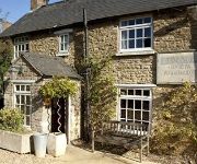
Kings Arms Inn
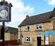
The Finchs Arms
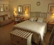
Barnsdale Lodge Rutland Water
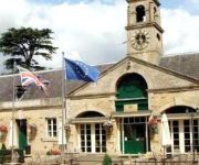
BEST WESTERN Normanton Park Hotel
Hambleton Hall
Broccoli Bottom
Boot and Shoe
TRAVELODGE GRANTHAM SOUTH WITHAM
Videos from this area
These are videos related to the place based on their proximity to this place.
Hambleton Hall from a Hobie tandem Island Kayak 2 OCT 2011
Hambleton Hall from a Hobie tandem Island Kayak 2 OCT 2011.
Hambleton Hall Hotel and Restaurant
An award winning traditional country house hotel with 17 bedrooms over-looking Rutland Water and a Michelin Star restaurant. http://www.prideofbritainhotels.com/hambleton_hall.
RS600FF Sailboat new boat setup day 7 - 30th Nov 2013
This is my 7th time sailing the new carbon RS600FF and you'll see in this video the small adjustments. For those of you on the same journey, the foil setting is now 1 & a half turns out of...
FDG at the Rutland Youth Fly Fishing Day 2014
Photos of the fly tying sessions run by the FDG as part of the Rutland Youth Fly Fishing Day at Rutland Water on 13th July 2014.
Rutland Water Bathing Beach
For now, Rutland Water Bathing Beach is just a building site, and at first glance it might seem that little is going on. Set on a grassy bank, surrounded by woodland, this carefully chosen...
WWE 2K15 Zombies : Survival Mode - John Cena Adjusts Some Attitude #2
After Roman Reigns set the benchmark in the season premier of WWE Zombies Survival Mode, it was left to the viewers to decide which past or present WWE superstar would be next in line to take...
Boxing Day Blowout Haul
If you find this video useful, please give it a "Like" and subscribe if you already haven't. Check out some of my other videos, I would appreciate it so so much! If you want to send me a message, you.
Crazy Flying F1 car CRASH, F1 2010 PC, Redbull gives you wings! HD YouTube
【 إشترك يا حلو】 ☜═㋡ ☜═㋡ ☜═㋡ رابط تحميل البرنامج تجده في هذه الصفحة.
Videos provided by Youtube are under the copyright of their owners.
Attractions and noteworthy things
Distances are based on the centre of the city/town and sightseeing location. This list contains brief abstracts about monuments, holiday activities, national parcs, museums, organisations and more from the area as well as interesting facts about the region itself. Where available, you'll find the corresponding homepage. Otherwise the related wikipedia article.
Rutland Water
Rutland Water is Anglian Water's drinking water reservoir in the county of Rutland, England, just east of the county town Oakham. It was known as Empingham Reservoir during its construction and until its official opening in 1976. The centre of its dam is at British national grid reference SK942078. It provides a reserve supply of water in the driest and most densely populated quarter of the United Kingdom and is one of the largest artificial lakes in Europe.
RAF Cottesmore
Royal Air Force Station Cottesmore or more simply RAF Cottesmore is a former Royal Air Force station in Rutland, England, situated between Cottesmore and Market Overton. The station housed all the operational Harrier GR9 squadrons in the Royal Air Force, and No. 122 Expeditionary Air Wing. On 15 December 2009 it was announced that the station would close in 2013 as part of defence spending cuts, along with the retirement of the Harrier GR9 and the disbandment of Joint Force Harrier.
Tri-National Tornado Training Establishment
The Tri-National Tornado Training Establishment (TTTE) was a multinational air unit based at RAF Cottesmore in Rutland, England from 1981 to 1999. It performed training on the Panavia Tornado for the Royal Air Force, Luftwaffe and Italian Air Force. Initially, pilots received four weeks of training on the ground, followed by nine weeks in the air.
Hambleton Peninsula
The Hambleton Peninsula lies within the reservoir Rutland Water, in Rutland, England. When the Gwash Valley was dammed in 1975, the area surrounding what was then a ridge were submerged, including a small number of properties in the hamlets of Nether Hambleton and Middle Hambleton. The village of Upper Hambleton survived, and now sits on the peninsula, which is some 3500 metres in length and 1000 metres in width.
Oakham Rural District
Oakham was a rural district in Rutland, England from 1894 to 1974, covering the north of the county. The rural district had its origins in the Oakham Rural Sanitary District, formed in 1875. Oakham RSD had an identical area to Oakham poor law union, and consisted of thirty-one civil parishes of which twenty-nine were in Rutland and two in Leicestershire.
Exton Hall
Exton Hall is an English country house on the western edge of the village of Exton, Rutland, England. It was the family seat of the family of Sir James Harington and later the Noel family, Earls of Gainsborough for almost four hundred years. The mansion burnt down in 1810 and is now a ruin which has grand gables and beautiful chimneys like many Elizabethan houses. The present Exton Hall was built in the 19th century close to the ruins of the original mansion.
Barnsdale Gardens
Barnsdale Gardens in Rutland, England were made famous by Geoff Hamilton through the BBC television series Gardeners' World which he presented from 1979 until his death in 1996. They are situated on The Avenue in the parish of Exton, a short distance north of Rutland Water. Geoff Hamilton began developing the garden in 1983 from what was then a ploughed field. It now covers 8 acres, comprising 37 individual gardens and features.
Rutland
Rutland is a landlocked county in central England, bounded on the west and north by Leicestershire, northeast by Lincolnshire and southeast by Northamptonshire. Its greatest length north to south is only 18 miles and its greatest breadth east to west is 17 miles . It has the smallest population of any normal unitary authority in mainland England and only the City of London is smaller in terms of area. It is 348th of the 354 districts in population.


