Sneinton
District of Nottingham
in Nottingham of England, United Kingdom

Noteable things around
Location Summary
Decimal Coordinates (Latitude, Longitude):
52.954 and -1.150 (Lat./Lng.)
Coordinates by Time:
N 52° 57' 12" and W -1° 9' 1"
Currency and Currency Code:
Pound - GBP
Spoken languages:
English, Welsh, Scottish Gaelic
Local electricity:
Mobile phone / cellular frequencies (MHz):
Local Time: 07:37 PM (Friday)
Timezone: Europe/London
UTC/GMT offset: 0 hours
Sunrise and Sunset:
6:39 am and 9:24 pm
Antipode Coordinates:
-45.817 and 170.717 (Lat./Lng.)
Closest place to antipode coordinates:
Otakou
References
This place on Geonames.org
Current travel safety evaluation for United Kingdom in Northern Europe

Safety Score: 3,0 of 5.0 based on data from 9 authorites. Meaning we advice caution when travelling to United Kingdom.

Travel warnings are updated daily. Source: Travel Warning United Kingdom. Last Update: 2024-04-26 08:02:42

Delve into Sneinton

The district Sneinton of Nottingham in Nottingham (England) is a subburb in United Kingdom about 108 mi north-west of London, the country's capital town.

If you need a hotel, we compiled a list of available hotels close to the map centre further down the page.

While being here, you might want to pay a visit to some of the following locations: Glenfield, Leicester, Derby, Wales and Todwick. To further explore this place, just scroll down and browse the available info.

Local weather forecast

Todays Local Weather Conditions & Forecast: 9°C / 48 °F

Morning Temperature 2°C / 36 °F
Evening Temperature 7°C / 45 °F
Night Temperature 3°C / 37 °F
Chance of rainfall 3%
Air Humidity 67%
Air Pressure 1004 hPa
Wind Speed Gentle Breeze with 6 km/h (4 mph) from West
Cloud Conditions Broken clouds, covering 77% of sky
General Conditions Light rain

Saturday, 27th of April 2024

10°C (50 °F)
6°C (42 °F)
Light rain, moderate breeze, overcast clouds.

Sunday, 28th of April 2024

6°C (43 °F)
4°C (39 °F)
Moderate rain, moderate breeze, overcast clouds.

Monday, 29th of April 2024

12°C (54 °F)
7°C (45 °F)
Light rain, moderate breeze, broken clouds.

Hotels and Places to Stay

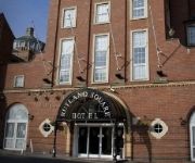
PREMIER SUITES Nottingham

Address
0,4 mi
Ice House, Belward Street
NG1 1JZ Nottingham
United Kingdom

Time Information

Checkout: 11:00 - Checkin: 15:00
Reception
Weekday: -
Weekend: closed


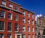
St James Hotel

Address
0,2 mi
Rutland Street
NG1 6EB Nottingham
United Kingdom

Time Information

Checkout: 11:00 - Checkin: 14:00
Reception
Weekday: 0:00 - 24:00
Weekend: 0:00 - 24:00


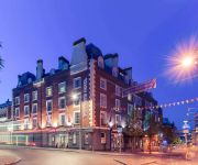
Lace Market

Address
0,3 mi
29-31 High Pavement
NG1 1HE Nottingham
United Kingdom

Time Information

Checkout: 11:00 - Checkin: 15:00
Reception
Weekday: 0:00 - 24:00
Weekend: 0:00 - 24:00


Mercure Nottingham City Centre George Hotel

Address
0,2 mi
2 George Street
NG1 3BP NOTTINGHAM
United Kingdom

Time Information

Checkout: 12:00 - Checkin: 14:00
Reception
Weekday: 0:00 - 24:00
Weekend: 0:00 - 24:00


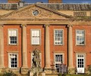
Colwick Hall Hotel

Address
1,9 mi
Colwick Park, Racecourse Road
NG2 4BH Nottingham
United Kingdom

Time Information

Checkout: 11:00 - Checkin: 14:00
Reception
Weekday: -
Weekend: closed


Hilton Nottingham

Address
0,2 mi
Milton Street
NG1 3PZ Nottingham
United Kingdom

Time Information

Checkout: 12:00 - Checkin: 15:00
Reception
Weekday: -
Weekend: closed


ROOMZZZ NOTTINGHAM CITY

Address
0,3 mi
STANLEY PLACE TALBOT STREET
NG1 5GS Nottingham
United Kingdom

Time Information

Checkout: 11:00 - Checkin: 15:00
Reception
Weekday: -
Weekend: closed


Crowne Plaza NOTTINGHAM

Address
0,2 mi
Wollaton Street
NG1 5RH NOTTINGHAM
United Kingdom

Time Information

Checkout: 12:00 - Checkin: 15:00
Reception
Weekday: -
Weekend: closed


Park Plaza Nottingham

Address
0,2 mi
Maid Marian Way 41
NG1 6GD Nottingham
United Kingdom

Time Information

Checkout: 12:00 - Checkin: 14:00
Reception
Weekday: 0:00 - 24:00
Weekend: 0:00 - 24:00


Park Inn By Radisson Nottingham

Address
1,1 mi
Mansfield Road 296
NG5 2BT Nottingham
United Kingdom

Time Information

Checkout: 12:00 - Checkin: 15:00
Reception
Weekday: 0:00 - 24:00
Weekend: 0:00 - 24:00


Videos from this area

These are videos related to the place based on their proximity to this place.

Nottingham Knights Cheerleaders Rugby Varsity 2012

Published: January 21, 2013
Length: 36:28 min
Rating: 3 of 5
Author: Keira Harrison


Romane gila (NOTTINGHAM)

Published: April 13, 2013
Length: 51:07 min
Rating: 5 of 5
Author: Sandra Mirga

Amengri rodzina kłodzko/nottingham.


Beekeeping in Nottingham: Thrive with a Hive at Stonebridge City Farm.dv

Published: September 02, 2011
Length: 38:23 min
Rating: 5 of 5
Author: nottinghamessence

With Keith Cosgrove. Stonebridge City Farm, St. Anns, Nottingham is open 7 days a week from 10am - 4pm with free entrance. More about the farm at http://www.stonebridgecityfarm.com/ More...


Steam Train at Colwick

Published: November 10, 2014
Length: 11:22 min
Rating: 5 of 5
Author: bonearrowgroup

Caught a passing steam train at Colwick, Nottingham on 9th November 2014.


Beekeeping in Nottingham: Thrive with a Hive at Stonebridge City Farm 2.dv

Published: September 01, 2011
Length: 38:31 min
Rating: 3 of 5
Author: nottinghamessence

A Modern Hive with Keith Cosgrove. Stonebridge City Farm, St. Anns, Nottingham is open 7 days a week from 10am - 4pm with free entrance. More about the farm on ...


Stonebridge City Farm Cafe.dv

Published: September 05, 2011
Length: 24:00 min
Rating: 5 of 5
Author: nottinghamessence

Chef Kristina Jones introduces the cafe at Stonebridge City Farm, St. Anns, Nottingham. Delicious home-cooked food from 10am - 3pm every day. More about the farm at http://www.stonebridgecityfarm....


Pirate Day at Stonebridge City Farm Nottingham.dv

Published: September 02, 2011
Length: 41:14 min
Rating: 5 of 5
Author: nottinghamessence

Pirate Day at Stonebridge City Farm, St. Anns, Nottingham in August 2011. The farm is open 7 days a week from 10am - 4pm with free entrance. More about the farm at http://www.stonebridgecityfarm....


Close pass from Nottingham City Council FJ03ZGB

Published: March 15, 2013
Length: 34:48 min
Rating: 5 of 5
Author: Cyberslayer

This was close and fast enough that I felt the rush of air as he speed past.


Lego city undercover unboxing wii u [limted editon

Published: March 29, 2013
Length: 02:20 min
Rating: 3 of 5
Author: wii u

Please subscribe and like also comment for more unboxing and swe you guys next time need help bildoling chase macan toy on lego city undercover then watch my 3rd video.


Lego city undercover wii u how to build chase maca

Published: March 29, 2013
Length: 00:00 min
Rating: 0 of 5
Author: wii u

Subscribe.


Videos provided by Youtube are under the copyright of their owners.

Attractions and noteworthy things

Distances are based on the centre of the city/town and sightseeing location. This list contains brief abstracts about monuments, holiday activities, national parcs, museums, organisations and more from the area as well as interesting facts about the region itself. Where available, you'll find the corresponding homepage. Otherwise the related wikipedia article.

BBC Radio Nottingham

BBC Radio Nottingham is a BBC Local Radio station serving the English county of Nottinghamshire. It broadcasts on FM, AM, and digital DAB radio from studios located on London Road in Nottingham city centre.

Located at 52.9497, -1.13985 (Lat. / Lng.), about 1 miles away.
Wikipedia Article, Homepage
Radio stations established in 1968, BBC Local Radio, Music in Nottinghamshire, Media in Nottingham, Radio stations in Nottinghamshire

Gem 106

Gem 106 is a regional radio station broadcasting to the East Midlands, owned and operated by Orion Media.

Located at 52.9488, -1.13418 (Lat. / Lng.), about 1 miles away.
Wikipedia Article, Homepage
Radio stations in Nottinghamshire, Radio stations established in 1997, Media in Nottingham, Defunct Heart Network stations

National Ice Centre

The National Ice Centre (NIC) is located in Nottingham, England. Just east of the city centre, it is close to the historic Lace Market area. The facility neighbours the Capital FM Arena Nottingham which is also known as Nottingham Arena. The site has hosted an ice arena since 1939, but the old building was showing its age: hence its nickname, "The Barn".

Located at 52.9528, -1.13944 (Lat. / Lng.), about 0 miles away.
Wikipedia Article
Sport in Nottingham, Indoor ice hockey venues in England, Indoor arenas in England, Music in Nottinghamshire, Exhibition and conference centres in England, Nottingham Panthers, Sports venues in Nottinghamshire, Visitor attractions in Nottingham, Buildings and structures in Nottingham

Hockley Village

Hockley is an area near the centre of Nottingham, England. Hockley lies adjacent to the Lace Market. With many bars, restaurants and trendy clothes shops, it is a vibrant, modern section of the city, and has been described as "the Soho of Nottingham". It is, however, housed in some fine old buildings, and there has been a mercantile presence on the land since at least the 13th century.

Located at 52.954, -1.143 (Lat. / Lng.), about 0 miles away.
Wikipedia Article
Areas of Nottingham, Nottingham

Nottingham East (UK Parliament constituency)

Nottingham East is a constituency represented in the House of Commons of the UK Parliament since 2010 by Chris Leslie, who has served previously as an MP, a member of the Labour Party.

Located at 52.96, -1.13 (Lat. / Lng.), about 1 miles away.
Wikipedia Article
Politics of Nottingham, Parliamentary constituencies in Nottinghamshire, United Kingdom Parliamentary constituencies established in 1885, United Kingdom Parliamentary constituencies disestablished in 1955, United Kingdom Parliamentary constituencies established in 1974

Meadow Lane

Not to be confused with The Meadow, home of Southern Football League Premier Division football team Chesham United The Meadow Lane Stadium (usually known simply as Meadow Lane) is a football stadium in Nottingham, England. It is the home ground of Notts County, who have played there since 1910. The stadium has also been home to Nottingham R.F.C. since 2006. It currently has an all-seated capacity of 20,229.

Located at 52.9425, -1.13722 (Lat. / Lng.), about 1 miles away.
Wikipedia Article
Sport in Nottingham, Sports venues in Nottinghamshire, Football venues in England, Rugby union stadiums in England, Notts County F.C., Sports venues completed in 1910

City Ground

The City Ground is a football stadium in the West Bridgford area of Nottingham, Nottinghamshire, England, on the banks of the River Trent. It has been home to Nottingham Forest Football Club since 1898, and has an all-seated capacity of 30,602.

Located at 52.94, -1.13278 (Lat. / Lng.), about 1 miles away.
Wikipedia Article
Nottingham, Rushcliffe, Visitor attractions in Nottinghamshire, Sports venues in Nottinghamshire, Nottingham Forest F.C., UEFA European Football Championship stadiums, Football venues in England, Premier League venues

St Ann's, Nottingham

St Ann's is an area of Nottingham, England, with a population of around 15,000 people (2005 figures).

Located at 52.962, -1.137 (Lat. / Lng.), about 1 miles away.
Wikipedia Article
Areas of Nottingham, History of Nottingham

Lady Bay Bridge

Lady Bay Bridge is a road bridge of two lanes that spans the River Trent in West Bridgford, Nottingham. It is the bridge following (downstream) from Trent Bridge and connects the main thoroughfare of Radcliffe Road (on the south side) with Meadow Lane (on the north side). See Lady Bay Bridge on Google Street View. Originally, the bridge was the rail crossing for the Midland Railway from Melton Mowbray to Nottingham Station (formerly known as Nottingham Midland).

Located at 52.9428, -1.13167 (Lat. / Lng.), about 1 miles away.
Wikipedia Article
Bridges in Nottingham, Bridges across the River Trent, Bridges completed in 1878

Green's Mill, Sneinton

Green’s Windmill is a restored and working 19th century tower windmill in Sneinton, Nottingham.

Located at 52.9522, -1.12917 (Lat. / Lng.), about 1 miles away.
Wikipedia Article
Windmills in Nottinghamshire, Tower mills, Grinding mills in the United Kingdom, Grade II listed buildings in Nottinghamshire, Museums in Nottingham, Science museums in the United Kingdom, Mill museums in England

A612 road

The A612 road is an A-class road in the United Kingdom running between Nottingham and Averham, on the A617 near Newark. It starts in central Nottingham at a junction with the A60. Initially running east, as Pennyfoot Street, before a right turn sees it head southwards onto Manvers Street, a 4 lane single carriageway which was formerly a B road.

Located at 52.9531, -1.1386 (Lat. / Lng.), about 0 miles away.
Wikipedia Article
Roads in England, Transport in Nottinghamshire, Transport in Nottingham

St Alban's Church, Sneinton

St. Albans's Church, Sneinton was built as a Church of England parish church on Bond Street in Sneinton, Nottingham. The parish was formed from the parishes of St. Stephen's Church, Sneinton and St. Matthias' Church, Nottingham. It was declared redundant by the Diocese of Southwell and Nottingham in 2003 and sold, and is now used as a Parish of the Apostolic Exarchate for Ukrainians, dedicated to Our Lady of Perpetual Succour and St Alban.

Located at 52.9536, -1.13556 (Lat. / Lng.), about 1 miles away.
Wikipedia Article
Churches in Nottingham, Grade II listed churches, Grade II listed buildings in Nottinghamshire, Religious buildings completed in 1887, 19th-century church buildings, Church of England churches in Nottinghamshire, Ukrainian diaspora in the United Kingdom, Ukrainian Catholic churches, Former Church of England churches

Nottingham London Road railway station

Nottingham London Road railway station was opened by the Great Northern Railway on London Road Nottingham in 1857.

Located at 52.9481, -1.1391 (Lat. / Lng.), about 1 miles away.
Wikipedia Article
Buildings and structures in Nottingham, Disused railway stations in Nottinghamshire, Former Great Northern Railway stations, Railway stations opened in 1857, Railway stations closed in 1972

St. Stephen's Church, Sneinton

St. Stephen's Church, Sneinton is a parish church in the Church of England. The church is Grade II listed by the Department for Culture, Media & Sport as it is a building of special architectural or historic interest.

Located at 52.9511, -1.13194 (Lat. / Lng.), about 1 miles away.
Wikipedia Article
Churches in Nottingham, Grade II listed churches, Grade II listed buildings in Nottinghamshire, Religious buildings completed in 1837, 19th-century church buildings, Church of England churches in Nottinghamshire, Commissioners' churches, Thomas Rickman buildings

IQ Nottingham

REDIRECT iQ Student Accommodation iQ Nottingham (Exchange), is a student residence converted from a former telephone exchange on Lower Parliament Street in Nottingham city centre. It was developed and constructed in 2003 to consist of 150 beds with the added new addition completed in 2006 of 127 bed giving it a total of 277 beds.

Located at 52.9542, -1.1394 (Lat. / Lng.), about 0 miles away.
Wikipedia Article
Buildings and structures in Nottingham

St Mary's Church, Nottingham

The Church of St Mary the Virgin is the oldest religious foundation in the City of Nottingham, England, the largest church after the Roman Catholic Cathedral and the largest mediaeval building in Nottingham. The church is Grade I listed by the Department for Culture, Media & Sport as a building of outstanding architectural or historic interest. It is one of only five Grade I listed buildings in the City of Nottingham.

Located at 52.9511, -1.14278 (Lat. / Lng.), about 0 miles away.
Wikipedia Article, Homepage
Churches in Nottingham, Grade I listed buildings in Nottinghamshire, Grade I listed churches, St Mary's Church, Nottingham, 1370s architecture, British churches bombed by the Luftwaffe, Temple Moore buildings

St. John the Baptist's Church, Leenside, Nottingham

The church of St. John the Baptist, Leenside, Nottingham was opened in 1844 as a parish church in the Church of England. It was destroyed in 1941.

Located at 52.9497, -1.14306 (Lat. / Lng.), about 0 miles away.
Wikipedia Article
Former Church of England churches, Demolished buildings and structures in England, British churches bombed by the Luftwaffe, George Gilbert Scott buildings, Religious buildings completed in 1844, 19th-century Church of England church buildings, Anglican congregations established in the 19th century, Churches in Nottingham, Commissioners' churches

St. Matthias' Church, Nottingham

St. Matthias' Church, Nottingham was a Church of England church in Sneinton, Nottingham between 1868 and 2003. It is a Grade II listed building.

Located at 52.9581, -1.13 (Lat. / Lng.), about 1 miles away.
Wikipedia Article
Churches in Nottingham, Grade II listed buildings in Nottinghamshire, British churches bombed by the Luftwaffe

St. Luke's Church, Nottingham

St. Luke’s Church, Nottingham was a Church of England church in Nottingham at the junction of Carlton Road and St. Luke's Road near Sneinton between 1862 and 1923.

Located at 52.9547, -1.13611 (Lat. / Lng.), about 1 miles away.
Wikipedia Article
Former Church of England churches, Church of England churches in Nottinghamshire, Demolished buildings and structures in England, Churches in Nottingham

St. Bartholomew's Church, Nottingham

St. Bartholomew's Church, Nottingham was a Church of England church in Nottingham on Blue Bell Hill Road between 1902 and 1971.

Located at 52.9622, -1.13139 (Lat. / Lng.), about 1 miles away.
Wikipedia Article
Demolished buildings and structures in England, Churches in Nottingham, Former Church of England churches, Church of England churches in Nottinghamshire

St. Philip's Church, Pennyfoot Street

St. Philip's Church, Nottingham was a Church of England church in Nottingham on Pennyfoot Street between 1879 and 1963.

Located at 52.9511, -1.13667 (Lat. / Lng.), about 1 miles away.
Wikipedia Article
Buildings and structures demolished in 1963, Demolished buildings and structures in England, Churches in Nottingham, Former Church of England churches, Church of England churches in Nottinghamshire

St. Stephen's Church, Bunker's Hill

St. Stephen's Church, Bunker's Hill, also known as Trinity Free Church, was a Church of England church in Nottingham between 1859 and 1896.

Located at 52.9511, -1.13667 (Lat. / Lng.), about 1 miles away.
Wikipedia Article
Buildings and structures demolished in 1896, Former Church of England churches, Demolished buildings and structures in England, Churches in Nottingham, Church of England churches in Nottinghamshire

St. Christopher's Church, Sneinton

St. Christopher's Church, Sneinton is a Church of England church in Sneinton Nottingham.

Located at 52.95, -1.12472 (Lat. / Lng.), about 1 miles away.
Wikipedia Article, Homepage
Churches in Nottingham, Religious buildings completed in 1910, Church of England churches in Nottinghamshire, British churches bombed by the Luftwaffe

Trade (gallery)

Trade is an artist run initiative based in Nottingham, UK that has been running since 2008. Trade is curated by the artist Bruce Asbestos and Trade exhibits a range of artworks from performance to sculpture and artists video. The Trade gallery website also has podcast interviews with artists.

Located at 52.9512, -1.1356 (Lat. / Lng.), about 1 miles away.
Wikipedia Article
Art museums and galleries in England, Art galleries established in 2008, 2008 establishments in England

Stoney Street Baptist Church

Stoney Street Baptist Chapel is a former Baptist Church on Plumptre Place Road in Nottingham. It is a Grade II listed building. Later it served as St. Mary's Schools, and the as a commercial premises.

Located at 52.9523, -1.14129 (Lat. / Lng.), about 0 miles away.
Wikipedia Article
Churches in Nottingham, Religious buildings completed in 1799, Baptist churches in Nottinghamshire, Grade II listed buildings in Nottinghamshire

Districts of the same city

These districts also belong to Nottingham.

Other districts

These are districts that are close by, but belong to a different city than Nottingham.

Popular in vicinity

These are some bigger and more relevant cities in the wider vivinity of Nottingham.

capture of the webcam Nottingham: Trent University − Peregrine falcons

Nottingham: Trent University − Peregrine falcons, Nottingham (source)

Webcams provided by webcam.travel are under the copyright of their owners.


This place is known by different names. Here the ones we know:
Snenton, Sneinton Elements, Sneinton, سنینتون