Safety Score: 3,0 of 5.0 based on data from 9 authorites. Meaning we advice caution when travelling to United Kingdom.
Travel warnings are updated daily. Source: Travel Warning United Kingdom. Last Update: 2024-04-27 08:23:39
Touring Holwell
Holwell in Leicestershire (England) is a town located in United Kingdom about 94 mi (or 151 km) north of London, the country's capital place.
Time in Holwell is now 12:54 AM (Sunday). The local timezone is named Europe / London with an UTC offset of one hour. We know of 11 airports nearby Holwell, of which 5 are larger airports. The closest airport in United Kingdom is RAF Cottesmore in a distance of 11 mi (or 18 km), East. Besides the airports, there are other travel options available (check left side).
There are several Unesco world heritage sites nearby. The closest heritage site in United Kingdom is Derwent Valley Mills in a distance of 23 mi (or 38 km), North-East. Also, if you like the game of golf, there are several options within driving distance. Need some hints on where to stay? We compiled a list of available hotels close to the map centre further down the page.
Being here already, you might want to pay a visit to some of the following locations: Langham, Ashwell, Oakham, Brooke and Market Overton. To further explore this place, just scroll down and browse the available info.
Local weather forecast
Todays Local Weather Conditions & Forecast: 9°C / 49 °F
| Morning Temperature | 3°C / 38 °F |
| Evening Temperature | 7°C / 44 °F |
| Night Temperature | 5°C / 40 °F |
| Chance of rainfall | 1% |
| Air Humidity | 74% |
| Air Pressure | 1005 hPa |
| Wind Speed | Moderate breeze with 10 km/h (6 mph) from West |
| Cloud Conditions | Overcast clouds, covering 100% of sky |
| General Conditions | Light rain |
Sunday, 28th of April 2024
5°C (41 °F)
4°C (39 °F)
Moderate rain, fresh breeze, overcast clouds.
Monday, 29th of April 2024
12°C (54 °F)
9°C (48 °F)
Broken clouds, moderate breeze.
Tuesday, 30th of April 2024
15°C (59 °F)
10°C (50 °F)
Scattered clouds, fresh breeze.
Hotels and Places to Stay
BEST WESTERN SYSONBY KNOLL HTL
Quorn Lodge
Scalford Hall
The Noels Arms
Melton Mowbray
Harboro
Videos from this area
These are videos related to the place based on their proximity to this place.
Melton Mowbray parkrun #9 14/03/2015
Great atmosphere and lovely two-lap parkrun course with one cheeky hill. http://www.parkrun.org.uk/meltonmowbray/results/weeklyresults/?runSeqNumber=9.
Melton Mowbray in 1846: widescreen
I found the illustration on a hand-drawn map of Melton Mowbray dated 1875. It was drawn from sketches taken in 1846 - the year the railway came to Melton. The artist was obviously no fan...
SSLT59 Arriving at Melton Mowbray Station
Filmed from the signal box steps at Melton Mowbray station on 22nd May 2012 under it's usual headcode of 7X23. Sorry for the shakiness of the camera work in parts, but I'm only using my Nokia...
47727 + 395011 on 5X95 Old Dalby to Ashford at Melton Mowbray
Colas 47727 'Rebecca' drags SouthEastern Javelin 395011 'Katherine Grainger' at Melton Mowbray just after 19:00 working 5X95 Old Dalby to Ashford, the Hitachi EMU returning to home soil after...
Melton Mowbray; Leicester Rd and High St in the past
This clip showing old photos of Leicester Road and High Street in Melton Mowbray comes from a DVD I published some years ago. The DVD is no longer available, but I've put all the the chapters...
Melton Mowbray; The Market Place in the past
This clip showing old photos of the Market Place in Melton Mowbray comes from a DVD I published some years ago. The DVD is no longer available, but I've put all the the chapters on YouTube....
Melton Mowbray 'Then and now' no.1
A view of Burton Street Bridge in Melton Mowbray taken from the church tower in about 1915. Today there's a never-ending stream of cars and lorries crossing the bridge. This photos come from...
Melton Mowbray, Town Centre, Market and Church, Leicestershire
Melton Mowbray, Town Centre, Market, St Mary's Church, Melton in Bloom, Leicestershire Police, Military Working Dog Bronze statue of German Shepherd by sculpture Lloyd Le Blanc, Melton Estates,...
70808 6C20 SLADE GREEN CROSS RAIL TO MOUNTSORREL @ MELTON MOWBRAY
70808 6C20 SLADE GREEN CROSS RAIL TO MOUNTSORREL @ MELTON MOWBRAY.
Videos provided by Youtube are under the copyright of their owners.
Attractions and noteworthy things
Distances are based on the centre of the city/town and sightseeing location. This list contains brief abstracts about monuments, holiday activities, national parcs, museums, organisations and more from the area as well as interesting facts about the region itself. Where available, you'll find the corresponding homepage. Otherwise the related wikipedia article.
Melton Rural District
Melton was a rural district in Leicestershire, England from 1894 to 1935. It was created in 1894 under the Local Government Act 1894 as a successor to the Melton Rural Sanitary District. It entirely surrounded, but did not include, Melton Mowbray Under the County Review Orders of the 1930s it was merged with the Belvoir Rural District to form a larger Melton and Belvoir Rural District, with Eye Kettleby and parts of other parishes going to Melton Mowbray Urban District.
Melton Mowbray railway station
Melton Mowbray railway station serves the town of Melton Mowbray in Leicestershire, England. It is owned by Network Rail and operated by East Midlands Trains (EMT) train operating company (TOC). The station is on the (as built) Syston and Peterborough Railway, the line is now part of the much bigger Birmingham to Peterborough Line. CrossCountry operate the majority of services as part of their Birmingham to Stansted Airport route. The station lies between Leicester and Peterborough stations.
Egerton Park
The Egerton Park Ground is a cricket ground based in the town of Melton Mowbray, Leicestershire. It held three Leicestershire games in between 1946 and 1948 with Leicestershire hosting Somerset, Lancashire and Kent. It is still the home ground of Egerton Park CC.
River Eye, Leicestershire
The River Eye is a river in north-eastern Leicestershire that becomes the Wreake. The Eye rises at Bescaby, about six miles (10 km) north-east of Melton Mowbray. It flows east towards Saltby, where it turns south and flows past Sproxton, Coston and Garthorpe. At Saxby it turns west and flows by Stapleford, Freeby, Wyfordby, Brentingby and Thorpe Arnold. At Swan's Nest it enters Melton Mowbray, where it flows under bridges at Burton Road and Leicester Road.
Sysonby Knoll
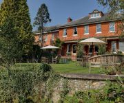
Sysonby Knoll was built as a country house in 1911 by the Thurman family of Riverside Farm, Melton Mowbray in Leicestershire, England. There have been a succession of owners, the most recent being the Booth family, who purhased the house in 1965 and converted it into a hotel. The hotel has 30 en-suite bedrooms and a locally well respected restaurant, serving lunches and evening meals as well as Sunday Lunch.
Melton Mowbray North railway station
Melton Mowbray North railway station was a railway station in Melton Mowbray in Leicestershire, United Kingdom on the Great Northern and London and North Western Joint Railway. The station was built of red brick but with lavish ornamentation in the classical style. There were two platforms connected by a subway.
Melton Carnegie Museum
The Melton Carnegie Museum is a museum in Melton Mowbray, Leicestershire, which documents the history of the market town. It is managed by Leicestershire County Council and supported by Melton Borough Council and is Heritage Lottery Funded.
St Mary's Church, Melton Mowbray
St Mary's Church, Melton Mowbray is a parish church in the Church of England located in Melton Mowbray, Leicestershire.


