Safety Score: 3,0 of 5.0 based on data from 9 authorites. Meaning we advice caution when travelling to United Kingdom.
Travel warnings are updated daily. Source: Travel Warning United Kingdom. Last Update: 2024-05-02 08:23:34
Discover Litlington
Litlington in East Sussex (England) is a town in United Kingdom about 51 mi (or 82 km) south of London, the country's capital city.
Current time in Litlington is now 10:59 PM (Thursday). The local timezone is named Europe / London with an UTC offset of one hour. We know of 11 airports near Litlington, of which 5 are larger airports. The closest airport in United Kingdom is Shoreham Airport in a distance of 20 mi (or 32 km), West. Besides the airports, there are other travel options available (check left side).
There are several Unesco world heritage sites nearby. The closest heritage site in United Kingdom is Stonehenge, Avebury and Associated Sites in a distance of 30 mi (or 49 km), North-West. Also, if you like playing golf, there are a few options in driving distance. We discovered 2 points of interest in the vicinity of this place. Looking for a place to stay? we compiled a list of available hotels close to the map centre further down the page.
When in this area, you might want to pay a visit to some of the following locations: Lewes, Rottingdean, Brighton, Fulking and Felbridge. To further explore this place, just scroll down and browse the available info.
Local weather forecast
Todays Local Weather Conditions & Forecast: 13°C / 56 °F
| Morning Temperature | 11°C / 53 °F |
| Evening Temperature | 13°C / 55 °F |
| Night Temperature | 11°C / 51 °F |
| Chance of rainfall | 0% |
| Air Humidity | 94% |
| Air Pressure | 1001 hPa |
| Wind Speed | Strong breeze with 18 km/h (11 mph) from East |
| Cloud Conditions | Overcast clouds, covering 99% of sky |
| General Conditions | Light rain |
Friday, 3rd of May 2024
11°C (53 °F)
11°C (51 °F)
Light rain, fresh breeze, overcast clouds.
Saturday, 4th of May 2024
12°C (53 °F)
10°C (50 °F)
Overcast clouds, gentle breeze.
Sunday, 5th of May 2024
12°C (54 °F)
12°C (53 °F)
Broken clouds, gentle breeze.
Hotels and Places to Stay
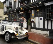
The Star Inn Alfriston
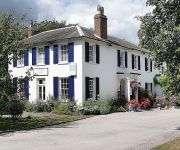
Crossways Hotel
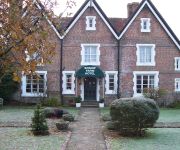
Boship Farm
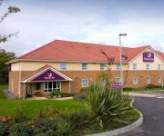
TRAVELODGE HELLINGLY EASTBOURNE
Eastbourne (Polegate)
Videos from this area
These are videos related to the place based on their proximity to this place.
Seven Sisters Country Park
Seven Sisters Country Park Situated in the South Downs National Park, the Seven Sisters Country Park comprises 280 hectares of chalk cliffs, meandering river valley and open chalk ...
Alfriston, E.Sussex. UK.
A delightful village in the heart of sussex. St Andrews is known as the Cathedral of the downs, though i believe there maybe a few others which claim that title. Full of quaint tea rooms and...
LBW 2010 (proposal): the hall
Alfriston Village Hall, Alfriston, East Sussex, UK The hall in our proposal.
Spoonbill (Platalea leucorodia)
Spoonbill (Platalea leucorodia) at Seven Sisters Country Park, East Sussex England 11 April 2014.
Flooded Alfriston Road
The flooded road on the way into Alfriston, of the first sunny day of February... the 16th! A big thank you to the tireless David, who's rescued so many of the stricken. Please excuse the...
OktoXL fun at Alfriston
This was quite a rewarding flight. Good light, a lot of eye-pleasing features to film and low wind. Equipment used: MK Okto XL with Navboard and GPS. MK Hisight SLR2 gimbal Canon EOS...
David Foster starts 2009 with a splash
Kristin Nelson www.planetkrikri.blogspot.com took this vid of me on the River Cuckmere on New Years Day.
Paragliding High and Over March 20th 2009
Started the day off at High and Over. Light then very quicky got very windy. After a couple of flights it got too much. Had an early lunch and then over to Beachy Head where it was just about...
Beachy Head Marathon 2011-Part 3 - Litlington to Eastbourne
The final third of the race from Litlington to Eastbourne, crossing the Seven Sisters & Beachy Head. See my video of the 2012 Beachy Head Marathon: http://youtu.be/oU3FfNwKc_Y See my other...
Videos provided by Youtube are under the copyright of their owners.
Attractions and noteworthy things
Distances are based on the centre of the city/town and sightseeing location. This list contains brief abstracts about monuments, holiday activities, national parcs, museums, organisations and more from the area as well as interesting facts about the region itself. Where available, you'll find the corresponding homepage. Otherwise the related wikipedia article.
Alfriston Clergy House
Alfriston Clergy House in Alfriston, Polegate, East Sussex, England, was the first property to be acquired by the National Trust. It was purchased in 1896 for £10. The house lies adjacent to the Church of St. Andrew.
Long Man of Wilmington
The Long Man of Wilmington is a hill figure located in Wilmington, East Sussex, England, on the steep slopes of Windover Hill, 9.6 kilometres northwest of Eastbourne. It was formerly often known as the Wilmington Giant, or locally as the Green Man. The Long Man is 69.2 metres tall, holds two "staves", and is designed to look in proportion when viewed from below.
Cuckmere Haven
Cuckmere Haven (also known as the Cuckmere Estuary) is an area of flood plains in Sussex, England where the river Cuckmere meets the English Channel between Eastbourne and Seaford. The river is an example of a meandering river, and contains several oxbow lakes. It is a popular tourist destination with an estimated 350,000 visitors per year, where they can engage in long walks, or water activities on the river. The beach at Cuckmere Haven is next to the famous chalk cliffs, the Seven Sisters.
Lullington Church
Lullington Church, also known as the Church of the Good Shepherd, on the South Downs at Lullington in East Sussex is claimed to be the smallest church in England. It was built from the remains of the chancel of an earlier church that was destroyed by fire, generally believed to have occurred at the time of Oliver Cromwell. It measures a mere 16 feet (5 metres) square and seats 20 people.
Church of St. Andrew, Alfriston
St Andrew's Church is the parish church of Alfriston, East Sussex, England. This Grade I listed building was built in the 1370s and is also known as the 'Cathedral of the Downs'. It sits on a small, flint-walled mound, indicating that it was the site of a pre-Christian place of worship, in the middle of 'the Tye' (the local village green), overlooking the River Cuckmere, and is surrounded by the flowered graveyard. It is built in the form of a cross.
Drusillas Zoo Park
Drusillas Park is a small 10 acres zoo near to Alfriston, in East Sussex, UK. Its exhibits are targeted towards children between 2 and 10 years old The zoo is home to both wild and domestic animals, including ring-tailed lemurs, meerkats, and penguins. There are many hands-on activities, an adventure play area separated for different age groups, an indoor soft play centre, and a Thomas & Friends train that runs daily. There are also cafes, shops, and a restaurant.
Ladycross School
Ladycross was a Catholic preparatory school based in Seaford, East Sussex, overlooking the downs with trenches which led up to the cliffs. Founded in 1891, more than 2,000 pupils attended it before its closure in 1977.
Alfriston Windmill
Alfriston Windmill is a tower mill at Alfriston, Sussex, England which has been converted to residential accommodation.


