Safety Score: 3,0 of 5.0 based on data from 9 authorites. Meaning we advice caution when travelling to United Kingdom.
Travel warnings are updated daily. Source: Travel Warning United Kingdom. Last Update: 2024-04-27 08:23:39
Touring Thorncombe
Thorncombe in Dorset (England) is a town located in United Kingdom about 129 mi (or 207 km) west of London, the country's capital place.
Time in Thorncombe is now 06:55 PM (Saturday). The local timezone is named Europe / London with an UTC offset of one hour. We know of 9 airports nearby Thorncombe, of which 5 are larger airports. The closest airport in United Kingdom is RNAS Yeovilton in a distance of 17 mi (or 27 km), North-East. Besides the airports, there are other travel options available (check left side).
There are two Unesco world heritage sites nearby. The closest heritage site in United Kingdom is City of Bath in a distance of 66 mi (or 107 km), North-East. Also, if you like the game of golf, there is an option about 21 mi (or 35 km). away. Need some hints on where to stay? We compiled a list of available hotels close to the map centre further down the page.
Being here already, you might want to pay a visit to some of the following locations: Taunton, Dorchester, Bleadon, Hutton and Burrington. To further explore this place, just scroll down and browse the available info.
Local weather forecast
Todays Local Weather Conditions & Forecast: 10°C / 50 °F
| Morning Temperature | 5°C / 41 °F |
| Evening Temperature | 9°C / 48 °F |
| Night Temperature | 7°C / 44 °F |
| Chance of rainfall | 8% |
| Air Humidity | 91% |
| Air Pressure | 1002 hPa |
| Wind Speed | Moderate breeze with 9 km/h (6 mph) from South-West |
| Cloud Conditions | Overcast clouds, covering 100% of sky |
| General Conditions | Moderate rain |
Sunday, 28th of April 2024
10°C (49 °F)
5°C (41 °F)
Moderate rain, moderate breeze, overcast clouds.
Monday, 29th of April 2024
12°C (53 °F)
11°C (51 °F)
Light rain, fresh breeze, overcast clouds.
Tuesday, 30th of April 2024
11°C (51 °F)
10°C (51 °F)
Moderate rain, fresh breeze, overcast clouds.
Hotels and Places to Stay
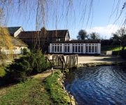
Hornsbury Mill
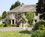
Fairwater Head
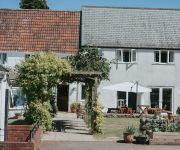
The Lordleaze
Bath House Hotel
Videos from this area
These are videos related to the place based on their proximity to this place.
The Fox, The Hunt & The Railway Line
How irresponsible would a hunt have to be to lay a trail right near a mainline railway track? That is assuming of course, that they did lay an artificial trail. Have a look at these idiots....
The Queen's View, Chard Scottish Country Dance Club, 9 Feb 2015
Queen's View, Chardstock Village Hall, 9 February 2015 32 bar reel for 3 couples in a 4 couple set, devised by Bill Forbes and published in the Third Craigievar Book of Scottish Dances.
Chard, Somerset, England. Garage Clearance, Waste, Junk, Rubbish, Removal, Collection and Disposal.
Location: Chard, Somerset, England. Project: Clear all garage contents. The occupier of this garage has decided to give up renting this garage as the costs of rental have escalated to an...
Steve Adams Extreme Snowboarding Country Style...
One BIG Somerset snowfall. One Snowboard. One 4x4, and three bottles of cider, ...and I give you....
Eclipse 2015
Partial Solar Eclipse as viewed from Chard in Somerset on 20 March 2015. Cloud obscured it for some of the time but it also helped with viewing conditions too.
YBW ChardRes
1st Yellow-browed warbler recorded at Chard Res LNR. Sorry for the shake but it was hand-held unfortunately and not easy to see - hence only a few short seconds of footage.
Lemurs at Cricket St Thomas
Lemurs bouncing around at Cricket St Thomas Wildlife Park, Chard, Somerset. Best watched in HD. Filmed on a Flip mino HD in a low light environment. The first clip was in digital zoom...
Videos provided by Youtube are under the copyright of their owners.
Attractions and noteworthy things
Distances are based on the centre of the city/town and sightseeing location. This list contains brief abstracts about monuments, holiday activities, national parcs, museums, organisations and more from the area as well as interesting facts about the region itself. Where available, you'll find the corresponding homepage. Otherwise the related wikipedia article.
Marshwood
Marshwood is a village in west Dorset, England, situated on the northern edge of the Marshwood Vale six miles north of Lyme Regis. The village has a population of 283, 8.6% of dwellings are second homes. The Bottle Inn on the outskirts of Marshwood is home to the world stinging nettle eating championships.
Lambert's Castle
Lambert's Castle is an Iron Age hill fort in the county of Dorset in southwest England. Since 1981 it has been designated as a Site of Special Scientific Interest (SSSI) on account of its geology, archaeology and ecology. The hillfort is situated on a broad northerly spur at the summit of Lambert's Castle Hill, which rises to a height of 256 metres . There are steep natural slopes on three sides of the fort, and linear ramparts across the flat southern approaches.
The Bottle Inn
The Bottle Inn is a 16th century public house in Marshwood in Dorset, England which hosts the World Nettle Eating Championship. The building started life as an ale house being close to a church where people came to pay their tithes. It was named The Bottle Inn sometime late in the 18th Century when it became the first inn in the area to sell bottled beers. During its history the building has also housed the village shop and during World War II, the village school.
Forde Abbey
Forde Abbey is a privately owned former Cistercian monastery in Dorset, England. The house and gardens are run as a tourist attraction while the 1,600-acre estate is farmed to provide additional revenue. Forde Abbey is a Grade I listed building.
Lambert's Castle Hill
Lambert's Castle Hill (258 metres, 846 feet high) rises between the villages of Marshwood and Fishpond Bottom in the county of Dorset, England. It is part of the South Dorset Downs and its prominence qualifies it as one of the so-called HuMPs. From the castle there are "spectacular views across the Marshwood Vale". Visible landmarks include: Pilsdon Pen and Lewesdon Hill to the east, Hardown Hill, Langdon Hill and Golden Cap to the south.


