Safety Score: 3,0 of 5.0 based on data from 9 authorites. Meaning we advice caution when travelling to United Kingdom.
Travel warnings are updated daily. Source: Travel Warning United Kingdom. Last Update: 2024-04-27 08:23:39
Discover Burstock
Burstock in Dorset (England) is a town in United Kingdom about 126 mi (or 203 km) south-west of London, the country's capital city.
Current time in Burstock is now 09:27 AM (Saturday). The local timezone is named Europe / London with an UTC offset of one hour. We know of 9 airports near Burstock, of which 5 are larger airports. The closest airport in United Kingdom is RNAS Yeovilton in a distance of 15 mi (or 24 km), North-East. Besides the airports, there are other travel options available (check left side).
There are two Unesco world heritage sites nearby. The closest heritage site in United Kingdom is City of Bath in a distance of 64 mi (or 103 km), North-East. Also, if you like playing golf, there is an option about 22 mi (or 36 km). away. Looking for a place to stay? we compiled a list of available hotels close to the map centre further down the page.
When in this area, you might want to pay a visit to some of the following locations: Taunton, Dorchester, Bleadon, Burrington and Hutton. To further explore this place, just scroll down and browse the available info.
Local weather forecast
Todays Local Weather Conditions & Forecast: 7°C / 45 °F
| Morning Temperature | 5°C / 40 °F |
| Evening Temperature | 7°C / 45 °F |
| Night Temperature | 6°C / 42 °F |
| Chance of rainfall | 5% |
| Air Humidity | 95% |
| Air Pressure | 1003 hPa |
| Wind Speed | Moderate breeze with 12 km/h (7 mph) from South-West |
| Cloud Conditions | Overcast clouds, covering 100% of sky |
| General Conditions | Moderate rain |
Sunday, 28th of April 2024
7°C (44 °F)
4°C (39 °F)
Heavy intensity rain, fresh breeze, overcast clouds.
Monday, 29th of April 2024
11°C (52 °F)
8°C (46 °F)
Light rain, moderate breeze, broken clouds.
Tuesday, 30th of April 2024
9°C (49 °F)
10°C (50 °F)
Moderate rain, fresh breeze, overcast clouds.
Hotels and Places to Stay
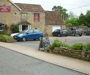
Coach and Horses
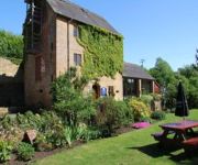
Haselbury Mill and Tythe Barn
Videos from this area
These are videos related to the place based on their proximity to this place.
South West Trains Train arriving at Crewkerne from London.
URL to Share: http://youtu.be/M8nmHQWixV0 South West Trains Train arriving at Crewkerne from London. This is a South West Trains service ariving at Crewkerne Railway Station from London....
Was there ever a Dorset cider? Part 2
Cider apple expert Liz Copas tackles the big Dorset cider question. She and Dorset cidermaker Nick Poole spent every autumn from 2007 to 2010 hunting for apples from old Dorset orchards. ...
Homefront the Revolution and Xbox One Dev kit info
Check out this KIckstarter for Tech Industry Tycoon: http://www.kickstarter.com/projects/735603083/untitled-business-management-simulator.
The Fox, The Hunt & The Railway Line
How irresponsible would a hunt have to be to lay a trail right near a mainline railway track? That is assuming of course, that they did lay an artificial trail. Have a look at these idiots....
Testing Breathing Masks at Kingcombe Aquacare
We've been testing fitted masks so as to give Kingcombe Aquacare staff the best possible protection on jobs such as working in dusty confined spaces. In this video, you can see our maintenance...
Planting Trees at the Bincombe Beeches Nature Reserve
DOZENS of people armed with spades and wellies were at the ready on Saturday, to help plant trees at Bincombe Beeches Nature Reserve. Seeds for 195 native trees and shrubs were planted by ...
Lemurs at Cricket St Thomas
Lemurs bouncing around at Cricket St Thomas Wildlife Park, Chard, Somerset. Best watched in HD. Filmed on a Flip mino HD in a low light environment. The first clip was in digital zoom...
Videos provided by Youtube are under the copyright of their owners.
Attractions and noteworthy things
Distances are based on the centre of the city/town and sightseeing location. This list contains brief abstracts about monuments, holiday activities, national parcs, museums, organisations and more from the area as well as interesting facts about the region itself. Where available, you'll find the corresponding homepage. Otherwise the related wikipedia article.
Broadwindsor
Broadwindsor is a village in west Dorset, England, two miles west of Beaminster. The village has a population of 1,218 (2001). Broadwindsor was also formerly a liberty, containing only the parish itself. Broadwindsor is renowned for its Craft Centre, Lewesdon Hill in bluebell time, 13th century church, in which Thomas Fuller preached.
Burstock
Burstock is a village in west Dorset, England, five miles south of Crewkerne. The village has a population of 109 (2001).
Seaborough
Seaborough is a hamlet in north west Dorset, England, situated on the River Axe two miles south of Crewkerne. The village has a population of 65. The parish was part of the hundred of Crewkerne.
Lewesdon Hill
Lewesdon Hill is about 4 km west of Beaminster in south west Dorset, England. Like many of the high hills in Dorset, including its neighbour Pilsdon Pen, it is the site of an Iron Age hill fort. The hill is formed from upper greensand which is more resistant to erosion than the surrounding clay. The hill is the highest point in Dorset, closely followed by Pilsdon Pen (277 m) and Bulbarrow Hill (275 m). To the south of the hill is the Marshwood Vale. It is a National Trust property.
Conegar Road Cutting
Conegar Road Cutting is a 0.15 hectare geological Site of Special Scientific Interest in Dorset, notified in 1996.
Waddon Hill
Waddon Hill is a hill and the site of an old Roman fort near Beaminster, in the English county of Dorset. The name Waddon is from the Old English meaning wheat hill. The Wessex Ridgeway passes to the north around the base of the hill. The B3162 road passes close to the western end of the hill. Lewesdon Hill is about 0.6 miles to the west.
Drimpton
Drimpton is a village in the English county of Dorset. It lies in the West Dorset administrative district of the county, about 5 miles northwest of the small town of Beaminster and 3.5 miles southwest of Crewkerne in Somerset. It is sited on a small tributary of the River Axe. This tributary stream was unnamed until 2005 when, after a vote by villagers, it was officially named the "Little Axe". Neighbouring settlements to Drimpton include Clapton, Broadwindsor, Burstock, Netherhay and Greenham.


