Safety Score: 3,0 of 5.0 based on data from 9 authorites. Meaning we advice caution when travelling to United Kingdom.
Travel warnings are updated daily. Source: Travel Warning United Kingdom. Last Update: 2024-05-02 08:23:34
Discover Blisland
Blisland in Cornwall (England) is a city in United Kingdom about 209 mi (or 337 km) west of London, the country's capital city.
Local time in Blisland is now 06:26 AM (Friday). The local timezone is named Europe / London with an UTC offset of one hour. We know of 9 airports in the vicinity of Blisland, of which 3 are larger airports. The closest airport in United Kingdom is Newquay Cornwall Airport in a distance of 15 mi (or 24 km), South-West. Besides the airports, there are other travel options available (check left side).
There is one Unesco world heritage site nearby. It's Cornwall and West Devon Mining Landscape in a distance of 27 mi (or 44 km), South. Also, if you like golfing, there is an option about 25 mi (or 41 km). away. Looking for a place to stay? we compiled a list of available hotels close to the map centre further down the page.
When in this area, you might want to pay a visit to some of the following locations: Helland, Roche, Trewen, Jacobstow and Duloe. To further explore this place, just scroll down and browse the available info.
Local weather forecast
Todays Local Weather Conditions & Forecast: 13°C / 55 °F
| Morning Temperature | 8°C / 47 °F |
| Evening Temperature | 11°C / 51 °F |
| Night Temperature | 6°C / 43 °F |
| Chance of rainfall | 0% |
| Air Humidity | 73% |
| Air Pressure | 1011 hPa |
| Wind Speed | Moderate breeze with 9 km/h (6 mph) from East |
| Cloud Conditions | Overcast clouds, covering 100% of sky |
| General Conditions | Overcast clouds |
Saturday, 4th of May 2024
13°C (56 °F)
8°C (46 °F)
Few clouds, gentle breeze.
Sunday, 5th of May 2024
13°C (55 °F)
8°C (47 °F)
Light rain, moderate breeze, overcast clouds.
Monday, 6th of May 2024
12°C (54 °F)
9°C (47 °F)
Light rain, moderate breeze, overcast clouds.
Hotels and Places to Stay
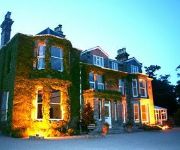
Tredethy House
Trehellas House
White Hart
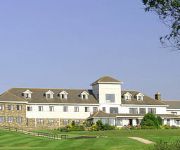
Bowood Park
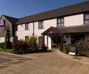
Bodmin
Videos from this area
These are videos related to the place based on their proximity to this place.
Bodmin Moor Zodiac: Cancer, the Cabilla Crab
Piecing a ritual walk together from the remnants of the Cabilla crab, through gorse bushes and stone tracks, is like retrieving a false memory, the visual evidence for truths we prefer to forget....
Cornwall Holiday - Feb 2014 - Tom and Luke
The adventures of Tom and I in Cornwall! A very fun holiday with lots of singing and lots of alcohol! Good times!
Journey Not Destination
Seizing a 3 hour opportunity window I went on my daughter and I's first walk together. Aged 3.5 weeks I did most of the walking! Filmed on an iPhone and edited using YouTube Capture. Mountain...
The Importance of Attraction Marketing
To gain access to the FREE video bootcamp training click here: http://tidyurl.com/0tarbs Attraction Marketing is the alternative to sleezy sales tactics The ONLY people who are really succeeding...
Bodmin Moor Zodiac: Gemini, the Temple twins
The sun is in this sign from 22nd May to 22nd June. An air sign. Key words: letters, books, stories, reports, radio, telephone, roads, railways, twins, dexterity, handicrafts. Light or planet:...
Stay in Cornwall
Find your perfect holiday in Cornwall on www.stayincornwall.co.uk. Hotels | Holiday Parks | Cottages | B&B | Camping.
Waves breaking over 200ft cliff - Brigid Storm Hits Sennen
Winter storm Brigid hit in to Cornwall with a vengeance this evening, with huge waves crashing over the 70metre cliffs and onto the village of Sennen and it's iconic lifeboat station. Storm...
Cornwall sea storms - monster waves smash the coastline.
http://www.stundumplings.co.uk - Cornwall sea storms and damage caused by gale force winds, spring tides and heavy rainfall. Huge waves continue to batter the West country as communities assess...
On Top Of The World
Hi guys! I'm Maddy, and I'm new to this YouTubing world! I ride horses, you guessed it! This is my first of hopefully many videos, so please keep an eye on my channel! If you like this video...
Videos provided by Youtube are under the copyright of their owners.
Attractions and noteworthy things
Distances are based on the centre of the city/town and sightseeing location. This list contains brief abstracts about monuments, holiday activities, national parcs, museums, organisations and more from the area as well as interesting facts about the region itself. Where available, you'll find the corresponding homepage. Otherwise the related wikipedia article.
De Lank Quarries
De Lank Quarries is a 21.9-hectare geological Site of Special Scientific Interest in St Breward parish, north Cornwall, notified in 1994. The quarries have produced typical biotite granites and are of such quality that a slab now forms the base section of the reception desk at the Geological Society of London. Another notable structure built of De Lank granite is the fourth Eddystone Lighthouse, 1882. A branch of the Bodmin and Wadebridge railway served the De Lank quarry.
Bodmin Airfield
Bodmin Airfield is located 3.5 NM northeast of Bodmin, Cornwall, England, UK. Bodmin Aerodrome has a CAA Ordinary Licence (Number P633) that allows flights for the public transport of passengers or for flying instruction as authorised by the licensee (Cornwall Flying Club Limited). The aerodrome is not licensed for night use and runway 03/21 is no longer licensed. Radio equipped microlights can use Bodmin (radio contact preferred). All aircraft are strictly Prior Permission Required.
St Breward
St Breward is a civil parish and village in Cornwall, England, United Kingdom. It is on the western side of Bodmin Moor, about 6 miles (10 km) north of Bodmin. The parish name derives from Saint Branwalader. Until the 19th century it was commonly known by the corrupt form of the name: 'Simonward'.
Lank, Cornwall
Lank is a settlement in Cornwall, United Kingdom. It is situated approximately one mile (1.6 km) south of St Breward and six miles (10 km) east-northeast of Wadebridge in St Breward civil parish. The settlement consists of two hamlets, Higher Lank (to the north) and Lower Lank (to the south), situated on high ground between the valleys of the River Camel and De Lank River from which the settlements take their name. The De Lank granite quarry is half-a-mile east of Lower Lank.
Bradford, Cornwall
Bradford is a hamlet in the county of Cornwall, England, UK, 10.3 km north northeast of the town of Bodmin, near the A30 road.
Wenfordbridge
Wenfordbridge, or Wenford Bridge, is a hamlet some 6 miles north of Bodmin and on the western flank of Bodmin Moor, in the English county of Cornwall. It takes its name from an old granite bridge over the River Camel, and lies on the border between the parishes of St Breward and St Tudy. Wenford Bridge was the terminus of a former railway line from Wadebridge that was originally built by the Bodmin and Wadebridge Railway in 1834.
Bodrigan
Bodrigan is a house near Wenford in the Camel Valley, north Cornwall.
Bodmin Rural District
Bodmin Rural District was a local government division of Cornwall in England, UK, between 1894 and 1934. Established under the Local Government Act 1894, the rural district was abolished in 1934 to create Wadebridge Rural District as well as enlarging Bodmin Municipal Borough, Liskeard Rural District, Lostwithiel Municipal Borough and St Austell Rural District.


