Safety Score: 3,0 of 5.0 based on data from 9 authorites. Meaning we advice caution when travelling to United Kingdom.
Travel warnings are updated daily. Source: Travel Warning United Kingdom. Last Update: 2024-05-04 08:22:41
Delve into Lanlivery
Lanlivery in Cornwall (England) is a town located in United Kingdom about 213 mi (or 343 km) west of London, the country's capital town.
Time in Lanlivery is now 06:39 AM (Sunday). The local timezone is named Europe / London with an UTC offset of one hour. We know of 10 airports closer to Lanlivery, of which 3 are larger airports. The closest airport in United Kingdom is Newquay Cornwall Airport in a distance of 13 mi (or 21 km), West. Besides the airports, there are other travel options available (check left side).
There is one Unesco world heritage site nearby. It's Cornwall and West Devon Mining Landscape in a distance of 19 mi (or 30 km), South. Also, if you like the game of golf, there is an option about 19 mi (or 31 km). away. In need of a room? We compiled a list of available hotels close to the map centre further down the page.
Since you are here already, you might want to pay a visit to some of the following locations: Helland, Roche, Duloe, Tregoney and Padstow. To further explore this place, just scroll down and browse the available info.
Local weather forecast
Todays Local Weather Conditions & Forecast: 14°C / 57 °F
| Morning Temperature | 10°C / 50 °F |
| Evening Temperature | 12°C / 53 °F |
| Night Temperature | 10°C / 49 °F |
| Chance of rainfall | 0% |
| Air Humidity | 72% |
| Air Pressure | 1006 hPa |
| Wind Speed | Moderate breeze with 10 km/h (6 mph) from West |
| Cloud Conditions | Overcast clouds, covering 90% of sky |
| General Conditions | Light rain |
Monday, 6th of May 2024
15°C (58 °F)
9°C (48 °F)
Light rain, moderate breeze, broken clouds.
Tuesday, 7th of May 2024
14°C (58 °F)
8°C (46 °F)
Overcast clouds, moderate breeze.
Wednesday, 8th of May 2024
15°C (59 °F)
11°C (53 °F)
Light rain, light breeze, broken clouds.
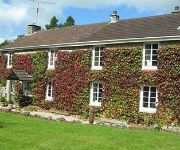
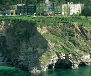
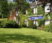
Hotels and Places to Stay
The Fowey Hotel
Ivy Cottage
Artist's House
Carlyon Bay Hotel
Brambles B&B
BEST WESTERN FOWEY VALLEY
Porth Avallen
White Hart
The Innis Inn B&B
Boscundle Manor
Videos from this area
These are videos related to the place based on their proximity to this place.
Cornish Main Line - Part 2 Liskeard to St Austell
Scenes from aboard the 07:30 ex Paddington HST on the Cornish Main Line between Liskeard & St Austell.
Nansavallen
This is a short tour of the holiday home we stay in when we visit Tywardreath in Cornwall.
The nutcracker machine, Eden Project
It seemed simple but do you read the instructions first or just turn the handle? We finally cracked the nut! A group from the Barn international holiday to Cornwall visited the Eden project...
Testing the dens at #maycamp
A team building, den building exercise at the Big Lunch Extras May Camp 2014.
Sedum Green Roof Installation at the Eden Project by Bauder Ltd.wmv
This is how sedum roofs are installed using long rolls of pre-cultivated sedum plants grown like 'turf'. This building is down at the Eden Project which is open to the public. The hardy sedum...
The Eden Project Rainforest and Mediterranean Biomes in Daylight and at Night
The video is taken during the one-day visit to the Eden Project (http://en.wikipedia.org/wiki/Eden_Project) on 25th of January, 2014. The biomes were visited during the daytime and at night,...
The Curnow Irrupter | Newquay Branch Line | 28/5/2011
MINI VID - Pathfinders 'The Curnow Irrupter' Traveling towards St. Blazey on the Newquay Branch Line.
The Penventon Hotel Redruth Cornwall.wmv
This fantastic hotel is situated in the Cornish town of Redruth. For weddings ,overnight stops or like my wife and I pure relaxation. The food in the resturant is out of this world. Such a...
92 day Juice Feast Day 11
Day 11 of the 92 day juice feast. Hey, this is going really well and I love it - quite a contrast to my life of 2 weeks ago. All I need now is to learn to pronounce 'Spirulina'!
Videos provided by Youtube are under the copyright of their owners.
Attractions and noteworthy things
Distances are based on the centre of the city/town and sightseeing location. This list contains brief abstracts about monuments, holiday activities, national parcs, museums, organisations and more from the area as well as interesting facts about the region itself. Where available, you'll find the corresponding homepage. Otherwise the related wikipedia article.
Battle of Lostwithiel
The Battles of Lostwithiel or Lostwithiel Campaign, took place near Lostwithiel and Fowey during the First English Civil War in 1644. After defeating the Army of Sir William Waller at the Battle of Cropredy Bridge, King Charles marched west in pursuit of the Parliamentarian army of the Earl of Essex, who was invading the Royalist stronghold of Cornwall. Essex had been misled into believing that he could expect substantial support from the people of Cornwall.
St Bartholomew's Church, Lostwithiel
St Bartholomew's Church is a parish church of the Church of England in Lostwithiel, Cornwall, UK.
Lanescot
Lanescot is a village in Cornwall, England, United Kingdom. It is in a former mining area, about four miles (6 km) east-northeast of St Austell and four miles (6 km) west-northwest of Fowey. Lanescot is recorded in the Domesday Book as Lisnestoch. The Saints' Way long distance footpath passes through Lanescot.
Treffry Viaduct
The Treffry Viaduct is a historic dual-purpose railway viaduct and aqueduct located close to the village of Luxulyan, Cornwall, England in the United Kingdom. The viaduct crosses the Luxulyan Valley, and with it forms an integral part of the Cornwall and West Devon Mining Landscape, a World Heritage Site.
Lostwithiel Stannary Palace
The Stannary Palace, circa 1265–1300, is reputed to be the oldest non-ecclesiastical building in Cornwall and was said to have been built as a replica of the Great Hall of Westminster. Its original function was as a Court dealing with the Cornish tin industry. The Earls of Cornwall and later after 1337, the Dukes of Cornwall had their residence at Restormel Castle so the original name would have been the Stannary Hall or the Great Hall of Lostwithiel.
Lantyan
Lantyan is a settlement in Cornwall, United Kingdom. It is situated on the west side of the River Fowey just over a mile (1.6 km) south of Lostwithiel. Lantyan Wood is in the care of the Woodland Trust. It is south of the settlement and covers the steep-sided Fowey valley with a network of tracks to give access. The Saints' Way long-distance footpath passes nearby.
Fowey Consols mine
Fowey Consols mine is a group of mines in the St Blazey district of Cornwall. They were owned by wealthy Cornishman, Joseph Treffry. The mines were worked by 6 steam engines and 17 waterwheels. The mines were linked to the port at Par by a canal. It was one of the deepest, richest and most important copper mines in Cornwall. In 1813, these mines, then called Wheal Treasure, Wheal Fortune, and Wheal Chance, commenced working, and stopped in 1819.
Breney Common
Breney Common is a nature reserve and Site of Special Scientific Interest, noted for its biological characteristics, in central Cornwall, England, UK. It is located mainly in Lanlivery civil parish, with the Saints' Way footpath running through it. The common forms part of Breney Common and Goss and Tregoss Moors Special Area of Conservation. The nature reserve is owned by the Cornwall Wildlife Trust/Cornwall Trust for Nature.


