Safety Score: 3,0 of 5.0 based on data from 9 authorites. Meaning we advice caution when travelling to United Kingdom.
Travel warnings are updated daily. Source: Travel Warning United Kingdom. Last Update: 2024-05-03 08:06:06
Delve into Camelford
Camelford in Cornwall (England) with it's 2,335 habitants is a city located in United Kingdom about 207 mi (or 333 km) west of London, the country's capital town.
Current time in Camelford is now 03:42 PM (Friday). The local timezone is named Europe / London with an UTC offset of one hour. We know of 9 airports closer to Camelford, of which 3 are larger airports. The closest airport in United Kingdom is Newquay Cornwall Airport in a distance of 19 mi (or 30 km), South-West. Besides the airports, there are other travel options available (check left side).
There is one Unesco world heritage site nearby. It's Cornwall and West Devon Mining Landscape in a distance of 34 mi (or 54 km), South. Also, if you like playing golf, there is an option about 31 mi (or 49 km). away. In need of a room? We compiled a list of available hotels close to the map centre further down the page.
Since you are here already, you might want to pay a visit to some of the following locations: Helland, Jacobstow, Poundstock, Trewen and North Hill. To further explore this place, just scroll down and browse the available info.
Local weather forecast
Todays Local Weather Conditions & Forecast: 13°C / 55 °F
| Morning Temperature | 8°C / 47 °F |
| Evening Temperature | 11°C / 51 °F |
| Night Temperature | 6°C / 43 °F |
| Chance of rainfall | 0% |
| Air Humidity | 73% |
| Air Pressure | 1011 hPa |
| Wind Speed | Moderate breeze with 9 km/h (6 mph) from East |
| Cloud Conditions | Overcast clouds, covering 100% of sky |
| General Conditions | Overcast clouds |
Saturday, 4th of May 2024
13°C (56 °F)
8°C (46 °F)
Few clouds, gentle breeze.
Sunday, 5th of May 2024
13°C (55 °F)
8°C (47 °F)
Light rain, moderate breeze, overcast clouds.
Monday, 6th of May 2024
12°C (54 °F)
9°C (47 °F)
Light rain, moderate breeze, overcast clouds.
Hotels and Places to Stay
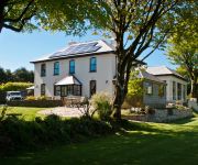
Pendragon Country House Old Vicarage Hill
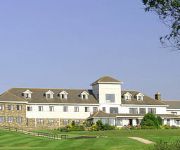
Bowood Park
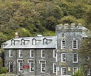
Wellington
Atlantic View Hotel
Port William
Videos from this area
These are videos related to the place based on their proximity to this place.
Uno game - Barn holiday, Cornwall
The game of Uno, played by a group of international students on a holiday in Tintagel, Cornwall.
Holidays in Boscastle
Visit http://www.holidaycottages.co.uk/cornwall/north-cornwall/boscastle to view our collection of holiday cottages in Boscastle. Boscastle is a traditional picturesque village hidden in...
Silage 2014 - Mowing with a view part 1
First cut started in my local village this weekend so went down and had a look. Mowing with a great view looking down on Tintagle (Cornwall) and over to Trebarwith. John Deere 7530 with a set...
storytelling.mpg
Just an Extract: Jill Lamede, The Tintagel Storyteller, and Wilberforce, her White Mouse companion, tell the first part of an ancient folktale.
Jenga game
The game of Jenga reaches new heights - level 32! Played by a group of international students and English friends from the Barn on holiday in Cornwall.
3D Boscastle Floods 10th Anniversary
URL to Share: http://youtu.be/sMDDMNns_qU 10th Anniversaryof the Boscastle Floods in 3D. Visit to Boscastle in North Cornwall.
A Dog's Eye View of Helsbury Park
Take a tour of the 'back garden' at luxury dog friendly holiday cottages Helsbury Park, set in the Camel Valley in North Cornwall.
entertainers
People from the village of Delabole Cornwall who have kept us entertained down the years.
Videos provided by Youtube are under the copyright of their owners.
Attractions and noteworthy things
Distances are based on the centre of the city/town and sightseeing location. This list contains brief abstracts about monuments, holiday activities, national parcs, museums, organisations and more from the area as well as interesting facts about the region itself. Where available, you'll find the corresponding homepage. Otherwise the related wikipedia article.
Camelford water pollution incident
The Camelford water pollution incident involved the accidental contamination of the drinking water supply to the town of Camelford, Cornwall, England with 20 tonnes of aluminium sulphate in July 1988, raising the concentration to 3,000 times the admissible level. As the aluminium sulphate broke down it produced several tonnes of sulphuric acid which "stripped a cocktail of chemicals from the pipe networks as well as lead and copper piping in people’s homes.
Lowermoor Water Treatment Works
The Lowermoor Water Treatment Works supplies drinking water to the north Cornwall water distribution network. Raw water is obtained from the Crowdy Reservoir, which is 3/4 mile to the north east, and which is filled predominantly by run-off and drainage from surrounding moorland. The works were constructed in 1973. At the time of the Camelford water pollution incident, water treatment was being carried out by South West Water.
Slaughterbridge
Slaughterbridge, Treague and Camelford Station are three adjoining settlements in north Cornwall, United Kingdom. They straddle the boundary of Forrabury and Minster and Lanteglos by Camelford civil parishes just over a mile (2 km) north-west of the market town of Camelford The settlements are on the B3314 road from the A39 to Delabole (now part of a busy route from the A30 near Launceston to north Cornwall).
Helstone
Helstone is a settlement in north Cornwall, United Kingdom. It is situated two miles (3 km) southwest of Camelford on the A39 road.
Condolden
Condolden is a hill in north Cornwall, United Kingdom. The summit is 308 metres (1010 feet) above ordnance datum. Condolden is two miles (3 km) southeast of Tintagel village and is on the eastern border of Tintagel civil parish between Waterpit Down (to the east) and Penpethy (to the west). It is the highest point in the parish and the second highest point in Cornwall outside Bodmin Moor. The largest of the Bronze Age barrows in Tintagel is at Condolden (another is at Menadue).
North Cornwall Museum and Art Gallery
The North Cornwall Museum and Art Gallery is a privately owned local museum and art gallery in Camelford, north Cornwall, England. The museum opened around 1974 in a building that was originally used for building coaches and wagons. The museum covers life in North Cornwall between 50–100 years ago, including cider making, dairy, farming, and wagons, with sections on the tools used by different types of traditional crafts and professions.
Delabole wind farm
The Delabole wind farm is a wind farm located in Delabole, Cornwall, England. It was the first commercial wind farm constructed in the UK. The farm was first proposed in 1989, and was opened in 1991. For its first two decades, it operated ten wind turbines, built by Vestas. In February 2011, an £11.8 million rebuilding of the facility was completed, which replaced the original ten with four new turbines, which are larger than the original ones.
Camelford Rural District
Camelford Rural District was a local government division of north Cornwall between 1894 and 1974. The district council offices were at Camelford, Cornwall, England, UK, latterly in the former grammar school. It was one of several rural districts in Cornwall which carried out some local government functions while those for Cornwall as a whole were the responsibility of the Cornwall County Council.


