Safety Score: 3,0 of 5.0 based on data from 9 authorites. Meaning we advice caution when travelling to United Kingdom.
Travel warnings are updated daily. Source: Travel Warning United Kingdom. Last Update: 2024-04-26 08:02:42
Delve into Otterham
Otterham in Cornwall (England) is located in United Kingdom about 202 mi (or 325 km) west of London, the country's capital town.
Current time in Otterham is now 06:46 AM (Saturday). The local timezone is named Europe / London with an UTC offset of one hour. We know of 9 airports close to Otterham, of which 3 are larger airports. The closest airport in United Kingdom is Newquay Cornwall Airport in a distance of 24 mi (or 39 km), South-West. Besides the airports, there are other travel options available (check left side).
There are two Unesco world heritage sites nearby. The closest heritage site in United Kingdom is Cornwall and West Devon Mining Landscape in a distance of 38 mi (or 61 km), South. Also, if you like playing golf, there is an option about 25 mi (or 40 km). away. If you need a hotel, we compiled a list of available hotels close to the map centre further down the page.
While being here, you might want to pay a visit to some of the following locations: Jacobstow, Poundstock, Trewen, Boyton and North Hill. To further explore this place, just scroll down and browse the available info.
Local weather forecast
Todays Local Weather Conditions & Forecast: 8°C / 47 °F
| Morning Temperature | 6°C / 43 °F |
| Evening Temperature | 7°C / 45 °F |
| Night Temperature | 7°C / 45 °F |
| Chance of rainfall | 2% |
| Air Humidity | 83% |
| Air Pressure | 1003 hPa |
| Wind Speed | Fresh Breeze with 13 km/h (8 mph) from South-West |
| Cloud Conditions | Overcast clouds, covering 100% of sky |
| General Conditions | Light rain |
Sunday, 28th of April 2024
11°C (51 °F)
7°C (44 °F)
Light rain, fresh breeze, overcast clouds.
Monday, 29th of April 2024
12°C (54 °F)
10°C (50 °F)
Light rain, strong breeze, overcast clouds.
Tuesday, 30th of April 2024
12°C (53 °F)
9°C (48 °F)
Moderate rain, strong breeze, overcast clouds.
Hotels and Places to Stay
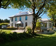
Pendragon Country House Old Vicarage Hill
Videos from this area
These are videos related to the place based on their proximity to this place.
Davenant school activity week at Outdoor Adventure
Davenant school visit Outdoor Adventure for a week of activities in the sun.
Sandymouth Helicopter Rescue
Coastguard Rescue at Sandymouth Bay. 2 persons stuck up cliff 3/5/2008.
Corwall Crissis - A few good men
Few friends for cornwall put together a selection oh good times they have shared together in biking please rate.
67001 returns tpo stock to st blazey
A day @ Par station 06/2003, 67001 returns TPO stock to St Blazey yard. 66004 turns up with China clay empties & forgets the brakes.....listen up!
Crackington Haven - Eclipse 20/3/15 (or how to play with colanders!)
I created this video with the YouTube Slideshow Creator (http://www.youtube.com/upload)
Hentervene Holiday Park, Crackington Haven, Cornwall.
Hentervene Holiday Park accommodation video. Holiday park in Crackington Haven, North Cornwall. Self catering holidays. Lodges and caravans to let. www.hentervene.co.uk.
Videos provided by Youtube are under the copyright of their owners.
Attractions and noteworthy things
Distances are based on the centre of the city/town and sightseeing location. This list contains brief abstracts about monuments, holiday activities, national parcs, museums, organisations and more from the area as well as interesting facts about the region itself. Where available, you'll find the corresponding homepage. Otherwise the related wikipedia article.
North Cornwall (UK Parliament constituency)
North Cornwall is a constituency represented in the House of Commons of the UK Parliament since 2005 by Dan Rogerson, a Liberal Democrat.
River Inny, Cornwall
The River Inny is a small river in east Cornwall, United Kingdom. It is a tributary of the River Tamar and is about twenty miles (32 km) long from its source near Davidstow on the eastern flank of Bodmin Moor to its confluence with the Tamar at Inny Foot near Dunterton. The River Inny's catchment is 108 square kilometres. Penpont Water is the main tributary and joins the Inny at Two Bridges. The course of the River Inny is initially east-southeast.
Otterham
Otterham is a village and a civil parish in north Cornwall, England, United Kingdom. The village is situated approximately ten miles (16 km) south of Bude and six miles (10 km) north of Camelford. Otterham Mill, Otterham Down and Otterham Station (see below) are neighbouring settlements to Otterham village; all take the name from the River Ottery which rises in the parish. The parish is in the Hundred of Lesnewth and Deanery of Trigg Major.
River Ottery
The River Ottery is a small river in northeast Cornwall, United Kingdom. The river is about twenty miles (33 km) long from its source southeast of Otterham to its confluence with the River Tamar at Nether Bridge, two miles (3 km) northeast of Launceston. The headwaters of the River Ottery are within the civil parish of Otterham but formerly came under the parish of Forrabury and Minster. In 1311, the rector of that parish wrote: ..
Trelash
Trelash is a hamlet in the civil parish of Warbstow, Cornwall, England, UK.
Trengune
Trengune is a hamlet in Cornwall, England, UK. It is part of the civil parish of Warbstow. The River Ottery passes through Trengune. The earliest record of Trengune was in 1356; the meaning is "farm at the downs".


