Safety Score: 3,0 of 5.0 based on data from 9 authorites. Meaning we advice caution when travelling to United Kingdom.
Travel warnings are updated daily. Source: Travel Warning United Kingdom. Last Update: 2024-04-28 08:22:10
Touring Hough
Hough in Cheshire East (England) is a town located in United Kingdom about 145 mi (or 233 km) north-west of London, the country's capital place.
Time in Hough is now 08:25 AM (Monday). The local timezone is named Europe / London with an UTC offset of one hour. We know of 8 airports nearby Hough, of which 5 are larger airports. The closest airport in United Kingdom is Manchester Airport in a distance of 22 mi (or 35 km), North. Besides the airports, there are other travel options available (check left side).
There are several Unesco world heritage sites nearby. The closest heritage site in United Kingdom is Pontcysyllte Aqueduct and Canal in a distance of 21 mi (or 34 km), West. Also, if you like the game of golf, there are several options within driving distance. Need some hints on where to stay? We compiled a list of available hotels close to the map centre further down the page.
Being here already, you might want to pay a visit to some of the following locations: Chorlton, Weston, Willaston, Market Drayton and Winsford. To further explore this place, just scroll down and browse the available info.
Local weather forecast
Todays Local Weather Conditions & Forecast: 12°C / 53 °F
| Morning Temperature | 7°C / 45 °F |
| Evening Temperature | 11°C / 51 °F |
| Night Temperature | 10°C / 50 °F |
| Chance of rainfall | 0% |
| Air Humidity | 81% |
| Air Pressure | 1009 hPa |
| Wind Speed | Strong breeze with 18 km/h (11 mph) from North |
| Cloud Conditions | Overcast clouds, covering 100% of sky |
| General Conditions | Light rain |
Tuesday, 30th of April 2024
16°C (60 °F)
10°C (50 °F)
Light rain, fresh breeze, overcast clouds.
Wednesday, 1st of May 2024
14°C (58 °F)
12°C (53 °F)
Light rain, gentle breeze, overcast clouds.
Thursday, 2nd of May 2024
13°C (55 °F)
9°C (48 °F)
Light rain, gentle breeze, overcast clouds.
Hotels and Places to Stay
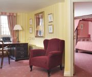
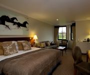
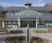
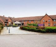
CREWE HALL - QHOTELS
Rookery Hall
Best Western Crewe Arms
Wychwood Park
ibis Styles Crewe
Holiday Inn Express CREWE
TRAVELODGE CREWE
Crewe Central
Crewe West
Crewe (Nantwich)
Videos from this area
These are videos related to the place based on their proximity to this place.
Trains In The 1980's Crewe Diesel & Electric Variety, Autumn 1988
A great variety of diesel and electric locos and units filmed at Crewe - including examples of Class 08, 20, 31, 37, 47, 56, 58, 85, 86, 87, 90, 97, 150, 155, 303, and 304 - all seen during...
Timelapse Journey North Wales Coast Railway -Crewe to Holyhead 1 of 2
Timelapse Journey from Crewe to Holyhead on the North Wales Coast Railway. 1 of 2 Crewe to Rhyll part. Mileage represents distance from the start of the journey at Crewe. Filmed with specialized...
Crewe Railway Station (Class 47 Collection Part 1)
Two days spent at a busy Crewe Railway Station filmed in Summer 2000. Collection of mainly Virgin's Class 47s on Holyhead - Crewe and Cross Country duties.
Trains In The 1990's Crewe Diesel & Electric Variety 1990
A variety of Diesels & Electrics plus DMU's and EMU captured on video at Crewe station in 1990 on various workings during a fairly short visit there. Features Classes 20, 31, 37, 47, 85, 86,...
68013-4Z44-07Mar2015-Crewe
68013 departs Crewe Station at 15:45 on the 7th March 2015 having run round the working, 4Z44 from Motherwell TMD to Crewe Carriage Siding.
Crewe Railway Station (Day 1, Part 1)
Two days spent at a busy Crewe Railway Station filmed in Summer 2000.
Crewe Railway Station (Day 1, Part 3)
Two days spent at a busy Crewe Railway Station filmed in Summer 2000.
37603 and 37601 departing Crewe with the Crewe - Kingswear. 29/08/14.
37603 and 37601 are seen departing Crewe (with 37605 and 37611 in the background) with a Pathfinder special from Crewe - Kingswear. 29/08/14.
Crewe Railway Station (Day 1, Part 5)
Two days spent at a busy Crewe Railway Station filmed in Summer 2000.
Crewe Railway Station (Class 47 Collection Part 2)
Two days spent at a busy Crewe Railway Station filmed in Summer 2000. Collection of mainly Virgin's Class 47s on Holyhead - Crewe and Cross Country duties.
Videos provided by Youtube are under the copyright of their owners.
Attractions and noteworthy things
Distances are based on the centre of the city/town and sightseeing location. This list contains brief abstracts about monuments, holiday activities, national parcs, museums, organisations and more from the area as well as interesting facts about the region itself. Where available, you'll find the corresponding homepage. Otherwise the related wikipedia article.
Chorlton, Cheshire East
Chorlton is a village SJ728504 and civil parish in the unitary authority of Cheshire East and the ceremonial county of Cheshire, England. The village lies 4 miles to the south east of Crewe. Nearby villages include Betley, Hough, Shavington, Weston and Wybunbury. The Crewe to Stafford railway line runs north to south through the parish. According to the 2001 census, the parish had a population of 113.
Hough, Cheshire
Hough is a village and civil parish in the unitary authority of Cheshire East and the ceremonial county of Cheshire, England. The village is located 3 miles to the south of Crewe and 4 miles to the east of Nantwich. The parish also includes part of the settlement of Goodalls Corner. The total population is a little under 800. Nearby villages include Basford, Chorlton, Shavington, Weston and Wybunbury.
Shavington cum Gresty
Shavington cum Gresty is a civil parish in the unitary authority of Cheshire East and the ceremonial county of Cheshire, England. It lies to the south of Crewe. It includes the large village of Shavington, which lies 2½ miles south of Crewe, as well as the smaller settlements of Dodds Bank, Park Estate, Puseydale, Sugar Loaf and part of Goodall's Corner. Nearby villages include Basford, Hough, Willaston, Wistaston and Wybunbury. The total population of the civil parish is a little under 5,000.
Walgherton
Walgherton is a village and civil parish in the unitary authority of Cheshire East and the ceremonial county of Cheshire, England. The village lies 3½ miles to the south east of Nantwich and 4½ miles to the south of Crewe. It also includes the settlement of Hussey's Nook. Nearby villages include Hatherton, Stapeley and Wybunbury. The A51 road runs east–west through the parish. According to the 2001 census, the parish had a population of 121.
Weston, Cheshire
Weston is a village and civil parish in the unitary authority of Cheshire East and the ceremonial county of Cheshire, England. The village lies 3 miles to the south east of Crewe. The parish also includes the small settlements of Carters Green, Gorstyhill, Rose Hill, Snape, Stowford and part of Englesea Brook as well as the new settlements of Wychwood Park and Wychwood Village. Nearby villages include Basford, Hough and Shavington.
Wybunbury
Wybunbury is a village and civil parish in the unitary authority of Cheshire East and the ceremonial county of Cheshire, England. The village lies 3¼ miles to the south east of Nantwich and 3¾ miles to the south of Crewe. The parish also includes the settlements of Clannor Heath, Daisy Hill, The Flag, Pinfold and parts of Blakelow, Haymoor Green and Howbeck Bank. Nearby villages include Hough, Shavington, Stapeley and Walgherton.
Lea, Cheshire
Lea is a civil parish in the unitary authority of Cheshire East and the ceremonial county of Cheshire, England, which lies to the north east of Audlem and to the south of Crewe. The parish is predominantly rural, but it includes the hamlet of Lea Forge. Nearby villages include Betley, Blakenhall, Hough, Walgherton and Wybunbury. According to the 2001 census, it had a population of 25.
St Chad's Church, Wybunbury
St Chad's Church, Wybunbury was an Anglican church in the village of Wybunbury, Cheshire, England. The body of the church has been demolished but the tower still stands. The tower is designated by English Heritage as a Grade II* listed building. The site of the church is a Scheduled Monument.


