Safety Score: 3,0 of 5.0 based on data from 9 authorites. Meaning we advice caution when travelling to United Kingdom.
Travel warnings are updated daily. Source: Travel Warning United Kingdom. Last Update: 2024-04-27 08:23:39
Explore Cranage
Cranage in Cheshire East (England) is a city in United Kingdom about 151 mi (or 243 km) north-west of London, the country's capital.
Local time in Cranage is now 06:49 PM (Saturday). The local timezone is named Europe / London with an UTC offset of one hour. We know of 8 airports in the vicinity of Cranage, of which 5 are larger airports. The closest airport in United Kingdom is Manchester Airport in a distance of 11 mi (or 17 km), North. Besides the airports, there are other travel options available (check left side).
There are several Unesco world heritage sites nearby. The closest heritage site in United Kingdom is Pontcysyllte Aqueduct and Canal in a distance of 28 mi (or 45 km), South-West. Also, if you like golfing, there are multiple options in driving distance. If you need a place to sleep, we compiled a list of available hotels close to the map centre further down the page.
Depending on your travel schedule, you might want to pay a visit to some of the following locations: Peover Superior, Mobberley, Mere, Siddington and Marston. To further explore this place, just scroll down and browse the available info.
Local weather forecast
Todays Local Weather Conditions & Forecast: 10°C / 51 °F
| Morning Temperature | 4°C / 38 °F |
| Evening Temperature | 9°C / 49 °F |
| Night Temperature | 5°C / 40 °F |
| Chance of rainfall | 0% |
| Air Humidity | 64% |
| Air Pressure | 1005 hPa |
| Wind Speed | Gentle Breeze with 9 km/h (5 mph) from West |
| Cloud Conditions | Broken clouds, covering 62% of sky |
| General Conditions | Broken clouds |
Sunday, 28th of April 2024
10°C (50 °F)
5°C (40 °F)
Light rain, fresh breeze, overcast clouds.
Monday, 29th of April 2024
12°C (54 °F)
10°C (50 °F)
Light rain, fresh breeze, overcast clouds.
Tuesday, 30th of April 2024
15°C (59 °F)
9°C (49 °F)
Overcast clouds, fresh breeze.
Hotels and Places to Stay
Bears Paw
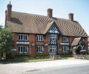
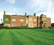
De Vere Cranage Estate PH Hotels
Moss Wood
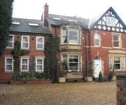
The Sandhurst
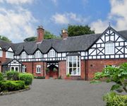
Chimney House Hotel & Restaurant
Bridge Farm Bed & Breakfast
TRAVELODGE MIDDLEWICH
Videos from this area
These are videos related to the place based on their proximity to this place.
A50 - Holmes Chapel to Knutsford - Front View with Rearview Mirror
The A50 runs from Leicester to Warrington, but originally ran to Hockliffe just north west of Luton. Between Stoke-on-Trent and the M1 near Nottingham, the A50 is a major dual carriageway,...
A50 - Arclid to Holmes Chapel - Front View with Rearview Mirror
The A50 runs from Leicester to Warrington, but originally ran to Hockliffe just north west of Luton. Between Stoke-on-Trent and the M1 near Nottingham, the A50 is a major dual carriageway,...
Driving On The M6 Motorway From J18 Middlewich To J17 Sandbach, Cheshire East, England
Driving on the M6 motorway from junction 18 (A54 Northwich Chester Middlewich Holmes Chapel) to junction 17 (A534 Congleton Sandbach), Cheshire East, England Videoed on Thursday, 5th April...
Danny's Stag Part One - Extreme Delta Force Paintball June 2012
Danny's Stag, Paintballing in Cheshire, Great day, plenty of Funny moments, Pure carnage, Head mount view/Static, Plenty of Head shots, Plenty of Mud Sorry Danny!!!
Driving On The M6 Motorway From J8 West Bromwich To J21A Warrington, Cheshire, England
Driving northbound on the M6 motorway from junction 8 (West Midlands M5 Interchange) to junction 21A (M62 Liverpool Warrington North Southport M57), Warrington, Cheshire, England Videoed on...
Driving On The M6 Motorway From J16 Crewe To J17 Sandbach, Cheshire East, England 14th April 2012
Driving at night on the M6 motorway from junction16 (A500 Nantwich Crewe) to junction 17 (A534 Congleton Sandbach), Cheshire East, England Videoed on Saturday,14th April 2012 Playlist: ...
Delta Force paintball zuluwood GoPro
Paintball using GoPro chest mount in next videos I use the head mount.
Videos provided by Youtube are under the copyright of their owners.
Attractions and noteworthy things
Distances are based on the centre of the city/town and sightseeing location. This list contains brief abstracts about monuments, holiday activities, national parcs, museums, organisations and more from the area as well as interesting facts about the region itself. Where available, you'll find the corresponding homepage. Otherwise the related wikipedia article.
St Luke's Church, Goostrey
St Luke's Church, Goostrey is in the village of Goostrey, Cheshire, England. It is designated by English Heritage as a Grade II* listed building. It is an active Anglican parish church in the diocese of Chester, the archdeaconry of Macclesfield and the deanery of Congleton. Its benefice is combined with that of St Peter, Swettenham.
Goostrey Primary School
Goostrey School is a Community Primary school situated in the centre of the village of Goostrey at the heart of rural Cheshire, England. Across from St Luke's Church, Goostrey is Goostrey Primary School which was originally a Church of England School. The earliest reference to a school in the Church records is in 1640 when it was repaired. It was then next to the north wall of the churchyard where the old vicarage now stands, in a house which was also used as the court house for Goostrey Manor.
Holmes Chapel railway station
Holmes Chapel railway station serves the town of Holmes Chapel in Cheshire, England. The station is 8½ miles (14 km) north east of Crewe on the Crewe to Manchester Line.
Sproston
Sproston is a village and civil parish in the unitary authority of Cheshire West and Chester and the ceremonial county of county of Cheshire, in the north west of England, approximately 2 miles east of Middlewich. Sproston is on the A54 road between Middlewich and Junction 18 of the M6 Motorway.
St Luke's Church, Holmes Chapel
St Luke's Church, Holmes Chapel is in the village of Holmes Chapel, Cheshire, England on the A50 road at its junction with the A535 road. The church is designated by English Heritage as a Grade I listed building. It is an active Anglican parish church in the diocese of Chester, the archdeaconry of Macclesfield and the deanery of Congleton.
A535 road
The A535 road is a non-primary route in England that runs from Holmes Chapel, Cheshire to Alderley Edge, Cheshire. It passes through the Dane River valley. It is the main road that gives access to the Jodrell Bank Observatory and the Quinta Arboretum, planted by Sir Bernard Lovell in 1948.
Cranage Hall
Cranage Hall is a former country house in the village of Cranage, Cheshire, England. It was built in 1828–29 for Lawrence Armitstead, and designed by Lewis Wyatt. In 1932 a parallel wing was added. Since the hospital closed, it has been used as a hotel and conference centre owned and run by the Principal Hayley hotel group. The building is constructed in red brick with blue brick diapering, and in yellow sandstone. It is roofed in slate. The architectural style is Elizabethan.
Twemlow Hall
Twemlow Hall is a country house standing on a former moated site in the parish of Twemlow, Cheshire, England. It dates from the 17th century, and was "much altered" in 1810 for William Bache Booth. It was altered again in 1974. The house is constructed in brick on a stone plinth. It has flush stone quoins and a slate roof. It has two storeys, and a symmetrical entrance front of five bays, three of which are gabled. Above the doorway are the arms of the Booth family. The windows are sashes.


