Safety Score: 3,0 of 5.0 based on data from 9 authorites. Meaning we advice caution when travelling to United Kingdom.
Travel warnings are updated daily. Source: Travel Warning United Kingdom. Last Update: 2024-04-28 08:22:10
Delve into Wilburton
Wilburton in Cambridgeshire (England) with it's 1,013 habitants is located in United Kingdom about 60 mi (or 96 km) north of London, the country's capital town.
Current time in Wilburton is now 10:25 PM (Sunday). The local timezone is named Europe / London with an UTC offset of one hour. We know of 10 airports close to Wilburton, of which 5 are larger airports. The closest airport in United Kingdom is Cambridge Airport in a distance of 10 mi (or 16 km), South. Besides the airports, there are other travel options available (check left side).
There are several Unesco world heritage sites nearby. The closest heritage site in United Kingdom is Blenheim Palace in a distance of 49 mi (or 79 km), South-West. Also, if you like playing golf, there are some options within driving distance. If you need a hotel, we compiled a list of available hotels close to the map centre further down the page.
While being here, you might want to pay a visit to some of the following locations: Cambridge, Fulbourn, Grantchester, Barton and Linton. To further explore this place, just scroll down and browse the available info.
Local weather forecast
Todays Local Weather Conditions & Forecast: 8°C / 46 °F
| Morning Temperature | 8°C / 47 °F |
| Evening Temperature | 9°C / 49 °F |
| Night Temperature | 5°C / 42 °F |
| Chance of rainfall | 7% |
| Air Humidity | 75% |
| Air Pressure | 1001 hPa |
| Wind Speed | Moderate breeze with 12 km/h (8 mph) from East |
| Cloud Conditions | Overcast clouds, covering 90% of sky |
| General Conditions | Moderate rain |
Monday, 29th of April 2024
13°C (56 °F)
8°C (47 °F)
Overcast clouds, fresh breeze.
Tuesday, 30th of April 2024
11°C (52 °F)
9°C (48 °F)
Moderate rain, moderate breeze, overcast clouds.
Wednesday, 1st of May 2024
16°C (60 °F)
12°C (54 °F)
Light rain, gentle breeze, overcast clouds.
Hotels and Places to Stay
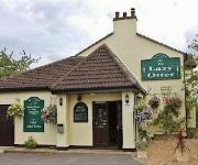
The Lazy Otter
The Hayloft
Anchor Inn
The Nyton
Poets House
The Village Inn
The Brambles B&B
Lamb Hotel
TRAVELODGE ELY
Videos from this area
These are videos related to the place based on their proximity to this place.
Time Lapse Grey's of Ely Vinyls 720p
Our Time Lapse of one of our new coaches getting its vinyl branding applied, what took hours is seen in just 2 minutes!
Cambridge Coach Hire Company - Grey's of Ely
Our informercial about Grey's of Ely shows you what sets us apart if you need Coach Hire in Cambridge, with our range of high quality coaches and unique customer orientated features.
Grey's of Ely - A unique way of inspecting coaches!
Grey's of Ely have a unique way of checking their coaches, no job is to big or small! Part of a trilogy of short fun videos, to celebrate the launch of our new website.
Grey's of Ely - Keeping our Coaches secure!
Grey's of Ely's unique way of making sure their coaches get put away after a days hire!
Windmills of Cambridgeshire: Stretham Windmill
This video documents the windmill in the lovely village of Stretham in Cambridgeshire. Me and my sister have had a lifelong interest in tall and interesting buildings such as windmills, and...
Gog Magog Molly at The Lazy Otter 2008
Gog Magog Molly dance at The Lazy Otter 2008 as part of the Ouse Washes Winter Day of Dance.
Marshall Threshing Machine & Baler Working at Haddenham Steam Rally 2011
Photos of this event can be found here: http://rhobbs.co.uk/at3 A vintage Marshall threshing machine and Baler powered by a steam traction engine at a working demonstration at Haddenham Steam...
Threshing Machine at Haddenham Steam Rally 2009
Photos of the event can be found here: http://rhobbs.co.uk/8lp Threshing machine powered by a steam traction engine at Haddenham Steam Rally 2009.
Haddenham Steam Rally 2013
Photos of the event can be found here: http://rhobbs.co.uk/csv A video of Haddenham Steam Rally 2013, including traction engines, steam rollers, threshing machine & baler, a ride to the pub...
Videos provided by Youtube are under the copyright of their owners.
Attractions and noteworthy things
Distances are based on the centre of the city/town and sightseeing location. This list contains brief abstracts about monuments, holiday activities, national parcs, museums, organisations and more from the area as well as interesting facts about the region itself. Where available, you'll find the corresponding homepage. Otherwise the related wikipedia article.
North Witchford Rural District
North Witchford was a rural district in England from 1894 to 1974. It was named after the ancient hundred of North Witchford. It was formed in 1894 under the Local Government Act 1894 based on the North Witchford rural sanitary district. It covered the parishes of Benwick, Doddington, Manea, Welches Dam and Wimblington. From 1894 to 1965 it was part of the administrative county of the Isle of Ely, and then Cambridgeshire and Isle of Ely.
Mereham
Mereham is a potential new town near Ely in East Cambridgeshire. The developer, Multiplex Stannifer, has applied for planning permission but has not yet received it. The application for planning permission was turned down by East Cambridgeshire District Council but the developers have appealed to the Planning Inspectorate and the decision has been called in by the Secretary of State. The inquiry closed, after a number of adjournments on 8 January 2008.
Doghouse Grove
Doghouse Grove is managed as a nature reserve by the Wildlife Trust for Bedfordshire, Cambridgeshire, Northamptonshire and Peterborough. It lies south of the village of Wilburton in the county of Cambridgeshire.
Wentworth, Cambridgeshire
Wentworth is a small village near Ely in Cambridgeshire, England.
Witchford
Witchford /ˈwɪtʃfɔrd/ is a small village near Ely in Cambridgeshire, England with a 2011 population of 2,385. Witchford houses the secondary school Witchford Village College that serves all of the surrounding villages, including Haddenham, Little Thetford, Mepal, Stretham, Sutton, Wilburton and Witcham. The village hosts the Grunty Fen Half Marathon road race, which has been staged annually in the village since 1991.
Huntingdonshire Football Association
The Huntingdonshire Football Association, also simply known as the Huntingdonshire FA, is the governing body of football in Huntingdonshire.
Grunty Fen
Grunty Fen was a former parish in Cambridgeshire, England, four miles south west of Ely. It was amalgamated with Wilburton parish in 1933.
A1421 road
The A1421 is a short 'A' road in the English county of Suffolk It links Haddenham (and the A1123, which it meets there) with the A142 near Sutton, which leads to Ely, Cambridgeshire.


