Safety Score: 3,0 of 5.0 based on data from 9 authorites. Meaning we advice caution when travelling to United Kingdom.
Travel warnings are updated daily. Source: Travel Warning United Kingdom. Last Update: 2024-05-08 08:04:21
Delve into Purls Bridge
The district Purls Bridge of in Cambridgeshire (England) is a subburb in United Kingdom about 67 mi north of London, the country's capital town.
If you need a hotel, we compiled a list of available hotels close to the map centre further down the page.
While being here, you might want to pay a visit to some of the following locations: Cambridge, Fulbourn, Grantchester, Barton and Thorney. To further explore this place, just scroll down and browse the available info.
Local weather forecast
Todays Local Weather Conditions & Forecast: 18°C / 64 °F
| Morning Temperature | 7°C / 45 °F |
| Evening Temperature | 18°C / 65 °F |
| Night Temperature | 10°C / 51 °F |
| Chance of rainfall | 0% |
| Air Humidity | 60% |
| Air Pressure | 1029 hPa |
| Wind Speed | Gentle Breeze with 6 km/h (4 mph) from North |
| Cloud Conditions | Scattered clouds, covering 44% of sky |
| General Conditions | Scattered clouds |
Thursday, 9th of May 2024
19°C (66 °F)
13°C (56 °F)
Light rain, gentle breeze, scattered clouds.
Friday, 10th of May 2024
19°C (65 °F)
12°C (53 °F)
Overcast clouds, gentle breeze.
Saturday, 11th of May 2024
20°C (68 °F)
13°C (55 °F)
Light rain, gentle breeze, overcast clouds.
Hotels and Places to Stay
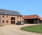
Kings Barn Farmhouse Bed & Breakfast
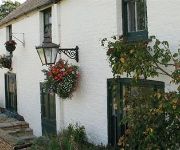
Anchor Inn
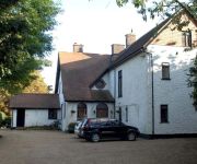
The Nyton
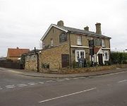
The Village Inn
VS King William
Oliver Cromwell
TRAVELODGE ELY
Videos from this area
These are videos related to the place based on their proximity to this place.
Time Lapse Grey's of Ely Vinyls 720p
Our Time Lapse of one of our new coaches getting its vinyl branding applied, what took hours is seen in just 2 minutes!
Cambridge Coach Hire Company - Grey's of Ely
Our informercial about Grey's of Ely shows you what sets us apart if you need Coach Hire in Cambridge, with our range of high quality coaches and unique customer orientated features.
Grey's of Ely - A unique way of inspecting coaches!
Grey's of Ely have a unique way of checking their coaches, no job is to big or small! Part of a trilogy of short fun videos, to celebrate the launch of our new website.
Grey's of Ely - Keeping our Coaches secure!
Grey's of Ely's unique way of making sure their coaches get put away after a days hire!
Norwich Kitwiches - Ouse Washes 2008
Norwich Kitwiches with one of the weirdest dances I've ever seen - I think they all go into a trance during this dance! Outside the Plough at Little Downham. Ouse Washes 2008.
F-15mx Tracks - Stop Mepal Motocross Track Closure Petition Please Sign
F-15mx Tracks - Mepal Track Petition. Please sign! http://www.change.org/petitions/fenland-district-council-cambs-county-council-support-mepal-motocross-track-planning-application They are...
Motion MX 2014
Motion Motocross. The Ultra Slow Motion Edition- EASSC RND1 2014. Film and Edit By Jason Kirby. Facts about Motocross From Wikipedia: Did you know that Motocross first evolved in the United...
Ian Ashmeade Knocks out 4 times world champion George Hollis
July 2009 Ian Ashmeade Knocks out 4 times World Pea Shoting Champion George Hollis, only to get beaten in the final round by Jim Collins.
Windmills of Cambridgeshire: Pymore Windmill
This video documents the windmill in the tiny village of Pymore in Cambridgeshire (sometimes spelt Pymoor). Me and my sister have had a lifelong interest in tall and interesting buildings such...
Angry Ground
Watch this with the sound turned up!!! One fine day..... (Well not a fine day because it had rained for about 24 hours and everywhere there was water...... ) in a field somewhere near Little...
Videos provided by Youtube are under the copyright of their owners.
Attractions and noteworthy things
Distances are based on the centre of the city/town and sightseeing location. This list contains brief abstracts about monuments, holiday activities, national parcs, museums, organisations and more from the area as well as interesting facts about the region itself. Where available, you'll find the corresponding homepage. Otherwise the related wikipedia article.
Isle of Ely
The Isle of Ely is a historic region around the city of Ely now in Cambridgeshire, England but previously a county in its own right.
North West Cambridgeshire (UK Parliament constituency)
North West Cambridgeshire is a county constituency represented in the House of Commons of the Parliament of the United Kingdom. It elects one Member of Parliament (MP) by the first past the post system of election.
The King's School, Ely
King's Ely, which was renamed from The King's School in March 2012, is a coeducational independent day and boarding school in the cathedral city of Ely, Cambridgeshire, England. It was founded in 970 A.D. , making it one of the oldest schools in the world, though it was given its Royal Charter by King Henry VIII in 1541. The school consists of a nursery, a reception class, junior school, senior school, and an international school.
Stanground North
Stanground North was a civil parish in the City of Peterborough, England. The 2001 census recorded a population of zero. The parish, which covered open fields on a flood plain of the River Ouse, has since been abolished as redundant. The parish was originally created in 1905, when Stanground parish was divided into two, having hitherto been the only parish to still cross a county border.
Ely Rural District
Ely was a rural district in England from 1894 to 1974. It was named after Ely, and surrounded it to the west and north. The district was created in 1894 under the Local Government Act 1894 from the Ely rural sanitary district. It formed part of the administrative county of the Isle of Ely from 1894 to 1965, when this was merged into Cambridgeshire and Isle of Ely. In 1974 it was abolished, and its area made part of the new East Cambridgeshire district of Cambridgeshire.
North Witchford Rural District
North Witchford was a rural district in England from 1894 to 1974. It was named after the ancient hundred of North Witchford. It was formed in 1894 under the Local Government Act 1894 based on the North Witchford rural sanitary district. It covered the parishes of Benwick, Doddington, Manea, Welches Dam and Wimblington. From 1894 to 1965 it was part of the administrative county of the Isle of Ely, and then Cambridgeshire and Isle of Ely.
Ely City F.C
Ely City F.C. is an English football club based in Ely, Cambridgeshire. The club are currently members of the Eastern Counties League Premier Division and play at the Unwin Sports Ground.
Manea railway station
Manea railway station, on the line between Peterborough and Ely, serves the village of Manea in Cambridgeshire, England. It was proposed for closure under the Beeching report of 1963 but was reprieved due to "the acute social hardship this would cause".
Stonea Camp
Stonea Camp is an Iron Age hill fort located near March in the Cambridgeshire Fens. Situated on a gravel bank just 2 metres above sea-level, it is the lowest hill fort in Britain. Around 500 BC, when fortification is thought to have begun at this site, this "hill" would have provided a significant area of habitable land amidst the flooded marshes of the fens.
A1101 road
The A1101 is the lowest road in Great Britain; along its 53 miles approx. stretch it rarely rises above sea level. The road runs from Bury St. Edmunds north west to Littleport where it disappears for approximately 2 miles, it then re-appears on the other side of the A10 heading north through Wisbech and to its end at the A17 in Long Sutton. The A1101's route takes it across the Fens in Lincolnshire and Norfolk, a famously low lying area to Suffolk through Cambridgeshire.
Chettisham Meadow
Chettisham Meadow is a Site of Special Scientific Interest managed as a nature reserve by the Wildlife Trust for Bedfordshire, Cambridgeshire, Northamptonshire and Peterborough. It is located north of Ely and west of the village of Chettisham in the county of Cambridgeshire. In January 2009 an appeal by the Wildlife Trust to buy Chettisham Meadow reached its target; it had managed the site as a tenant since 1972.
Wimblington railway station
Wimblington railway station was a station in the village of Wimblington, Cambridgeshire. It was closed in 1967 as part of the Beeching Axe. The station was demolished in the early 1970s and the site used for the construction of the new alignment of the A141 road. Preceding station Disused railways Following station Chatteris GN and GE Joint Railway March
Black Bank railway station
Black Bank railway station was a railway station in Black Bank, Cambridgeshire which is now closed. The station platforms have been demolished but the goods shed still stands and remains in use. Although the station is closed, the line is still in use. Former Services Preceding station Historical railways Following station Manea Great Eastern Railway Chettisham
Stonea railway station
Stonea railway station is a former railway station serving the small village of Stonea, Cambridgeshire. Although the station closed in 1966, the line is still in use. Preceding station Historical railways Following station March Great Eastern Railway Manea
Wentworth, Cambridgeshire
Wentworth is a small village near Ely in Cambridgeshire, England.
Witchford
Witchford /ˈwɪtʃfɔrd/ is a small village near Ely in Cambridgeshire, England with a 2011 population of 2,385. Witchford houses the secondary school Witchford Village College that serves all of the surrounding villages, including Haddenham, Little Thetford, Mepal, Stretham, Sutton, Wilburton and Witcham. The village hosts the Grunty Fen Half Marathon road race, which has been staged annually in the village since 1991.
Dunhams Wood
Dunhams Wood is a privately owned broadleaved woodland that is occasionally open to the public. The area was planted over a period of 6 years starting in 1985. It is located approximately 2 miles outside of March, Cambridgeshire in Fenland. The area is owned by Margaret and Arthur Dunham, who open the woodlands to the public during the summer. Treasure hunts and other games take place within the wood. A major feature of the wood is the Dunhams Wood Railway.
Sawtry Abbey
Sawtry Abbey was a Cistercian abbey located between Sawtry and Woodwalton in Cambridgeshire, England. The abbey was founded in 1147 by Simon I de Senlis, Earl of Northampton, who was the grandson of Earl Waltheof and Judith, the niece of William the Conqueror who held the manor when the Domesday Survey was compiled. A colony of monks from Wardon Abbey in Bedfordshire joined the new monastery, which was founded as an independent abbey.
Grunty Fen
Grunty Fen was a former parish in Cambridgeshire, England, four miles south west of Ely. It was amalgamated with Wilburton parish in 1933.
Welches Dam
Welches Dam is a parish in Cambridgeshire around 5 miles to the north west of Ely. It covers an area of 2,355 acres . The parish of Welches Dam is surrounded by those of Coveney, Manea, Mepal, and Witcham. The civil parish was divided between Chatteris and Manea in 1960.
Oliver Cromwell's House
Oliver Cromwell's House is a house in Ely, Cambridgeshire, England. This was the family home of Oliver Cromwell. The kitchen dates from around 1215, other parts being built later. In 1988, it was bought by the local council, and has been refurbished to show how it may have looked during Cromwell's lifetime. The house, which has eight period rooms, is promoted by the Campaign to Protect Rural England.
Euximoor
Euximoor is a village in Cambridgeshire, England.
Stonea
Stonea is a village in Cambridgeshire, England.
RAF Witchford
Royal Air Force Station Witchford or RAF Witchford is a former Royal Air Force station located 1.8 miles south west of Ely, Cambridgeshire, England and 13 miles north of Cambridge, Cambridgeshire.
A1421 road
The A1421 is a short 'A' road in the English county of Suffolk It links Haddenham (and the A1123, which it meets there) with the A142 near Sutton, which leads to Ely, Cambridgeshire.


