Safety Score: 3,0 of 5.0 based on data from 9 authorites. Meaning we advice caution when travelling to United Kingdom.
Travel warnings are updated daily. Source: Travel Warning United Kingdom. Last Update: 2024-04-27 08:23:39
Delve into Llandwrog
Llandwrog in Gwynedd (Wales) is located in United Kingdom about 208 mi (or 334 km) north-west of London, the country's capital town.
Current time in Llandwrog is now 09:31 AM (Saturday). The local timezone is named Europe / London with an UTC offset of one hour. We know of 12 airports close to Llandwrog, of which 5 are larger airports. The closest airport in United Kingdom is Anglesey Airport in a distance of 15 mi (or 24 km), North-West. Besides the airports, there are other travel options available (check left side).
There are several Unesco world heritage sites nearby. The closest heritage site in United Kingdom is Castles and Town Walls of King Edward in Gwynedd in a distance of 25 mi (or 40 km), East. Also, if you like playing golf, there are some options within driving distance. We encountered 1 points of interest near this location. If you need a hotel, we compiled a list of available hotels close to the map centre further down the page.
While being here, you might want to pay a visit to some of the following locations: Llanwnda, Caernarfon, Llangefni, Llanberis and Pwllheli. To further explore this place, just scroll down and browse the available info.
Local weather forecast
Todays Local Weather Conditions & Forecast: 10°C / 50 °F
| Morning Temperature | 4°C / 40 °F |
| Evening Temperature | 9°C / 48 °F |
| Night Temperature | 5°C / 42 °F |
| Chance of rainfall | 0% |
| Air Humidity | 63% |
| Air Pressure | 1006 hPa |
| Wind Speed | Moderate breeze with 9 km/h (6 mph) from South-West |
| Cloud Conditions | Overcast clouds, covering 100% of sky |
| General Conditions | Overcast clouds |
Sunday, 28th of April 2024
11°C (51 °F)
6°C (43 °F)
Overcast clouds, moderate breeze.
Monday, 29th of April 2024
13°C (55 °F)
9°C (48 °F)
Light rain, fresh breeze, overcast clouds.
Tuesday, 30th of April 2024
11°C (51 °F)
10°C (50 °F)
Light rain, fresh breeze, overcast clouds.
Hotels and Places to Stay
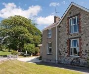
Plas Dinas Country House
Dinas Farm
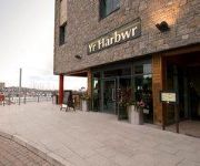
Celtic Royal
TRAVELODGE CAERNARFON
Caernarfon
Videos from this area
These are videos related to the place based on their proximity to this place.
GAS IT European Fill point Adaptors
When traveling in other countries outside the UK with a GAS IT Autogas tank on your Motorhome or Caravan, or even Autogas converted Car, you will need to use a European Fillpoint adaptor to...
Hobbyking Laser 230 Quadcopter
First video footage of my newly built quad, only hovering while on holiday, need to lower the PID's and the fpv range isn't brilliant yet only about 300m, ill try and push it a bit more next...
Welsh Highland Railway Super Power Weekend 2010
11th September 2010. Maximum Power with the Garratt!
Walking South of Caernarfon: Foyrd & Llanfaglan
A timelapse style walk along a footpath across the fields from Foryd Bay nature reserve through the hamlet of Llanfaglan finishing by Lon Eifion to the west of Bontnewydd.
Dinas Dinlle, Beach & Iron Age Fort
This is a video about the beach in North Wales, Dinas Dinlle. Talking about the iron age fort which looks over the beach and just give you a feel for the beach. great places for familys and...
Glandwyfach, Bryncir, Llanllyfni, Penygroes - Walia ( Cymru )
Utworzyłem ten film w narzędziu do tworzenia pokazu slajdów YouTube (http://www.youtube.com/upload)
Ymgymerwr Angladdau -- Iolo Owen
Cyfarwyddwyr Angladdau sydd wedi ei leoli yn Benygroes,Caernarfon, Gwynedd. Funeral Directors based in Penygroes, Nr Caernerfon, Gwynedd. North Wales.
Videos provided by Youtube are under the copyright of their owners.
Attractions and noteworthy things
Distances are based on the centre of the city/town and sightseeing location. This list contains brief abstracts about monuments, holiday activities, national parcs, museums, organisations and more from the area as well as interesting facts about the region itself. Where available, you'll find the corresponding homepage. Otherwise the related wikipedia article.
A499 road
The A499 road is the major road of the Llŷn peninsula in North Wales. Its northern terminus is a roundabout with the A487 trunk road between Llanwnda and Llandwrog . It then runs south-westerly along the northern coast of the peninsula, through Clynnog Fawr then turns inland crossing the peninsula to meet the southern coast at Pwllheli, it then follows that southern coast to terminate at Abersoch . The total length is 23.4 miles.
Groeslon
Groeslon is a small village in the community of Llandwrog in the Welsh traditional county of Caernarfonshire. Groeslon is administered by Gwynedd Council. Nearby villages are Penygroes, Carmel and Dinas. The village lies approximately five miles south of Caernarfon. It has one primary school in the centre of the village and no secondary schools. Most secondary school age pupils go to Ysgol Dyffryn Nantlle in Penygroes.
Groeslon railway station
Groeslon was a railway station located in Groeslon, Gwynedd. This station was closed in December 1964.
Llanwnda railway station
Llanwnda was a railway station located in Llanwnda, Gwynedd. This station was closed in December 1964. Following the building of the Penygroes By-pass in 1999/2000, the site of the station has been obliterated by a roundabout where the A487 and A499 meet.
Llandwrog
Llandwrog is a village and community in Gwynedd, north-west Wales, most notable for the presence of the headquarters of Welsh record label Sain and the site of Caernarfon Airport. It has a population of 2,466. It was the base of the first ever Sea and Mountain Rescue team, and includes the estate of Glynllifon. RAF Llandwrog was a training airfield during World War II, and was later used as a weapons storage facility.
Glynllifon
Glynllifon is the name of the old estate which belonged to the Lords Newborough, near the village of Llandwrog on the main A499 road between Pwllheli and Caernarfon in Gwynedd, Wales The original mansion is now a privately owned Country House hotel and wedding venue The greater part of the original park, Parc Glynllifon, now includes an agricultural college, craft workshops and many educational facilities.
RAF Llandwrog
RAF Llandwrog was opened in January 1941 as a RAF Bomber Command airfield for training gunners, radio operators and navigators. It was located at Llandwrog, 4 nautical miles (7.4 km) southwest of Caernarfon, Gwynedd, Wales, and it remains in civil operation today as Caernarfon Airport.
Foryd Bay
Foryd Bay (Welsh: Y Foryd or Bae'r Foryd) is a tidal bay in Gwynedd, Wales. It is located at the south-western end of the Menai Straits, about two miles south-west of Caernarfon. Several rivers flow into the bay and there are large areas of mudflats and salt marsh. A shingle spit partly blocks the mouth of the bay. At the north-western end is Fort Belan, built during the 18th century.


