Safety Score: 3,0 of 5.0 based on data from 9 authorites. Meaning we advice caution when travelling to United Kingdom.
Travel warnings are updated daily. Source: Travel Warning United Kingdom. Last Update: 2024-05-01 08:01:32
Delve into Rumney
The district Rumney of Saint Mellons in Cardiff (Wales) is a subburb in United Kingdom about 129 mi west of London, the country's capital town.
If you need a hotel, we compiled a list of available hotels close to the map centre further down the page.
While being here, you might want to pay a visit to some of the following locations: Marshfield, Cardiff, Crosskeys, Newport and Newbridge. To further explore this place, just scroll down and browse the available info.
Local weather forecast
Todays Local Weather Conditions & Forecast: 11°C / 51 °F
| Morning Temperature | 11°C / 51 °F |
| Evening Temperature | 10°C / 49 °F |
| Night Temperature | 9°C / 48 °F |
| Chance of rainfall | 14% |
| Air Humidity | 95% |
| Air Pressure | 1003 hPa |
| Wind Speed | Moderate breeze with 13 km/h (8 mph) from East |
| Cloud Conditions | Overcast clouds, covering 100% of sky |
| General Conditions | Moderate rain |
Friday, 3rd of May 2024
9°C (49 °F)
9°C (47 °F)
Moderate rain, moderate breeze, overcast clouds.
Saturday, 4th of May 2024
12°C (53 °F)
9°C (49 °F)
Broken clouds, gentle breeze.
Sunday, 5th of May 2024
12°C (54 °F)
11°C (52 °F)
Light rain, gentle breeze, broken clouds.
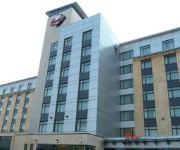
Hotels and Places to Stay
Hilton Cardiff
Future Inn Cardiff Bay
Radisson Blu Cardiff
Park Plaza Cardiff
Novotel Cardiff Centre
Mercure Cardiff Holland House Hotel and Spa
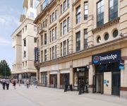
TRAVELODGE CARDIFF CENTRAL QUEEN STREET
TRAVELODGE CARDIFF ATLANTIC WHARF
Park Inn By Radisson Cardiff City Centre
Jurys Inn Cardiff
Videos from this area
These are videos related to the place based on their proximity to this place.
Sponsored charity walk from Cardiff Castle to the Bettws Rugby Club in Newport - Part 1
Paul Murphy and Ray Cripps arrange a sponsored charity walk from Cardiff Castle to the Bettws Rugby Club in Newport, a distance of about 15+ miles in aid of the Lymphoma Charity Association...
Best Fish and Chips Cardiff
Frydays Fish and Chip Emporium The best fish and chips in Cardiff Multi-Award winning fish and chip shop in old St Mellons, Cardiff www.bnestfishandchipscardiff.com.
Forza Horizon 2 - Custom Show Cars #3 - Chevy Bel Air (V8 Swap)
songs in my Vids:https://www.youtube.com/results?search_query=ncs Comment, like and subscribe thanks!! Twitch: http://www.twitch.tv/wruchamps/profile Overclockers: http://www.overclockers.co.uk/...
Kayak theft in Cardiff.avi
Dick head steeling kayak in Cardiff and getting caught on CCTV, Money shot of dick at 2.50mins and 8.35mins.
Honey Bee King 3
Yet another day of rain so got out the king 3, not much room to fly only 5ftx5ft, come on rain go away i wont to get outside and fly.
Beacon Family Festival -St Mellons, Cardiff
Beacon Family festival 2010 filmed on Pastors Steve's iphone!
Videos provided by Youtube are under the copyright of their owners.
Attractions and noteworthy things
Distances are based on the centre of the city/town and sightseeing location. This list contains brief abstracts about monuments, holiday activities, national parcs, museums, organisations and more from the area as well as interesting facts about the region itself. Where available, you'll find the corresponding homepage. Otherwise the related wikipedia article.
Willows High School
Willows High School (Welsh: Ysgol Uwchradd Willows) is a secondary school located in the Tremorfa area of Cardiff, Wales. It's an English medium community school which caters for children aged 11 to 16. As of September 2011, the New Headmaster is Joy Ballard. There were 863 pupils at the school during the 2006 Estyn inspection, with 25% coming from ethnic minority backgrounds. 18% of the pupils came from homes where neither English nor Welsh was the first language spoken.
Tremorfa
Tremorfa (English: Tremorfa) is a district of the city of Cardiff, Wales. It falls into the Splott ward of Cardiff. The 2011 UK Census classed the area as "Economically deprived", with 91% of residents claiming unemployment or disability benefithttp://neighbourhood. statistics. gov. uk/dissemination/LeadTableView. do?a=7&b=6275349&c=CF24+2SR&e=14&g=6498107&i=1001x1012x1013x1003x1004&j=6317216&m=1&p=-1&q=1&r=0&s=1364906068469&enc=1&dsFamilyId=1380.
Llanrumney
Llanrumney is a district and suburb in the east of Cardiff, the capital city of Wales.
Trowbridge, Cardiff
Trowbridge is an electoral ward in the east of the city of Cardiff, capital of Wales. The ward includes some or all of the areas of Cefn Mably, St Mellons estate and Trowbridge in the parliamentary constituency of Cardiff South & Penarth. It is bounded by Pontprennau & Old St. Mellons to the north west; Marshfield to the east; and Splott and Rumney to the west. Until 1938, the area was part of the civil parish of Rumney, in the former county of Monmouthshire.
St Mellons
St Mellons is a district and suburb of eastern Cardiff, the capital city of Wales. Previously located in Monmouthshire, St Mellons became part of South Glamorgan and Cardiff in 1974. It consists of Old St Mellons and a newer, much larger area of modern housing and business parks.
Llanedeyrn
Llanedeyrn is a district in the east of the city of Cardiff, Wales, located around 3.5 miles from the city centre.
Cardiff Central (UK Parliament constituency)
Cardiff Central (Caerdydd Canolog in Welsh) is a borough constituency in the city of Cardiff. It returns one Member of Parliament (MP) to the House of Commons of the Parliament of the United Kingdom, elected by the first past the post system.
Rhymney River
The Rhymney River is a river in the Rhymney Valley, south-east Wales, flowing through Cardiff into the Severn estuary. The river forms the boundary between the historic counties of Glamorgan and Monmouthshire.
Penylan
Penylan is a district in the east of Cardiff, the capital city of Wales, known for its Victorian era period houses and spacious tree lined roads and avenues. Situated to both the north and south of the A48 dual carriageway, it is one of the most affluent districts of Cardiff, although subdivision of the large Victorian period properties is starting to occur in the areas at the south end of the ward, mimicking the trend in neighbouring Plasnewydd.
Rumney, Cardiff
Rumney is a district in the east of the city of Cardiff, Wales. It lies east of the Rhymney River, and is historically part of Monmouthshire. On 1 April 1938 the Cardiff Extension Act 1937 incorporated it into the county borough of Cardiff, and thus it became associated with the geographical county of Glamorgan. This is a predominately residential area with a variety of social and private housing.
Coleg Glan Hafren
Coleg Glan Hafren was a Further Education college based in Cardiff which merged with Barry College in September 2011 to form the new Cardiff and Vale College.
St Teilo's Church in Wales High School
St Teilo's Church in Wales High School (Welsh: Ysgol Uwchradd yr Eglwys yng Nghymru Teilo Sant) was opened in September 1966 as an 11-16 school and provides a church school comprehensive education for secondary students living mainly in the eastern half of Cardiff. It is now one of three Voluntary Aided Secondary Schools in the Diocese of Llandaff and serves a much wider geographical and spiritual 'catchment' area; many students come from the Diocese of Monmouth and as far away as Caerphilly.
Cardiff Gate services
Cardiff Gate services is the motorway service station on the junction of the M4 motorway (junction 30) and the A4232, located on the 100-acre Cardiff Gate International Business Park, adjacent to Pontprennau, north east of Cardiff, Wales.
St Mellons Rural District
St Mellons Rural District is a defunct district council. It was established under the provisions of the Local Government Act 1894 from part of the existing Newport Rural Sanitary District. It comprised the parishes of Bedwas, Bettws, Coedkernew, Duffryn, Graig, Henllys, Machen Lower, Machen Upper, Malpas, Marshfield, Michaelstone-y-Fedw, Peterstone Wentloog, Rogerstone, Rumney, St Brides Wentloog, St Mellons and St Woolos in the administrative county of Monmouthshire.
Cardiff Central (Assembly constituency)
Cardiff Central is a constituency of the National Assembly for Wales. It elects one Assembly Member by the first past the post method of election. Also, however, it is one of eight constituencies in the South Wales Central electoral region, which elects four additional members, in addition to eight constituency members, to produce a degree of proportional representation for the region as a whole.
Pentwyn, Cardiff
Pentwyn is a district in the east of Cardiff, Wales, located northeast of the city centre.
National Indoor Athletics Centre
The National Indoor Athletics Centre is an indoor track and field athletics sports venue in the Cyncoed area of Cardiff, capital of Wales. It is sited on the Cardiff Metropolitan University Campus and is one of the main facilities used by Welsh Athletics, which organises the Cardiff branch of the Athletics Development Centre at the National Indoor Athletics Centre.
A4161 road
The A4161 is a main road in Cardiff, Wales, United Kingdom. The road links Cardiff city centre with Ely and the M4 motorway (Junction 33) via the A48 and the A4232 to the west and Cardiff city centre with Rumney and the A48(M) motorway via the A4232 and the A48 to the east.
Cardiff Gate
Cardiff Gate is a business park development, located on the junction 30 of the M4 motorway and the A4232 north east of Cardiff, South Wales.
Cardiff United Synagogue
The Cardiff United Synagogue is the Orthodox Jewish congregation of Cardiff, the capital city of Wales.
Welsh Refugee Council
The Welsh Refugee Council is a sister organisation to the Refugee Council and Scottish Refugee Council, and works to help asylum seekers and refugees in Wales.
Cardiff East (geographical area)
Cardiff East or East Cardiff can refer to the collection of communities in the east of Cardiff, Wales. Although the usage is unofficial and boundaries are only ambiguously defined, they generally share the postcodes CF3, CF23 or CF24, and the telephone code 029. Unlike Cardiff North, Cardiff South and Cardiff West, it is not a political constituency. Cardiff East is covered by the Cardiff North and South constituencies.
Rumney High School
Rumney High School is an English medium co-educational, community school in the Rumney area of Cardiff, Wales. The school serves the communities of Rumney, Trowbridge and St Mellons on the eastern side of Cardiff and was opened in the 1950s alongside Llanrumney High School. It is a mixed sex school with 786 children aged 11–16 attending. Rumney High School was opened in the 1950s as Cae'r Castell School.
RAF Pengam Moors
RAF Pengam Moors (also known as RAF Cardiff) was a Royal Air Force station and maintenance unit (MU), located on the Pengam Moors area of Tremorfa, 2 miles south east of Cardiff city centre in Wales from June 1938 to January 1946. Prior to RAF service the site served as a private aerodrome later called Cardiff Municipal Airport. After World War II the airfield reverted to private commercial flying until closure in 1954 when all services were transferred to Rhoose airport.
St. John Lloyd
St. John Lloyd Catholic Comprehensive School is a mixed, community comprehensive school of around 500 pupils, catering for all abilities across an age range of 11 to 16 years. The school is situated in Llanelli's Dafen suburb, although pupils are drawn from as far afield as Carmarthen, Pembrey, Burry Port, Kidwelly, and Trimsaran. The main partner primary schools are: St.


