Safety Score: 3,0 of 5.0 based on data from 9 authorites. Meaning we advice caution when travelling to United Kingdom.
Travel warnings are updated daily. Source: Travel Warning United Kingdom. Last Update: 2024-04-25 08:17:04
Discover Castleton
Castleton in City of Newport (Wales) is a place in United Kingdom about 127 mi (or 204 km) west of London, the country's capital city.
Current time in Castleton is now 03:30 AM (Friday). The local timezone is named Europe / London with an UTC offset of one hour. We know of 10 airports near Castleton, of which 5 are larger airports. The closest airport in United Kingdom is Cardiff International Airport in a distance of 15 mi (or 25 km), South-West. Besides the airports, there are other travel options available (check left side).
There are several Unesco world heritage sites nearby. The closest heritage site in United Kingdom is Blaenavon Industrial Landscape in a distance of 18 mi (or 28 km), North-East. Also, if you like playing golf, there are a few options in driving distance. We encountered 1 points of interest in the vicinity of this place. If you need a hotel, we compiled a list of available hotels close to the map centre further down the page.
While being here, you might want to pay a visit to some of the following locations: Marshfield, Newport, Crosskeys, Cardiff and Nash. To further explore this place, just scroll down and browse the available info.
Local weather forecast
Todays Local Weather Conditions & Forecast: 9°C / 48 °F
| Morning Temperature | 5°C / 40 °F |
| Evening Temperature | 9°C / 47 °F |
| Night Temperature | 7°C / 45 °F |
| Chance of rainfall | 2% |
| Air Humidity | 63% |
| Air Pressure | 1003 hPa |
| Wind Speed | Moderate breeze with 12 km/h (7 mph) from South-West |
| Cloud Conditions | Overcast clouds, covering 95% of sky |
| General Conditions | Moderate rain |
Saturday, 27th of April 2024
5°C (41 °F)
6°C (43 °F)
Moderate rain, fresh breeze, overcast clouds.
Sunday, 28th of April 2024
11°C (52 °F)
6°C (44 °F)
Light rain, moderate breeze, overcast clouds.
Monday, 29th of April 2024
11°C (53 °F)
8°C (47 °F)
Light rain, moderate breeze, scattered clouds.
Hotels and Places to Stay
Future Inn Cardiff Bay
St Mellons
Park Inn By Radisson Cardiff North
The Knoll Guesthouse
Holiday Inn Express NEWPORT
ibis Cardiff Gate - International Business Park
Campanile Cardiff
TRAVELODGE CARDIFF LLANEDEYRN
TRAVELODGE NEWPORT CENTRAL
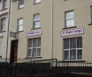
Night Lodge
Videos from this area
These are videos related to the place based on their proximity to this place.
First Bargoed then Newport
It's a Bank Holiday weekend, it rained, some of the sound is missing and the Murenger was closed when I got there. Apart from that the Lamb's loyalty has gone app based. Lovely.
Pinkmove Video Tour of 32 Violet Walk
Pinkmove Video Tour of 32 Violet Walk, A semi detached 3 Bedroom home in the Afon Village area of Rogerstone. For full details please visit http://www.pinkmove.co.uk.
Michaelston Diamond Jubilee Celebration
The Queen's Diamond Jubilee Celebration in Michaelston-y-Fedw. Barbecue, Games and Lighting the Jubilee Beacon.
Sponsored charity walk from Cardiff Castle to the Bettws Rugby Club in Newport - Part 1
Paul Murphy and Ray Cripps arrange a sponsored charity walk from Cardiff Castle to the Bettws Rugby Club in Newport, a distance of about 15+ miles in aid of the Lymphoma Charity Association...
Best Fish and Chips Cardiff
Frydays Fish and Chip Emporium The best fish and chips in Cardiff Multi-Award winning fish and chip shop in old St Mellons, Cardiff www.bnestfishandchipscardiff.com.
Forza Horizon 2 - Custom Show Cars #3 - Chevy Bel Air (V8 Swap)
songs in my Vids:https://www.youtube.com/results?search_query=ncs Comment, like and subscribe thanks!! Twitch: http://www.twitch.tv/wruchamps/profile Overclockers: http://www.overclockers.co.uk/...
Videos provided by Youtube are under the copyright of their owners.
Attractions and noteworthy things
Distances are based on the centre of the city/town and sightseeing location. This list contains brief abstracts about monuments, holiday activities, national parcs, museums, organisations and more from the area as well as interesting facts about the region itself. Where available, you'll find the corresponding homepage. Otherwise the related wikipedia article.
St Mellons
St Mellons is a district and suburb of eastern Cardiff, the capital city of Wales. Previously located in Monmouthshire, St Mellons became part of South Glamorgan and Cardiff in 1974. It consists of Old St Mellons and a newer, much larger area of modern housing and business parks.
Cwm Silicon
Cwm Silicon is an epithet applied to a region of South Wales in the far west of Newport that attracted much interest and inward investment from the technology sector in the early 2000s. The future of the area as an important technological centre is now uncertain following the closure of its key LG factory in August 2003. The area is next to the M4 and is a centre for high-technology companies, like much of the M4 corridor.
A48(M) motorway
The A48(M) is a motorway in Wales between Cardiff and Newport. It is a spur off the M4 into eastern Cardiff. It is 2 miles long and is a 2-lane motorway throughout its length. At St Mellons it runs continuously into a further 6 miles of the dual-carriageway A48, which also features (albeit narrow) hard shoulders. It opened in 1977, originally as an ending for the M4. The M4 was subsequently extended from junction 29 in 1980 and this section of road was renumbered A48(M).
Pontprennau & Old St. Mellons
Pontprennau & Old St Mellons is an electoral ward located in the north-east of Cardiff Wales. It has a population that probably now exceeds 10,000 people (8,037 from Census data, 2001) due to sustained housebuilding in the Pontprennau section of the division, which is likely to continue for the next 10 years as a major urban expansion of up to 4,000 homes is constructed. The electoral ward falls within the parliamentary constituency of Cardiff North.
Rhiwderin
Rhiwderin is a small village in the west of the city of Newport, South Wales. It lies in the community parish and electoral district (ward) of Graig. The original village lies across a level crossing off the main A468 Newport—Caerphilly road. There are additional houses on the other side of the main road known as Rhiwderin Heights which have almost merged the village with neighbouring Bassaleg. The Pentrepoeth School is the local primary school in the area.
South East Wales
South East Wales is a loosely-defined region of Wales generally corresponding to the former counties of South Glamorgan, Mid Glamorgan and Gwent. The region is the most highly-populated and urbanised area of the country, including two of the largest cities and a number of Wales' other large towns.
Treetops Shooting Ground
Treetops Sporting Ground is located in Coedkernew, Newport, South Wales. It is a sporting clay pigeon shooting ground. It also has facilities for air rifle owners.
Peterstone Gout
Peterstone Gout is a tidal flap controlling the outfall to the sea near Peterstone Wentlooge, Newport, south Wales. It is located several miles up the coast from Cardiff in the estuary of the River Usk. It is the main drainage point from the Wentloog Levels into the sea. The area is monitored by the Gwent Wildlife Trust. A plaque is located next to the sluice control valves marking the opening of the facility on July 25th 1960 by Clifford Williams, Chairman of the Usk River Board.


