Safety Score: 3,0 of 5.0 based on data from 9 authorites. Meaning we advice caution when travelling to United Kingdom.
Travel warnings are updated daily. Source: Travel Warning United Kingdom. Last Update: 2024-04-26 08:02:42
Delve into Bradley
Bradley in Staffordshire (England) with it's 513 habitants is located in United Kingdom about 123 mi (or 197 km) north-west of London, the country's capital town.
Current time in Bradley is now 08:21 PM (Friday). The local timezone is named Europe / London with an UTC offset of one hour. We know of 9 airports close to Bradley, of which 5 are larger airports. The closest airport in United Kingdom is Birmingham International Airport in a distance of 28 mi (or 45 km), South-East. Besides the airports, there are other travel options available (check left side).
There are several Unesco world heritage sites nearby. The closest heritage site in United Kingdom is Pontcysyllte Aqueduct and Canal in a distance of 34 mi (or 55 km), North-West. Also, if you like playing golf, there are some options within driving distance. We encountered 2 points of interest near this location. If you need a hotel, we compiled a list of available hotels close to the map centre further down the page.
While being here, you might want to pay a visit to some of the following locations: Stafford, Tong, Albrighton, Wolverhampton and Newport. To further explore this place, just scroll down and browse the available info.
Local weather forecast
Todays Local Weather Conditions & Forecast: 9°C / 48 °F
| Morning Temperature | 2°C / 36 °F |
| Evening Temperature | 7°C / 45 °F |
| Night Temperature | 3°C / 38 °F |
| Chance of rainfall | 1% |
| Air Humidity | 60% |
| Air Pressure | 1005 hPa |
| Wind Speed | Gentle Breeze with 8 km/h (5 mph) from West |
| Cloud Conditions | Overcast clouds, covering 92% of sky |
| General Conditions | Light rain |
Saturday, 27th of April 2024
9°C (48 °F)
5°C (41 °F)
Overcast clouds, moderate breeze.
Sunday, 28th of April 2024
7°C (45 °F)
5°C (41 °F)
Moderate rain, moderate breeze, overcast clouds.
Monday, 29th of April 2024
12°C (54 °F)
8°C (46 °F)
Light rain, moderate breeze, broken clouds.
Hotels and Places to Stay
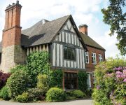
Moat House
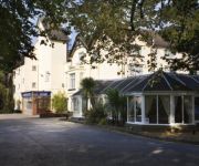
Mercure Stafford South Hatherton House Hotel
Best Western Tillington Hall
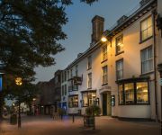
The Swan
Wyndale Guesthouse
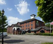
JCT.13 Holiday Inn Express STAFFORD M6
TRAVELODGE STAFFORD CENTRAL
Stafford North (Spitfire)
Videos from this area
These are videos related to the place based on their proximity to this place.
Freight Trains at Stafford 20 February 2015
A series of freight trains pass through Stafford station during the afternoon and evening of Friday 20 February 2015.
A Winters Day at Stafford - 10th November 2014
A Chilly November day at Stafford Station saw a nice mix of traction on 40 movements. Highlights of which were; 46115 "Scots Guardsman" moving back up to Carnforth 59103 along with 92031 &...
Class 387 New Thameslink Units at Stafford 20 February 2015
A couple of the new Class 387 Thameslink units pass through Stafford station during the afternoon of Friday 20 February 2015.
Tammy Davis - Payphone (Filmed at The Royal Oak, Gnosall 23/11/2012)
For more information about Tammy Davis, visit: www.Facebook.com/musictammydavis Cameras: Adam Westwood Laura Westwood Editing: Adam Westwood www.DiscoveryMedia.Moonfruit.com.
Tammy Davis - Dynamite (Filmed at The Royal Oak, Gnosall 23/11/2012)
For more information about Tammy Davis, visit: www.Facebook.com/musictammydavis Cameras: Adam Westwood Laura Westwood Editing: Adam Westwood www.DiscoveryMedia.Moonfruit.com.
Andy Appleby - Walking In Memphis (Filmed at The Royal Oak, Gnosall 23/11/2012)
Andy Appleby performing Walking In Memphis by Marc Cohn. For more information about Andy Appleby and more, visit his website: www.OpenMicJam.co.uk Cameras: Adam Westwood Laura ...
Andy Appleby - Valerie (Filmed at The Royal Oak, Gnosall 23/11/2012)
Andy Appleby performing Valerie by The Zutons. For more information about Andy Appleby and more, visit his website: www.OpenMicJam.co.uk Cameras: Adam Westwood Laura Westwood Editing: ...
Episode 16: 64 days on MiniMed 640G: Plain Jane vs Cindy Crawford
DiabetesMM640G vs VEO: Volvo vs Porche: Plain Jane vs Cindy Crawford! A brief summary of the difference between having the MiniMed 640G vs VEO during the first week. I have upgrades to a super ...
Shropshire Union Canal - Lord Vernon's Wharf
Either side of Bridge No 25 and apparently the site of a former Cadbury's depot.
Homestead Caravan Park movie.mp4
Views of the Homestead Caravan Park in Brewood, Staffordshire. England Caravan holiday homes staffordshire.
Videos provided by Youtube are under the copyright of their owners.
Attractions and noteworthy things
Distances are based on the centre of the city/town and sightseeing location. This list contains brief abstracts about monuments, holiday activities, national parcs, museums, organisations and more from the area as well as interesting facts about the region itself. Where available, you'll find the corresponding homepage. Otherwise the related wikipedia article.
Haughton, Staffordshire
Haughton is a village in Staffordshire, England, approximately 4 miles outside and to the west of the county town of Stafford. It lies on the A518 between Stafford and Gnosall. A small and peaceful rural village, Haughton contains 2 public houses, The Shropshire and The Bell. In the centre of the village situated on the main road is Haughton church, alongside which is the Old Village School. The new school is set back from the main road and caters for students between the ages of 5 and 11.
Stafford Rural District
Stafford Rural District was a rural district in the county of Staffordshire. It was created in 1894 and abolished in 1974 by virtue of the Local Government Act 1972.
Levedale
Levedale is a small somewhat elongated English village situated some 4 miles southwest of Stafford, 2 miles northwest of Penkridge and a mile west of Dunston, Staffordshire. It forms part of a group of hamlets and villages lying in a rectangular area of farmland lying to the southwest of Stafford and the east of Telford, between the A518 to the north, the A449 to the east, Watling Street to the south, and the A41 to the west.
Derrington
Derrington is a village near the M6 motorway, lying west of the town of Stafford, in the Stafford District, in the English county of Staffordshire. The village lies on the now disused Shropshire Union Railway running from Stafford to Shrewsbury. It has a pub, The Red Lion Inn and a parish church dedicated to St Matthew.
Bradley, Staffordshire
Bradley is a civil parish in Staffordshire, England. It is off the A518 road headed out to the villages of Haughton and Gnosall towards Telford.


