Safety Score: 3,0 of 5.0 based on data from 9 authorites. Meaning we advice caution when travelling to United Kingdom.
Travel warnings are updated daily. Source: Travel Warning United Kingdom. Last Update: 2024-05-15 08:00:47
Delve into Frankwell
The district Frankwell of in Shropshire (England) is a subburb in United Kingdom about 140 mi north-west of London, the country's capital town.
If you need a hotel, we compiled a list of available hotels close to the map centre further down the page.
While being here, you might want to pay a visit to some of the following locations: Shrewsbury, Bayston Hill, Bicton, Great Hanwood and Astley. To further explore this place, just scroll down and browse the available info.
Local weather forecast
Todays Local Weather Conditions & Forecast: 17°C / 62 °F
| Morning Temperature | 11°C / 52 °F |
| Evening Temperature | 16°C / 60 °F |
| Night Temperature | 11°C / 51 °F |
| Chance of rainfall | 0% |
| Air Humidity | 70% |
| Air Pressure | 1004 hPa |
| Wind Speed | Gentle Breeze with 8 km/h (5 mph) from North-West |
| Cloud Conditions | Broken clouds, covering 80% of sky |
| General Conditions | Light rain |
Thursday, 16th of May 2024
15°C (60 °F)
13°C (55 °F)
Moderate rain, light breeze, overcast clouds.
Friday, 17th of May 2024
14°C (58 °F)
11°C (52 °F)
Moderate rain, light breeze, overcast clouds.
Saturday, 18th of May 2024
17°C (62 °F)
13°C (55 °F)
Light rain, gentle breeze, overcast clouds.
Hotels and Places to Stay
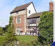
Albright Hussey Manor
Mercure Shrewsbury Albrighton Hall Hotel and Spa
The Lion Hotel Shrewsbury by Compass Hospitality
Three Tuns Hotel
Holiday Inn Express SHREWSBURY
TRAVELODGE SHREWSBURY BAYSTON HILL
TRAVELODGE SHREWSBURY BATTLEFIELD
Shrewsbury Town Centre
Shrewsbury North (Harmer Hill)
ABBOTS MEAD HOTEL
Videos from this area
These are videos related to the place based on their proximity to this place.
Great British Ghosts - The Prince Rupert Hotel, Shrewsbury
Find out about the various hauntings that have been reported at the Prince Rupert Hotel in Shrewsbury, Shropshire...
Trains at Shrewsbury Feb 2015
I spent an hour at Shrewsbury station before going off to discover the town and my heritage. Whilst at the station I spied Class 153 327 for Wrexham, Class 170 504 for Birmingham New Street...
SHREWSBURY BUSES FEBRUARY 2010
a trailer for www.pmpvideo.com Buses in Shropshire, Oswestry, Shrewsbury and Telford, Fen 2010 Purchase on Amazon, EBay or direct from PMP.
Town 4 Exeter City 0 - Behind The Goal - Town TV
The goals from the 4-0 win over Exeter City from our behind the goals angle.
MASTERCHEF: Skitty vs Vernon challenge
Club physio Chris Skitt and first team performance analyst Michael Vernon pick their teams and go head to head in the MasterChef challenge.
221143 departing after arriving with the first Virgin Euston - Shrewsbury train 14.12.14
221143 departing after arriving with the first Virgin Euston - Shrewsbury train 14.12.14.
Shrewsbury Railway Station Feb 2015
A video tour of Shrewsbury Railway Station on a dull and cold February Saturday morning.
Shrewsbury Ghost Tour
Part of the Destination Shrewsbury interactive map at visitshrewsburymap.co.uk.
Videos provided by Youtube are under the copyright of their owners.
Attractions and noteworthy things
Distances are based on the centre of the city/town and sightseeing location. This list contains brief abstracts about monuments, holiday activities, national parcs, museums, organisations and more from the area as well as interesting facts about the region itself. Where available, you'll find the corresponding homepage. Otherwise the related wikipedia article.
The Quarry
The Quarry is the main recreational park in Shrewsbury, the county town of Shropshire, England. The park was created in 1719 and encompasses 29 acres. With a location within easy walking distance of Shrewsbury town centre, Shrewsbury Sixth Form College and Shrewsbury School, it is the most heavily used public park within the county.
The Mount, Shrewsbury
The Mount is the site of a house in Shrewsbury, officially known as Mount House that belonged to Robert Darwin and was the birthplace of his son Charles Darwin.
Frankwell
Frankwell is a district of the town of Shrewsbury, in Shropshire, England. It lies adjacent to the River Severn, to the northwest of the town centre, and is one of Shrewsbury's oldest suburbs. Frankwell grew up as a port and trading location by the river and on the road to Wales, but across the river from the walled borough of Shrewsbury and therefore beyond the town's jurisdiction.
Golden Cross, Shrewsbury
The Golden Cross is a public house in Shrewsbury, England; it is reputed to be the oldest licensed pub in Shrewsbury.
Music Hall, Shrewsbury
The Music Hall in Shrewsbury, England, is a large Victorian building owned by Shropshire Council and currently houses the town's theatre and central Visitor Information Centre, as well as a cafe and some council offices. It is located on The Square in Shrewsbury town centre. In front of it is the Old Market Hall, now used as the borough council's cinema which was formerly housed within the Music Hall itself.
Welsh Bridge
The Welsh Bridge is a masonry arch viaduct in the town of Shrewsbury, England which crosses the River Severn. It connects Frankwell with the town centre. It is a Listed Building, Grade II*. The bridge was designed and built by John Tilley and John Carline (whose father was a mason on the English Bridge), who had built Montford Bridge for Thomas Telford. Four of the arches span 43 feet 4 inches, while the fifth and central arch is 46 feet 2 inches.
Roman Catholic Diocese of Shrewsbury
The Roman Catholic Diocese of Shrewsbury is a Latin Rite Roman Catholic diocese in England. The diocese encompasses parts of the North West of England and parts of the West Midlands. The diocese comprises the pre-1974 counties of Shropshire and Cheshire, varying from the rural areas of Shropshire to parts of Manchester south of the River Mersey and other large urban areas including Birkenhead, Stockport and Ellesmere Port.
Shrewsbury railway station
Shrewsbury railway station (formerly known as Shrewsbury General) is the railway station serving Shrewsbury, county town of Shropshire, England. It is the only remaining railway station in the town; Shrewsbury Abbey, as well as other small stations around the town, having long closed. The station was built in 1848 and has been extended several times since. It was designated as a grade II listed building in 1969.
New Riverside, Shrewsbury
New Riverside is a £150m shopping centre redevelopment project in Shrewsbury, Shropshire, which will link the town's Pride Hill and Darwin centres and comprehensively redevelop the Riverside centre site. The redevelopment will comprise approximately 50 new shops and 15 new restaurant and cafe units, totalling around 225,000 sq ft and create one, linked and extended centre of 680,000 sq ft. The scheme will be anchored by a Debenhams department store of 95,000 sq ft.
Bagley Brook
The Bagley Brook is a small watercourse that flows into the River Severn at Shrewsbury in Shropshire, England. Its course has been severely altered by urban development in the area, such that the brook is now little known or seen. However its name is used for an official area name - Bagley - which is an electoral division of the county council and a ward of the town council. The brook follows to some extent the old course of the River Severn.
Rad Brook
The Rad Brook is a small river in Shropshire, England. It flows through Shrewsbury and enters the River Severn there.
Shropshire County Show
The Shropshire County Show, formerly and to this day often called the West Mid Show (short for Shropshire and West Midlands Show), is an annual agricultural show held on the outskirts of Shrewsbury, England. It has its own showground - the Shropshire Agricultural Showground, which lies on the north bank of the River Severn in a rural setting (though it is less than a mile from Shrewsbury town centre). The showground is accessed via Berwick Road, the B5067.
Kingsland Bridge
Kingsland Bridge is a privately owned toll bridge, spanning the River Severn in Shrewsbury, Shropshire. It is located near Shrewsbury School and the cost for cars to cross is 20p. It is a Listed Building, Grade II.
Radbrook Green
Radbrook Green is the name of a small suburb of Shrewsbury, situated to the south-west of the town, approximately 1.5 miles from the town centre. Construction of the estate started in the late 1970s, with most of the estate completed by the early 1990s. It is a private housing estate, predominantly seen as a middle class area of the town.
Shrewsbury rail accident
The Shrewsbury rail accident occurred on 15 October 1907. An overnight sleeping-car and mail train from Manchester to the West of England derailed on the sharply curved approach to Shrewsbury station, killing 18 people. Those killed were the engine driver and fireman, two guards, eleven passengers, and three Post Office sorters working in the mail train. Thirty-three other people were reported injured. Speed was estimated at 60 mph on a curve limited to 10.
Old Market Hall
The Old Market Hall is an Elizabethan building situated in the town centre of Shrewsbury, the county town of Shropshire, England. Built in 1596, the property is now in the ownership of Shropshire Council. In 2004 the building underwent a £1.7 million restoration, having been previously restored in 1904. The OMH is a scheduled monument.
Shropshire Archives
Shropshire Archives is located in Shrewsbury, England and is the archives and local studies service for the historic county of Shropshire, which includes the borough of Telford and Wrekin. It preserves and makes accessible documents, books, maps, photographs, plans and drawings relating to Shropshire and its people dating from the early 12th to the 21st century.
Darwin Shopping Centre
The Darwin Shopping Centre is the largest of the three main shopping centres in Shrewsbury, the county town of Shropshire, England, comprising approximately 17 per cent of the town centre's retail offer by leasable area. It was built by John Laing Developments in 1989 and refurbished in 2002. It is due to undergo further refurbishment in a plan being devised by Chapman Taylor Architects as part of the New Riverside redevelopment.
Town Walls Tower
Town Walls Tower is a building in the care of the National Trust in the county town of Shrewsbury, Shropshire, England in the United Kingdom.
Coton Hill rail crash
The Coton Hill rail crash was a train crash which occurred on 11 January 1965, at Coton Hill, near Shrewsbury in Shropshire, England. It happened when a heavily loaded freight train ran out of control on the 1 in 100 Hencote incline, and was derailed on a set of trap points, eventually demolishing a signal box. The signalman on duty was killed, and the driver of the train seriously injured.
Shrewsbury Library
Shrewsbury Town Public Library is housed in a historically important building situated on Castle Hill near Shrewsbury Castle. The building was the site of Shrewsbury School until 1882. It opened as the Library in 1983 following restoration work. Above the main entrance are two statues bearing the inscriptions "Philomathes" and "Polumathes". These portray the virtues "Lover of learning" and "Much learning" to convey the lesson that it is good to gain knowledge through a love of learning.
St Chad's Church, Shrewsbury
St Chad's Church, Shrewsbury occupies a prominent position in the county town of Shropshire. The current church building was built in 1792, and with its distinctive round shape and high tower it is a well-known landmark in the town. It faces The Quarry area of parkland, which slopes down to the River Severn. The church is a Grade I listed building. The motto of the church is "open doors, open hearts, and open minds".
The Quantum Leap
The Quantum Leap is a sculpture situated next to the River Severn in Shrewsbury, Shropshire, England, United Kingdom. It was created to celebrate the bicentenary of the birth of evolutionist Charles Darwin, who was born in the town in 1809. The sculpture was unveiled on 8 October 2009 by Randal Keynes, a great-great-grandson of Darwin.
St Mary's Church, Shrewsbury
St Mary's Church, Shrewsbury, is a redundant Anglican church in St Mary's Place, Shrewsbury, Shropshire, England. It is designated by English Heritage as a Grade I listed building, and is under the care of the Churches Conservation Trust. It is the largest church in Shrewsbury. Clifton-Taylor includes the church in his list of 'best' English parish churches.
Mardol (street)
Mardol is a historic street in Shrewsbury, Shropshire with a variety of architectural styles, ranging from Tudor timber-framed buildings to more modern constructs. It runs from the Welsh Bridge up to the town centre. Shuts and passages leading from the street include the King's Head Passage, Phoenix Place, Mardol Gardens, Carnarvon Lane, Hill's Lane and Roushill Bank. At the top of Mardol now stands a new modern monument, Darwin's Gate. The original of the name of the street is not clear.


