Safety Score: 3,0 of 5.0 based on data from 9 authorites. Meaning we advice caution when travelling to United Kingdom.
Travel warnings are updated daily. Source: Travel Warning United Kingdom. Last Update: 2024-04-25 08:17:04
Discover Nether Edge
The district Nether Edge of Sheffield in Sheffield (England) is a district in United Kingdom about 140 mi north-west of London, the country's capital city.
Looking for a place to stay? we compiled a list of available hotels close to the map centre further down the page.
When in this area, you might want to pay a visit to some of the following locations: Orgreave, Bradfield, Wortley, Wentworth and Rotherham. To further explore this place, just scroll down and browse the available info.
Local weather forecast
Todays Local Weather Conditions & Forecast: 6°C / 43 °F
| Morning Temperature | 2°C / 35 °F |
| Evening Temperature | 7°C / 44 °F |
| Night Temperature | 2°C / 36 °F |
| Chance of rainfall | 0% |
| Air Humidity | 76% |
| Air Pressure | 1006 hPa |
| Wind Speed | Gentle Breeze with 6 km/h (4 mph) from South-West |
| Cloud Conditions | Overcast clouds, covering 86% of sky |
| General Conditions | Light rain |
Saturday, 27th of April 2024
9°C (47 °F)
5°C (41 °F)
Overcast clouds, gentle breeze.
Sunday, 28th of April 2024
6°C (43 °F)
5°C (41 °F)
Moderate rain, moderate breeze, overcast clouds.
Monday, 29th of April 2024
13°C (55 °F)
8°C (46 °F)
Light rain, moderate breeze, few clouds.
Hotels and Places to Stay
CORAL KHARTOUM HOTEL
Best Western Plus Kenwood Hall Hotels
Novotel Sheffield Centre
Holiday Inn SHEFFIELD
DoubleTree by Hilton Sheffield Park
Hilton Sheffield
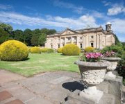
Wortley Hall
Mercure Sheffield St Paul's Hotel and Spa
Manor House Hotel
Leopold Hotel
Videos from this area
These are videos related to the place based on their proximity to this place.
Sheffield Means Business BPFS
Sheffield Means Business - Business, Professional and Financial Services; Sheffield City Region has a vibrant commercial sector and is the location of choice for a variety of recognised brand...
Sheffield Means Business Health Tech
Sheffield Means Business - Healthcare Technologies: The Sheffield City Region healthcare technologies sector is at the heart of significant business growth in developing 'user led' healthcare...
Sheffield Means Business CDI
Sheffield Means Business - Creative & Digital Industries; Sheffield has long been a hotbed for innovative talent, a substantial number of companies now share a unique body of experience and...
Neil Anderson Book Launch
Neil Anderson launches his book celebrating Sheffield City Hall's 80th birthday.
Xoxon's Footie Prediction's 3 - Jan 09
In this episode: Xoxon is joined by his and everyones old friends SKD and The German. Together they give their opinions on who will win the domestic football competitions as well as the added...
Videos provided by Youtube are under the copyright of their owners.
Attractions and noteworthy things
Distances are based on the centre of the city/town and sightseeing location. This list contains brief abstracts about monuments, holiday activities, national parcs, museums, organisations and more from the area as well as interesting facts about the region itself. Where available, you'll find the corresponding homepage. Otherwise the related wikipedia article.
Ecclesall
Ecclesall Ward—which includes the neighbourhoods of Bents Green, Ecclesall, Greystones, Millhouses, and Ringinglow—is one of the 28 electoral wards in City of Sheffield, England. It is located in the southwestern part of the city and covers an area of 9.4 km. The population of this ward in 2007 was 19,211 people in 7,626 households.
Sheffield Botanical Gardens
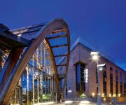
The Sheffield Botanical Gardens are botanical gardens situated off Ecclesall Road in Sheffield, England, with 5,000 species of plant in 19 acres (77,000 m) of land. The gardens were designed by Robert Marnock and first opened in 1836. The most notable feature of the gardens are the Grade II* listed glass pavilions, restored and reopened in 2003. Other notable structures are the main gateway, the south entrance lodge and a bear pit.
Nether Edge (ward)
Nether Edge Ward—which includes the districts of Brincliffe, Carter Knowle, Nether Edge, Sharrow Vale, and most of Banner Cross—is one of the 28 electoral wards in the City of Sheffield, England. It is located in the southern part of the city and covers an area of 3.4 km. The population of this ward in 2001 was 18,000 people in 7,100 households. Nether Edge ward is one of the wards that make up the Sheffield Central parliamentary constituency.
Sheffield General Cemetery
The General Cemetery is a cemetery in the City of Sheffield, England that opened in 1836, and closed for burial in 1978. It was the principal cemetery in Victorian Sheffield with over 87,000 burials. Today it is a conservation area (one of only six in South Yorkshire), and it is listed on the English Heritage National Register of Historic Parks and Gardens. It is owned by the City of Sheffield and managed on behalf of them by local community group Sheffield General Cemetery Trust.
Sheffield Central ward
Central ward—which includes the districts of Broomhall, Highfield, Sharrow, and the city centre—is one of the 28 electoral wards in City of Sheffield, England. It covers the central area of the city, an area of 4.8 km. The population of this ward in 2001 was 17,300 people in 7,300 households. It is one of the wards that make up the Sheffield Central constituency.
Abbeydale Picture House
Abbeydale Picture House (later Abbeydale Cinema) is a former cinema in the City of Sheffield, England. When opened by the Lord Mayor of Sheffield on 20 December 1920 the picture house was the largest and most luxurious cinema in Sheffield, it was often called Picture Palace because it was decorated in cream and gold with green velvet seats made of dark mahogany.
Abbeydale, South Yorkshire
Abbeydale is the segment of the City of Sheffield, England that follows the valley of the river Sheaf. It covers many districts of Sheffield running roughly from Heeley Bridge in the district of Heeley to Dore Road between Beauchief and Totley. It is named for the Abbey that existed at Beauchief from the 12th century to 1537. Although not the official name of any district, many businesses and institutions in the valley use Abbeydale in their name.
London Road (Sheffield)
London Road is a shopping street in Sheffield, England. It leads south from the city centre near Moorfoot, parallel to Bramall Lane, through Sharrow, Highfield, Lowfield and Heeley, before becoming Chesterfield Road in Meersbrook next to The Crown Inn. Near Heeley Bridge was Heeley railway station, opposite the Bridge Inn. The road ended at Toll Bar bridge on the Meers Brook, the former boundary between Yorkshire and Derbyshire.
Broom Hall
Broom Hall is a historic house in the City of Sheffield, England that gives its name to the surrounding Broomhall district of the city. The earliest part of the house is timber-framed; it has been tree-ring dated to c1498, and was built by the de Wickersley family, whose ancestral home was at Wickersley. The de Wickersley family descended from Richard FitzTurgis, who co-founded Roche Abbey in South Yorkshire.
Hunter's Bar
Hunter's Bar is a roundabout and former toll bar on Ecclesall Road in south-west Sheffield, England; the toll bar was active until the late 19th century. The name also attaches to the area surrounding Hunter's Bar roundabout at the intersection of Ecclesall Road, Brocco Bank, Sharrow Vale Road and Junction Road. The toll bar now stands in the middle of the roundabout.
St Paul's Church and Centre, Norton Lees, Sheffield
St Paul's Church and Centre is a Parish Church in the Church of England Diocese of Sheffield located at the junction of Norton Lees Lane and Angerford Avenue, just above Meersbrook Park. Originally built between 1875-7, St Paul's was much altered to meet the needs of an expanding congregation in 1935 when C. B. Flockton added broad North and South aisles. The recent phase of redevelopment, 2006-7, has just been completed.
Millhouses engine shed
Millhouses engine shed was an engine shed in Millhouses, Sheffield. It was built by the Midland Railway in 1901 as Ecclesall engine shed, to serve the Midland Main Line. It was used mainly to stable passenger and mixed-traffic locomotives for use on trains from the nearby Sheffield Midland station. The shed was built next to Millhouses railway station; it had 8 dead end roads, and could handle about forty steam locomotives. Ecclesall shed was renamed Millhouses in 1920.
Norton Cemetery (Sheffield)
Norton Cemetery is one of the city of Sheffield's many cemeteries. It was opened on 6 June 1869, and covers 6 acres . Norton is a smaller cemetery running along two alleys spanning to the right and the left from the two gate houses (not listed). From the furthest graves and along the boundary wall are stunning views of the Sheaf valley and the moors.
Meersbrook Park
Meersbrook Park is set on a steep hillside in Meersbrook, Sheffield, United Kingdom, and offers a stunning panoramic view over central Sheffield to the north. Within the park are two historic buildings: Bishops' House (c1500) is one of the oldest buildings in Sheffield and is open as a museum, and Meersbrook House. Meersbrook House was built in 1780 by Benjamin Roebuck. The property included walled kitchen garden and house's estate extended to Meers Brook.
Wilsons of Sharrow
Wilsons of Sharrow, now named Wilsons & Company (Sharrow) Ltd, based in the Sharrow district of Sheffield, United Kingdom, is the world’s oldest manufacturer of snuff. The company was founded 1737. Wilsons also manufactures the renowned Fribourg & Treyer snuffs. In the early 1740s, Joseph Wilson succeeded his father Thomas Wilson, a shearsmith, as tenant of Sharrow Mill. The mill suffered a fire in 1746, when his stock in trade included "tobacco stuff".
Lantern Theatre
The Lantern Theatre (Originally called The Chalet Theatre) is a small Sheffield theatre (seating capacity 84) built in 1893 and is Sheffield's oldest theatre. The Lantern Theatre is a professional theatre venue and arts centre that houses small and mid-scale theatre, music, and comedy. In 2011 the theatre produced their first professional co-production and in 2012 are producing their first in-house professional production of Order, a play by Martin Derbyshire.
South Yorkshire Transport Museum
The South Yorkshire Transport Museum, formerly the Sheffield Bus Museum, is a museum which documents the history of bus transport in South Yorkshire. The museum is located in the village of Aldwarke, part of Rotherham. In addition to many buses, the museum also features a Sheffield Tramway tram, a train and a tractor.
Highfield (stadium)
Highfield is a former home ground of The Wednesday Football Club and was located on London Road near to the centre of Sheffield, South Yorkshire, England. The club started to use the ground when they formed in 1867 and continued to use the ground until moving to Myrtle Road in 1870.
Sheffield Round Walk
The Sheffield Round Walk is a 14 mile walk through the south west of Sheffield, South Yorkshire, England. Starting from Hunters Bar, it travels along the Porter valley to Ringinglow. It then descends through the Limb valley and Ecclesall Woods to Abbeydale Road, before climbing through Ladies Spring Wood to Graves Park. The walk then passes through the Gleadless valley, Meersbrook Park and Chelsea Park before returning to Hunters Bar.
Abbeydale Grange School
Abbeydale Grange School was a mixed comprehensive school in Sheffield, England, established in 1958 and closed after the 2009/10 academic year, after being listed amongst the schools with worst GCSE examination results. The school was set in a green site off Abbeydale Road, a short bus journey from Sheffield city centre. It served both the local area and the wider city community.
Football Unites, Racism Divides
Football Unites, Racism Divides (FURD) is a youth and social inclusion project and charity based in Sheffield, England which uses football as a tool to 'break down barriers created by ignorance or prejudice'. It works locally, nationally and internationally to combat racism and increase understanding between different communities.
Mount Pleasant, Sheffield
Mount Pleasant is an 18th century mansion situated on Sharrow Lane in the Highfield area of the City of Sheffield in South Yorkshire, England. The house stands just under two km south of the city centre and is a grade II* listed building, it has been described as “one of the best 18th century houses in Sheffield”. The adjacent former stables and coach house are also Grade II* listed.
Portland Works
Portland Works is a former cutlery works in the Highfield area of Sheffield in England. Built in 1877, it is now a Grade II* listed building with a wide variety of cultural uses.
Moore Street electricity substation
The Moore Street electricity substation is an electrical substation in Sheffield, England, designed by Jefferson Sheard in 1968. The substation is an example of Brutalist architecture. Owen Hatherley describes it as "a shocking paroxysm of a building, an explosion in reinforced concrete, a bunker built with an aesthete's attention to detail, a building which is genuinely Brutalist in both senses of the term. " The building was illuminated in October 2010.
Chelsea Park (Sheffield)
Chelsea Park is a small public park located in the south west of Sheffield in the suburb of Nether Edge. It is listed as one of the city's Historic Parks, and was originally laid out as the private gardens to Brincliffe Towers in 1852. It was gifted to the people of Sheffield in 1935 by a former Lord Mayor and Alderman William Styring. The original small playground from 1966 was replaced, alongside a canopy and basketball area, in 2005.


