Safety Score: 3,0 of 5.0 based on data from 9 authorites. Meaning we advice caution when travelling to United Kingdom.
Travel warnings are updated daily. Source: Travel Warning United Kingdom. Last Update: 2024-04-19 08:03:45
Delve into Manor
The district Manor of Sheffield in Sheffield (England) is a subburb in United Kingdom about 140 mi north-west of London, the country's capital town.
If you need a hotel, we compiled a list of available hotels close to the map centre further down the page.
While being here, you might want to pay a visit to some of the following locations: Orgreave, Rotherham, Wentworth, Whiston and Ulley. To further explore this place, just scroll down and browse the available info.
Local weather forecast
Todays Local Weather Conditions & Forecast: 9°C / 49 °F
| Morning Temperature | 2°C / 36 °F |
| Evening Temperature | 8°C / 46 °F |
| Night Temperature | 3°C / 38 °F |
| Chance of rainfall | 0% |
| Air Humidity | 48% |
| Air Pressure | 1030 hPa |
| Wind Speed | Gentle Breeze with 9 km/h (5 mph) from South |
| Cloud Conditions | Broken clouds, covering 61% of sky |
| General Conditions | Broken clouds |
Sunday, 21st of April 2024
6°C (44 °F)
3°C (37 °F)
Overcast clouds, gentle breeze.
Monday, 22nd of April 2024
4°C (40 °F)
6°C (43 °F)
Light rain, light breeze, overcast clouds.
Tuesday, 23rd of April 2024
7°C (45 °F)
5°C (41 °F)
Light rain, moderate breeze, overcast clouds.
Hotels and Places to Stay
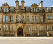
Mercure Sheffield St Paul's Hotel and Spa
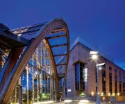
Copthorne Sheffield
DoubleTree by Hilton Sheffield Park
Holiday Inn SHEFFIELD
Hilton Sheffield
Leopold Hotel
Novotel Sheffield Centre
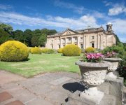
Wortley Hall
Hampton by Hilton Sheffield
Mercure Sheffield Parkway
Videos from this area
These are videos related to the place based on their proximity to this place.
Los Santos Transit - Route 83 (PC Exclusive) [First Person]
Game: Grand Theft Auto: V Public: Local Route: 83 Name Route: N/A Owner: NavZ Metro From: Textile City, Dashound Bus Station To: Morningwood, Backlot City.
Los Santos Transit - Route 250 Beta (PS4 Version) [Third Person]
Game: Grand Theft Auto V Public: Local Route: 250 Name Route: N/A Owner: NavZ Metro From: Textile City, Dashound Bus Station To: Backlot City.
Los Santos Transit - Route 250 (360 Version)
Game: Grand Theft Auto V Public: Local Route: 250 Name Route: N/A Owner: NavZ Metro From: Textile City, Dashound Bus Station To: Backlot City Route Available: PlayStation 3, PlayStation 4,...
Dashound Service - Route D4 (Part 2)
Game: Grand Theft Auto: V Public: Local Route: 4 Name Route: District Owner: From: Tataviam Mountain. To: Textile City, Dashound Bus Station.
Los Santos Transit - Route 88 (PC Exclusive) [Third Person]
Game: Grand Theft Auto: V Public: Local Route: 88 Name Route: N/A Owner: NavZ Metro From: Textile City, Dashound Bus Station To: Richman.
Los Santos Transit - Route 26a Part 1 (PC Exclusive)
This route been created by a member from NavZ Metro Transit Group Game: Grand Theft Auto V Owner: AlexBrindisi Castri Public: Local Route: 26 Name Route: Apart From: Textile City, Dashound...
Los Santos Transit - Route 153
This route been created by a member from NavZ Metro Transit Group Game: Grand Theft Auto V Owner: Z-Team Project Public: Local Route: 153 Name Route: N/A From: Textile City, Dashound Bus ...
Dashound Service - Route D4 (Part 1)
Game: Grand Theft Auto: V Public: Local Route: 4 Name Route: District Owner: From: Textile City, Dashound Bus Station To: Tataviam Mountain.
Dashound Service - Route D77 (PS4 Version) HAPPY HOLIDAYS
Game: Grand Theft Auto V Public: Local Route: 77 Name Route: District Owner: NavZ Metro From: Textile City, Dashound Bus Station To: Paleto Bay.
Folliculitis Treatment Guide and Advice
http://folliculitistreatments.com - CLICK FOR Folliculitis Treatment Information How To Treat Folliculitis - If you are watching this then I assume that you have the same problem as I did...
Videos provided by Youtube are under the copyright of their owners.
Attractions and noteworthy things
Distances are based on the centre of the city/town and sightseeing location. This list contains brief abstracts about monuments, holiday activities, national parcs, museums, organisations and more from the area as well as interesting facts about the region itself. Where available, you'll find the corresponding homepage. Otherwise the related wikipedia article.
Sheffield Manor
Sheffield Manor, also known as the Manor Lodge or Manor Castle, is a lodge built about 1516 in what then was a large deer park east of Sheffield, South Yorkshire, England, to provide a country retreat and further accommodate George Talbot, the 4th Earl of Shrewsbury, and his large family. The remnant of this estate is now known as Norfolk Park.
Don Valley Stadium
The Don Valley Stadium is a sports stadium in Sheffield, England. Originally built as an athletics stadium for the 1991 World Student Games it has since found a variety of uses. It was the home ground of Rotherham United F.C. from 2008 until they moved to the New York Stadium at the start of the 2012–13 season. It is also one of the stadiums used for home games by RLFC side Sheffield Eagles. It is the former home of the Parramore Sports football team.
Darnall (ward)
Darnall ward—which includes the districts of Attercliffe, Carbrook, Darnall, Tinsley, and parts of Handsworth—is one of the 28 electoral wards in City of Sheffield, South Yorkshire, England. It is located in the eastern part of the city and covers an area of 17.4 km. The population of this ward in 2001 was 21,000 people in 8,400 households. It is one of the wards that make up the Sheffield Attercliffe constituency.
Sheffield Attercliffe (UK Parliament constituency)
Sheffield Attercliffe was a parliamentary constituency in the City of Sheffield. It was created at the 1885 general election and abolished at the 2010 general election, when it was replaced by a new Sheffield South East constituency.
Arbourthorne
Arbourthorne ward—which includes the districts of Arbourthorne, Gleadless, and Norfolk Park—is one of the 28 electoral wards in City of Sheffield, England. It is located in the southeastern part of the city and covers an area of 1.74 square miles . The population of this ward in 2001 was 17,500 people in 7,800 households. It is one of the five wards that form the Sheffield Heeley parliamentary constituency.
Richmond, South Yorkshire
Richmond ward—which includes the districts of Four Lane Ends, Intake, Richmond, and Woodthorpe—is one of the 28 electoral wards in City of Sheffield, England. It is located in the southern part of the city and covers an area of 4.5 km. The population of this ward in 2001 was 17,300 people in 7,500 households. It is one of the five wards that form the Sheffield Heeley parliamentary constituency.
Sheffield Parkway
The Sheffield Parkway is a major dual carriageway which runs between the City of Sheffield and junction 33 of the M1 in South Yorkshire, England. The 5.5 mile road was opened in 1974, and runs to the east of the City, connecting Park Square in the City centre with the inner ring road, outer ring road and out to the M1 motorway at junction 33.
English Institute of Sport – Sheffield
The English Institute of Sport is a multi-sport facility in Sheffield, England. The facility designed by FaulknerBrowns Architects was opened in December 2003 at a cost of £24 million. Its main feature is a 200 m indoor track but it also hosts several other sporting arenas as well as a large gym and extensive sports medicine facilities. It is in the Lower Don Valley between the Sheffield Arena and Don Valley Stadium.
Darnall engine shed
Darnall engine shed was an engine shed in Darnall, Sheffield. It was built by the London and North Eastern Railway to serve the Sheffield area, passenger trains originating or changing at Sheffield Victoria and goods and pilot workings. The shed was built adjacent to the main line immediately west of Darnall station. British Railways initially allocated the shed code 39B to Darnall, and later 41A, both within the Eastern Region code sequence.
City Road Cemetery
The City Road Cemetery is a cemetery in the City of Sheffield, England that opened in May 1881 and was originally Intake Road Cemetery. Covering 100 acres it is the largest and is the head office for all the municipally owned cemeteries in Sheffield. The cemetery contains Sheffield Crematorium, whose first cremation was on 24 April 1905.
Bowden Housteads Woods
Bowden Housteads Woods are situated between Darnall and Handsworth, Sheffield,, South Yorkshire, England. the woods are encircled by Sheffield Outer Ring Road, Sheffield Parkway and Handsworth Road. The woods are classified as ancient woodlands, having been in existence since the 17th century, the Car Brook flows through the wooded area. Spring brings a carpet of bluebells. The 1853 Odnance Survey map of the area shows a sandstone quarry within the woods.
Tinsley Park Cemetery
Tinsley Park Cemetery is one of the city of Sheffield's many cemeteries. It was opened in 1882, and covers 19 acres . The cemetery is still open to burials, and since the first burial on 2 June 1882 over 59,000 burials have taken place. There are buried in the cemetery 42 Commonwealth service personnel from World War I and 32 from World War II. The entranceway to the cemetery is flanked by a pair of Grade II listed Gothic style chapels, where services can be held prior to the burial.
High Hazels Park
High Hazels Park is a large parkland area in Darnall, Sheffield, South Yorkshire, England. Since the 19th century Darnall has been a centre of coal and steel industry in Sheffield. High Hazels Park was built in 1850 by William Jeffcock (the first Lord Mayor of Sheffield). In 1894, Sheffield City Council (the Corporation of Sheffield) bought the land and house from the Duke of Norfolk and Messers Jeffcock for £10,875.
A630 road
The A630 is an A road in the United Kingdom. It runs between Sheffield city centre and junction 4 of the M18 motorway, passing through Rotherham and Doncaster on the way.
Nunnery engine shed
Nunnery engine shed was a small locomotive depot close to the city centre of Sheffield, South Yorkshire, England. After gaining running powers over the Manchester, Sheffield and Lincolnshire Railway to reach Sheffield, the London and North Western Railway (LNWR) set about building facilities, not only to serve its customers but to service the locomotives needed to operate these facilities.
Sheffield Outer Ring Road
Sheffield Outer Ring Road is one of two main routes circumventing Sheffield, a partial ring around Sheffield City Centre and its suburbs. It begins in Bradway as the B6054 Bradway Road, progressing anticlockwise as Greenhill Parkway, crossing the A61 Meadowhead/Chesterfield Road South into the A6102 Bochum Parkway, which turns north, passing through Norton. Heading east again, at Lightwood, it becomes the dual-carriageway A6102 Norton Avenue.
Nunnery Colliery
Nunnery Colliery was a coal mine close to the city centre of Sheffield, South Yorkshire. The mining company, known as The Waverley Coal Company, also worked High Hazels Colliery about 3 miles (5 km) further east.
Waltheof School, Sheffield
Frecheville Comprehensive
Frecheville Comprehensive School was a secondary school located in Sheffield, South Yorkshire, England. It is now a housing estate.
Darnall New Ground
Darnall New Ground at Darnall, Sheffield was a first-class cricket venue in the 1820s. It was the home ground of Sheffield Cricket Club which played six first-class matches there.
Shire Brook
Shire Brook is a small stream in the south eastern part of the City of Sheffield in South Yorkshire, England. It rises in the suburb of Gleadless Townend and flows in a general easterly direction for 6.5 km to its confluence with the River Rother between Beighton and Woodhouse Mill. In the past the brook has been both the border of Yorkshire and Derbyshire and between the sees of Canterbury and York.
Parkway Man
The Parkway Man is a statue located on the outskirts of the Bowden Howsteads Wood in the [handsworth district of Sheffield, England. The statue is visible from the road, and can be seen by people driving on the Mosborough Parkway or Handsworth Road. The statue can also be viewed using public footpaths in the woods. ] The statue depicts a large man made of cast iron; he is stripped to the waist and is wielding a sledgehammer; it weighs over 3 tonnes and is over 3 metres high.
Darnall Old Ground
Darnall Old Ground at Darnall, Sheffield was a first-class cricket venue in the 1820s. It was the home ground of Sheffield Cricket Club which played first-class matches there before relocating to Darnall New Ground.
Sheffield South East (UK Parliament constituency)
Sheffield South East is a constituency represented in the House of Commons of the UK Parliament since its 2010 creation by Clive Betts, a member of of the Labour Party.
Holy Cross Church, Gleadless Valley
Holy Cross Church, Gleadless Valley, is a Church of England church in the City of Sheffield, England. It is situated on Spotswood Mount and is a distinctive building constructed in 1964/65 and designed by the architects Braddock & Martin-Smith. It is positioned in a spectacular position among the houses on the Rollestone hillside. It has a canted front which is triangular in shape which has a large white cross at its apex.


!['Los Santos Transit - Route 83 (PC Exclusive) [First Person]' preview picture of video 'Los Santos Transit - Route 83 (PC Exclusive) [First Person]'](https://img.youtube.com/vi/Z1kT9f-ldGs/mqdefault.jpg)
!['Los Santos Transit - Route 250 Beta (PS4 Version) [Third Person]' preview picture of video 'Los Santos Transit - Route 250 Beta (PS4 Version) [Third Person]'](https://img.youtube.com/vi/BN6j9yZaVJA/mqdefault.jpg)


!['Los Santos Transit - Route 88 (PC Exclusive) [Third Person]' preview picture of video 'Los Santos Transit - Route 88 (PC Exclusive) [Third Person]'](https://img.youtube.com/vi/-5t6jnEey7M/mqdefault.jpg)


