Safety Score: 3,0 of 5.0 based on data from 9 authorites. Meaning we advice caution when travelling to United Kingdom.
Travel warnings are updated daily. Source: Travel Warning United Kingdom. Last Update: 2024-04-18 08:12:24
Discover Chapeltown
Chapeltown in Sheffield (England) with it's 23,056 citizens is a town in United Kingdom about 147 mi (or 236 km) north-west of London, the country's capital city.
Current time in Chapeltown is now 06:21 PM (Thursday). The local timezone is named Europe / London with an UTC offset of one hour. We know of 9 airports near Chapeltown, of which 5 are larger airports. The closest airport in United Kingdom is Robin Hood Doncaster Sheffield Airport in a distance of 19 mi (or 31 km), East. Besides the airports, there are other travel options available (check left side).
There are several Unesco world heritage sites nearby. The closest heritage site in United Kingdom is Liverpool – Maritime Mercantile City in a distance of 20 mi (or 32 km), East. Also, if you like playing golf, there are a few options in driving distance. Looking for a place to stay? we compiled a list of available hotels close to the map centre further down the page.
When in this area, you might want to pay a visit to some of the following locations: Wentworth, Wortley, Stainborough, Sheffield and Barnsley. To further explore this place, just scroll down and browse the available info.
Local weather forecast
Todays Local Weather Conditions & Forecast: 11°C / 51 °F
| Morning Temperature | 3°C / 37 °F |
| Evening Temperature | 7°C / 45 °F |
| Night Temperature | 9°C / 48 °F |
| Chance of rainfall | 0% |
| Air Humidity | 57% |
| Air Pressure | 1022 hPa |
| Wind Speed | Fresh Breeze with 13 km/h (8 mph) from East |
| Cloud Conditions | Overcast clouds, covering 100% of sky |
| General Conditions | Light rain |
Friday, 19th of April 2024
9°C (49 °F)
5°C (41 °F)
Light rain, fresh breeze, scattered clouds.
Saturday, 20th of April 2024
9°C (49 °F)
3°C (37 °F)
Scattered clouds, gentle breeze.
Sunday, 21st of April 2024
10°C (49 °F)
3°C (38 °F)
Overcast clouds, moderate breeze.
Hotels and Places to Stay
Novotel Sheffield Centre
Mercure Sheffield St Paul's Hotel and Spa
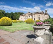
Wortley Hall
Holiday Inn SHEFFIELD
Hilton Sheffield
Whitley Hall
Leopold Hotel
Staindrop Lodge
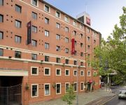
ibis Sheffield City
Alara Bed and Breakfast
Videos from this area
These are videos related to the place based on their proximity to this place.
Peaty's Steel City Downhill race - 4/2012
Peaty's Steel City Downhill mountain bike race, in Greno Woods near Sheffield, 21/4/2012. Produced for Monkeyspoon.com by Jeff R King, in association with BikeGarage.co.uk.
Vintage British Firework Poster Collection by Epic Fireworks
Old School Fireworks - http://epicfireworks.com/blog/2013/05/fire-fascination-firework-and-festival/
Werewolf 16 Shot by Epic Fireworks
Werewolf 16 Shot - http://epicfireworks.com/single-ignition-sib/werewolf-16-shot.
Perform a U-Turn on a national speed limit road
The van decides to perform a U-Turn in front of vehicles travelling at the national speed limit.
Wharnecliffe DH Road Trip
Some of the GoPro footage from my latest trip to Wharncliffe Woods DH Trails, with Olly and Will Tyne.
My holiday in Newquay
Become a Warrenater! http://www.youtube.com/subscription_center?add_user=Warrenaterz Welcome back everyone to another quick video. I just wanted to let you all know that I'm on holiday and...
Videos provided by Youtube are under the copyright of their owners.
Attractions and noteworthy things
Distances are based on the centre of the city/town and sightseeing location. This list contains brief abstracts about monuments, holiday activities, national parcs, museums, organisations and more from the area as well as interesting facts about the region itself. Where available, you'll find the corresponding homepage. Otherwise the related wikipedia article.
East Ecclesfield
East Ecclesfield ward—which includes the districts of Chapeltown and Ecclesfield—is one of the 28 electoral wards in City of Sheffield, England. It is located in the northern part of the city and covers an area of 3.8 square miles in the eastern part of Ecclesfield Parish. The population of this ward in 2001 was 17,800 people in 8,400 households. East Ecclesfield is one of the six wards that make up the Sheffield Hillsborough Parliamentary constituency.
West Ecclesfield
West Ecclesfield ward—which includes the districts of Burncross, Grenoside, High Green—is one of the 28 electoral wards in City of Sheffield, England. It is located in the northern part of the city and covers an area of 12.5 km in the western part of Ecclesfield Parish. The population of this ward in 2001 was 17,800 people in 7,400 households. West Ecclesfield is one of the six wards that make up the Sheffield Hillsborough Parliamentary constituency.
Church of St. Mary, Ecclesfield
The Church of St. Mary, Ecclesfield, is situated on Church Street in the village of Ecclesfield, now a northern suburb of Sheffield, South Yorkshire, England. It is situated seven kilometres north of the city centre. It is a Grade One listed building, one of only five within the Sheffield city boundary. It was originally the parish church for Hallamshire, one of the largest parishes in England and in the 17th century was known as the “Minster of the Moors” due to its then rural situation.
Pilley, South Yorkshire
Pilley is a village in the English county of South Yorkshire. Pilley forms part of the borough of Barnsley and lies to the south of that town and to the west of Junction 36 of the M1 motorway.
Ecclesfield Priory
Ecclesfield Priory was a religious house of Benedictine monks, lying in the village of Ecclesfield, north of Sheffield in Yorkshire, United Kingdom.
St Paul's Church, Wordsworth Avenue
St Paul’s Church is situated within the English city of Sheffield on Wordsworth Avenue in the northern suburb of Parson Cross. St Paul’s is a modern looking post war church which has been designated as a Grade II listed building.
Tankersley, South Yorkshire
Tankersley is a civil parish in the Metropolitan Borough of Barnsley in South Yorkshire, England. At the 2001 census it had a population of 1,414.
Whitley Hall
Whitley Hall is a 16th century mansion which since 1969 has been converted into a restaurant and then a hotel. It is situated in the northern rural district of the City of Sheffield in South Yorkshire, England. The small hamlet of Whitley lies in the countryside between the suburbs of Grenoside, Chapeltown and Ecclesfield some 7.5 km north of the city centre. The hall is a Grade II* listed building.


