Safety Score: 3,0 of 5.0 based on data from 9 authorites. Meaning we advice caution when travelling to United Kingdom.
Travel warnings are updated daily. Source: Travel Warning United Kingdom. Last Update: 2024-04-19 08:03:45
Delve into Brincliffe
The district Brincliffe of Sheffield in Sheffield (England) is a subburb in United Kingdom about 141 mi north-west of London, the country's capital town.
If you need a hotel, we compiled a list of available hotels close to the map centre further down the page.
While being here, you might want to pay a visit to some of the following locations: Bradfield, Wortley, Orgreave, Wentworth and Rotherham. To further explore this place, just scroll down and browse the available info.
Local weather forecast
Todays Local Weather Conditions & Forecast: 9°C / 48 °F
| Morning Temperature | 8°C / 47 °F |
| Evening Temperature | 6°C / 43 °F |
| Night Temperature | 3°C / 38 °F |
| Chance of rainfall | 0% |
| Air Humidity | 74% |
| Air Pressure | 1016 hPa |
| Wind Speed | Fresh Breeze with 14 km/h (9 mph) from South-East |
| Cloud Conditions | Scattered clouds, covering 33% of sky |
| General Conditions | Light rain |
Saturday, 20th of April 2024
9°C (49 °F)
3°C (38 °F)
Broken clouds, gentle breeze.
Sunday, 21st of April 2024
6°C (44 °F)
3°C (37 °F)
Overcast clouds, gentle breeze.
Monday, 22nd of April 2024
4°C (40 °F)
6°C (43 °F)
Light rain, light breeze, overcast clouds.
Hotels and Places to Stay
CORAL KHARTOUM HOTEL
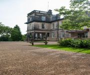
Halifax Hall
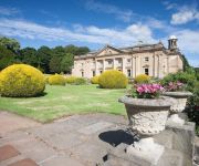
Wortley Hall
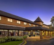
Holiday Inn SHEFFIELD
DoubleTree by Hilton Sheffield Park
Hilton Sheffield
Novotel Sheffield Centre
Mercure Sheffield St Paul's Hotel and Spa
Manor House Hotel
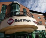
Leopold Hotel
Videos from this area
These are videos related to the place based on their proximity to this place.
Endcliffe CDC Tour of the Endcliffe Village!
Hi Friendcliffers! We're from the Endcliffe CDC 08/09 and we organise all of the activities and events happening in the Endcliffe Village at Sheffield University. We made this film to show...
Sheffield Means Business BPFS
Sheffield Means Business - Business, Professional and Financial Services; Sheffield City Region has a vibrant commercial sector and is the location of choice for a variety of recognised brand...
Sheffield Means Business Health Tech
Sheffield Means Business - Healthcare Technologies: The Sheffield City Region healthcare technologies sector is at the heart of significant business growth in developing 'user led' healthcare...
Sheffield Means Business CDI
Sheffield Means Business - Creative & Digital Industries; Sheffield has long been a hotbed for innovative talent, a substantial number of companies now share a unique body of experience and...
Neil Anderson Book Launch
Neil Anderson launches his book celebrating Sheffield City Hall's 80th birthday.
Xoxon's Footie Prediction's 3 - Jan 09
In this episode: Xoxon is joined by his and everyones old friends SKD and The German. Together they give their opinions on who will win the domestic football competitions as well as the added...
Escape Artists Sheffield Rollerblading Edit
An edit of me and friends from 2004. Skaters are:- Dean Crisculo - stall to soul - maidenhead David Wood (Woody) - topsoul to truspin top soyale 360 rewind - Sheffield train station Dean...
Mortons Neuroma Treatment - Cryosurgery Patient Review - Professional Dancer - Foot Pain Cured
Morton's Neuroma Treatment Morton's Neuroma is a benign thickening of a nerve in the foot that causes sharp, burning aching pains in the fore foot. Up until 2009 there was no alternative...
Boma 7 on Sheffield slopes!
Team from the Sheffield inclusive cycling group trying out the Boma on some steep slopes in Endcliff Park. Steep hills never look that impressive on video but trust me, you wouldn't want to...
Videos provided by Youtube are under the copyright of their owners.
Attractions and noteworthy things
Distances are based on the centre of the city/town and sightseeing location. This list contains brief abstracts about monuments, holiday activities, national parcs, museums, organisations and more from the area as well as interesting facts about the region itself. Where available, you'll find the corresponding homepage. Otherwise the related wikipedia article.
Ecclesall
Ecclesall Ward—which includes the neighbourhoods of Bents Green, Ecclesall, Greystones, Millhouses, and Ringinglow—is one of the 28 electoral wards in City of Sheffield, England. It is located in the southwestern part of the city and covers an area of 9.4 km. The population of this ward in 2007 was 19,211 people in 7,626 households.
Sheffield Botanical Gardens
The Sheffield Botanical Gardens are botanical gardens situated off Ecclesall Road in Sheffield, England, with 5,000 species of plant in 19 acres (77,000 m) of land. The gardens were designed by Robert Marnock and first opened in 1836. The most notable feature of the gardens are the Grade II* listed glass pavilions, restored and reopened in 2003. Other notable structures are the main gateway, the south entrance lodge and a bear pit.
Broomhill (ward)
Broomhill ward—which includes the districts of Broomhill, Crookesmoor, Endcliffe, and Tapton—is one of the 28 electoral wards in City of Sheffield, England. It is located in the western part of the city and covers an area of 2.7 km. The population of this ward in 2001 was 16,800 people in 5,700 households. Broomhill ward is one of the five wards that make up the Sheffield Central Parliamentary Constituency.
Sheffield General Cemetery
The General Cemetery is a cemetery in the City of Sheffield, England that opened in 1836, and closed for burial in 1978. It was the principal cemetery in Victorian Sheffield with over 87,000 burials. Today it is a conservation area (one of only six in South Yorkshire), and it is listed on the English Heritage National Register of Historic Parks and Gardens. It is owned by the City of Sheffield and managed on behalf of them by local community group Sheffield General Cemetery Trust.
Abbeydale, South Yorkshire
Abbeydale is the segment of the City of Sheffield, England that follows the valley of the river Sheaf. It covers many districts of Sheffield running roughly from Heeley Bridge in the district of Heeley to Dore Road between Beauchief and Totley. It is named for the Abbey that existed at Beauchief from the 12th century to 1537. Although not the official name of any district, many businesses and institutions in the valley use Abbeydale in their name.
Hunter's Bar
Hunter's Bar is a roundabout and former toll bar on Ecclesall Road in south-west Sheffield, England; the toll bar was active until the late 19th century. The name also attaches to the area surrounding Hunter's Bar roundabout at the intersection of Ecclesall Road, Brocco Bank, Sharrow Vale Road and Junction Road. The toll bar now stands in the middle of the roundabout.
Bingham Park and Whiteley Woods
Bingham Park is a park near Ecclesall and Ranmoor, Sheffield, South Yorkshire, England. Bingham Park is a grassy area high on a hillside with views across the valley, to Ranmoor. A footpath, leaving Rustlings Road serpents the valley bottom towards Whiteley Woods'. The footpath ends at Forge Dam Park, passing several dams of the Porter Brook, including Shepherd Wheel. The park possesses tennis courts, a mini golf course and a bowling green, an astroturf and has lots of woodland.
Endcliffe Park
Endcliffe Park is a large park in the city of Sheffield, South Yorkshire, England. The park was opened in 1887 to commemorate the Jubilee of Queen Victoria. Endcliffe Park comprises parkland as well as woodland. The portion along Rustlings Road is grassy and used as a recreation whilst the Northern border, separated from the recreation grounds by the Porter Brook, is woodland, and is traversed by many paths.
Wesley College, Sheffield
Wesley College, a school to educate the sons of the laity, opened in 1838 in new buildings designed by William Flockton on Glossop Road, Sheffield, England. It was founded by Rev. Samuel Dousland Waddy (1804–1876) to “supply a generally superior and classical education, combined with religious training in the principles of Methodism” and was initially called the “Wesleyan Proprietary Grammar School”.
Sheffield Grammar School
This article is about Sheffield (Royal) Grammar School (1604–1905) in Sheffield, England. Sheffield Grammar School began in 1604 as 'The Free Grammar School of James King of England within the Town of Sheffield in the County of York' in buildings in the Townhead area of Sheffield, resulting from the benefaction of John Smith of Crowland.
Sheffield Collegiate School
This article is about Sheffield Collegiate School (1836-1884) in Sheffield, England. Sheffield Collegiate School began in 1836 in new buildings on the corner of Ecclesall Road and Collegiate Crescent (now Grade II listed and part of Sheffield Hallam University). The school enjoyed academic success but lacked sound finances and was taken over by Sheffield Grammar School in 1884, to become Sheffield Royal Grammar School (SRGS) in 1885.
Tapton Hill transmitting station
The Tapton Hill transmitting station, more generally known as the Sheffield (Crosspool) transmitting station, is a broadcasting and telecommunications facility which serves Sheffield in South Yorkshire and is located on a hill in the suburb of Crosspool to the west of the city. It transmits digital television (with vertical polarisation), analogue radio (FM) and DAB digital radio.
Wilsons of Sharrow
Wilsons of Sharrow, now named Wilsons & Company (Sharrow) Ltd, based in the Sharrow district of Sheffield, United Kingdom, is the world’s oldest manufacturer of snuff. The company was founded 1737. Wilsons also manufactures the renowned Fribourg & Treyer snuffs. In the early 1740s, Joseph Wilson succeeded his father Thomas Wilson, a shearsmith, as tenant of Sharrow Mill. The mill suffered a fire in 1746, when his stock in trade included "tobacco stuff".
All Saints Church, Ecclesall
All Saints is a Church of England parish church in Sheffield, England. It is a Grade II listed building, and is located in Ecclesall, between Ringinglow Road and Ecclesall Road. All Saints' emergent youth and young adults congregation is called "The Uncut Project" and hosts "The Anvil"- All Saints' 7.45pm service.
Sheffield Medical School
The School of Medicine and Biomedical Sciences at the University of Sheffield is a medical school active in three fields of medicine: teaching, researching and practicing. Founded in 1828, the Medical School of the University of Sheffield is among the oldest in the UK. The school operated independently as the Sheffield School of Medicine until its mergers with Firth College in 1879 and with Sheffield Technical School in 1884. In 1897 the schools were renamed University College Sheffield.
Sheffield Round Walk
The Sheffield Round Walk is a 14 mile walk through the south west of Sheffield, South Yorkshire, England. Starting from Hunters Bar, it travels along the Porter valley to Ringinglow. It then descends through the Limb valley and Ecclesall Woods to Abbeydale Road, before climbing through Ladies Spring Wood to Graves Park. The walk then passes through the Gleadless valley, Meersbrook Park and Chelsea Park before returning to Hunters Bar.
Abbeydale Grange School
Abbeydale Grange School was a mixed comprehensive school in Sheffield, England, established in 1958 and closed after the 2009/10 academic year, after being listed amongst the schools with worst GCSE examination results. The school was set in a green site off Abbeydale Road, a short bus journey from Sheffield city centre. It served both the local area and the wider city community.
Endcliffe Hall
Endcliffe Hall is a 19th century 36 room mansion situated on Endcliffe Vale Road in the City of Sheffield in the suburb of Endcliffe. The hall is situated just over three km west of the city centre and is a Grade II* Listed building. The present hall was built between the years of 1863 and 1865 by the Sheffield architects Flockton & Abbot for the Sheffield industrialist John Brown.
The Mount, Sheffield
The Mount is a Grade II* listed building situated on Glossop Road in the Broomhill area of Sheffield in England. It stands just over 2 km west of the city centre. It is a neoclassical building which was originally a terrace of eight houses but since the 1950s has been used for commercial office space for various businesses. The building is part of the Broomhill Conservation Area, which was set up in March 1977 through an agreement with local residents and Sheffield City Council.
Tapton Hall
Tapton Hall is a Grade II listed building situated on Shore Lane in the Crosspool area of Sheffield, England.
Tapton Mount School
Tapton Mount School, formerly Sheffield School for Blind Children, formerly Sheffield School for the Blind was a school for the visually impaired situated at 20 Manchester Road, Sheffield, South Yorkshire. It opened in 1879 at a cost of £15,000. In the 1960s and 70s, the headmaster Frederick Tooze pioneered the integration of students into local comprehensive schools. It closed in 1997 after the pupil roll fall to twelve.
Banner Cross Hall
Banner Cross Hall is an English country house situated on Ecclesall Road South in the Banner Cross area of Sheffield, England. The hall is a Grade II listed building which is now the main headquarters of Henry Boot PLC, the Sheffield based property and construction company.
Thornbury Hospital
Thornbury Hospital is a private hospital situated on Fulwood Road in the Ranmoor area of the City of Sheffield, England. The hospital is owned by BMI Healthcare. The building was previously a private residence constructed in 1865.
Chelsea Park (Sheffield)
Chelsea Park is a small public park located in the south west of Sheffield in the suburb of Nether Edge. It is listed as one of the city's Historic Parks, and was originally laid out as the private gardens to Brincliffe Towers in 1852. It was gifted to the people of Sheffield in 1935 by a former Lord Mayor and Alderman William Styring. The original small playground from 1966 was replaced, alongside a canopy and basketball area, in 2005.
Banner Cross Methodist Church
Banner Cross Methodist Church is situated in the district of Banner Cross in the city of Sheffield, England. The church stands on Ecclesall Road South, four km south-west of the city centre. The church and attached schoolroom as well as the boundary wall and gate piers are all Grade II listed buildings.


