Safety Score: 3,0 of 5.0 based on data from 9 authorites. Meaning we advice caution when travelling to United Kingdom.
Travel warnings are updated daily. Source: Travel Warning United Kingdom. Last Update: 2024-04-26 08:02:42
Discover Hainford
Hainford in Norfolk (England) with it's 422 citizens is a town in United Kingdom about 103 mi (or 166 km) north-east of London, the country's capital city.
Current time in Hainford is now 04:10 AM (Saturday). The local timezone is named Europe / London with an UTC offset of one hour. We know of 10 airports near Hainford, of which 4 are larger airports. The closest airport in United Kingdom is Norwich International Airport in a distance of 3 mi (or 5 km), South. Besides the airports, there are other travel options available (check left side).
There are several Unesco world heritage sites nearby. The closest heritage site in United Kingdom is Royal Botanic Gardens, Kew in a distance of 95 mi (or 154 km), South-West. Also, if you like playing golf, there is an option about 11 mi (or 17 km). away. Looking for a place to stay? we compiled a list of available hotels close to the map centre further down the page.
When in this area, you might want to pay a visit to some of the following locations: Norwich, Surlingham, Brundall, Rockland Saint Mary and Hellington. To further explore this place, just scroll down and browse the available info.
Local weather forecast
Todays Local Weather Conditions & Forecast: 8°C / 46 °F
| Morning Temperature | 6°C / 43 °F |
| Evening Temperature | 11°C / 52 °F |
| Night Temperature | 9°C / 48 °F |
| Chance of rainfall | 8% |
| Air Humidity | 97% |
| Air Pressure | 1004 hPa |
| Wind Speed | Moderate breeze with 9 km/h (6 mph) from South-West |
| Cloud Conditions | Overcast clouds, covering 100% of sky |
| General Conditions | Moderate rain |
Sunday, 28th of April 2024
13°C (55 °F)
6°C (43 °F)
Moderate rain, fresh breeze, broken clouds.
Monday, 29th of April 2024
14°C (56 °F)
7°C (44 °F)
Sky is clear, moderate breeze, clear sky.
Tuesday, 30th of April 2024
16°C (61 °F)
9°C (48 °F)
Light rain, moderate breeze, overcast clouds.
Hotels and Places to Stay
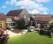
Woodman's Farm
Holiday Inn NORWICH - NORTH
Norfolk Mead
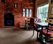
The Plough Inn
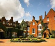
Sprowston Manor Marriott Hotel & Country Club
Mercure Norwich
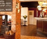
The Marsham Arms Inn
Holiday Inn Express NORWICH
BEST WESTERN BROOK HTL NORWICH
Wensum Guest House
Videos from this area
These are videos related to the place based on their proximity to this place.
From Norwich to Coltishall
SEE MY TRAVEL PAGE ON FACEBOOK : https://www.facebook.com/motorhomefulltime Coltishall is a village located just to the north of Norwich and this is the route to get to it. Coltishall, located...
Norfolk Wedding in Coltishall at the Norfolk Mead
A Video showing some of the Stills from a Wedding I shot at the Norfolk Mead hotel near Coltishall. See more of my work at http://photographybystephenthorpe.com/
Norfolk Journeys (Spring 09)
Filmed during Spring 09 in various locations, primarily Ranworth and the area between Newton St Faith and Horstead.
Horstead mill jackass kayaking
Alex Maine, Martin Klinge and Jez Strachan paddle at horstead mill in the summer of 2012!
Winter Wonderland at Hillside
A short film showing some of our rescued animals being cared for on a snowy day at Hillside. To help Hillside or for more info, please see: http://www.hillside.org.uk/HillsideDD.htm Filmed...
Horstead playboating practice
The usual wednesday night practice with an uncommon face making an appearance!
FIRST NORWICH: Dennis Trident To City 33164
3164 to city to have a meal out with our Aunty to end the 2 night stay nicely.
Bure Valley Train near Buxton and Lamas
Cheryl and I walked around this area of North Norfolk on Sunday; we were lucky enough to see a Bure Valley Railway train passing near the footpath between Lamas and Buxton.
My New Running Trainers!
Follow me: www.thetlady.wordpress.com facebook.com/TheTLady1 twitter.com/The_TLady instagram: thetlady So guys, I have been very practical this year and asked for new Running Trainers as a...
Videos provided by Youtube are under the copyright of their owners.
Attractions and noteworthy things
Distances are based on the centre of the city/town and sightseeing location. This list contains brief abstracts about monuments, holiday activities, national parcs, museums, organisations and more from the area as well as interesting facts about the region itself. Where available, you'll find the corresponding homepage. Otherwise the related wikipedia article.
Bure Valley Path
The Bure Valley Path is a 9-mile long walking trail and cycling trail in Norfolk, England. It runs alongside the Bure Valley Railway, a heritage railway from Wroxham to Aylsham.
City of Norwich Aviation Museum
The City of Norwich Aviation Museum is a volunteer run museum and charitable trust dedicated to the preservation of the aviation history of the county of Norfolk, England. The museum is located on the northern edge of Norwich International Airport and is reached by road through the village of Horsham St. Faith. The museum is open daily except Mondays during the summer months and on Wednesdays, some Fridays, Saturdays and Sundays through the winter. A small charge is made for admission.
Buxton railway station, Norfolk
Buxton railway station serves the village of Buxton in Norfolk and is served by the Bure Valley Railway. It is remarkable because it is one of the first stations on the Bure Valley Railway to have wireless internet access.
RAF Horsham St Faith
RAF Horsham St Faith was a Royal Air Force station near Norwich, Norfolk, England from 1939 to 1963. It was then developed as Norwich International Airport.
Horstead Hall
Horstead Hall was a country house in Norfolk that was demolished in the 1950s. The village of Horstead in the county of Norfolk is not short of country houses. Towards Norwich lie Horstead House and Heggatt Hall, while towards Buxton lies the Horstead Hall estate. The house lay in the middle of a substantial park. A seventeenth-century house stood here until 1835, when it was rebuilt in the Tudor style by Edward Harbord, 3rd Baron Suffield.
Buxton Watermill
Buxton Mill, is located on the River Bure about 0.5 miles east of the village of Buxton, Norfolk, and is in the hamlet of Lamas, Norfolk. A watermill was recorded here in the Domesday Book. The present mill is thought to date from 1754 and was built by William Pepper, a merchant living in Buxton.
Buxton Lamas railway station
Buxton Lamas was a railway station in Buxton with Lammas, Norfolk. It was located near the Bure Valley Railway's present Buxton station. Preceding station Disused railways Following station Aylsham South Great Eastern Railway Coltishall
Frettenham Windmill
Frettenham Mill is a Grade II listed tower mill at Frettenham, Norfolk, England which has been converted to residential accommodation.


