Safety Score: 3,0 of 5.0 based on data from 9 authorites. Meaning we advice caution when travelling to United Kingdom.
Travel warnings are updated daily. Source: Travel Warning United Kingdom. Last Update: 2024-04-26 08:02:42
Delve into Rackheath
Rackheath in Norfolk (England) with it's 1,628 habitants is located in United Kingdom about 102 mi (or 164 km) north-east of London, the country's capital town.
Current time in Rackheath is now 12:02 AM (Saturday). The local timezone is named Europe / London with an UTC offset of one hour. We know of 9 airports close to Rackheath, of which 3 are larger airports. The closest airport in United Kingdom is Norwich International Airport in a distance of 4 mi (or 7 km), West. Besides the airports, there are other travel options available (check left side).
There are several Unesco world heritage sites nearby. The closest heritage site in United Kingdom is Royal Botanic Gardens, Kew in a distance of 94 mi (or 151 km), South-West. Also, if you like playing golf, there is an option about 8 mi (or 13 km). away. If you need a hotel, we compiled a list of available hotels close to the map centre further down the page.
While being here, you might want to pay a visit to some of the following locations: Brundall, Surlingham, Rockland Saint Mary, Norwich and Hellington. To further explore this place, just scroll down and browse the available info.
Local weather forecast
Todays Local Weather Conditions & Forecast: 9°C / 49 °F
| Morning Temperature | 4°C / 40 °F |
| Evening Temperature | 10°C / 49 °F |
| Night Temperature | 4°C / 39 °F |
| Chance of rainfall | 0% |
| Air Humidity | 58% |
| Air Pressure | 1004 hPa |
| Wind Speed | Gentle Breeze with 7 km/h (4 mph) from West |
| Cloud Conditions | Overcast clouds, covering 88% of sky |
| General Conditions | Overcast clouds |
Saturday, 27th of April 2024
8°C (46 °F)
9°C (48 °F)
Moderate rain, moderate breeze, overcast clouds.
Sunday, 28th of April 2024
13°C (55 °F)
6°C (43 °F)
Moderate rain, fresh breeze, broken clouds.
Monday, 29th of April 2024
14°C (56 °F)
7°C (44 °F)
Sky is clear, moderate breeze, clear sky.
Hotels and Places to Stay
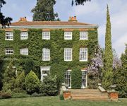
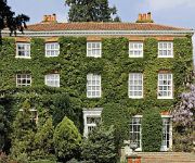
The Old Rectory Norwich
The Old Rectory
Norfolk Mead
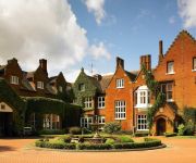
Sprowston Manor Marriott Hotel & Country Club
Holiday Inn NORWICH CITY
Hardwick House MAX Serviced Apartments Norwich
Hotel Belmonte
Colts Lodge B&B
OAKLANDS HOTEL AND COURT
The William IV
Videos from this area
These are videos related to the place based on their proximity to this place.
Thorpe St Andrew Lower School - Norwich
http://thorpestandrewschool.org.uk/ The Thorpe St Andrew School incorporates both a lower school and Sixth Form. tel: 01603 497711.
1 Intro to the Broads
General introduction to the Broads and boating holidays, including some traffic aerial video photography of the wonderful place which is the Broads.
Norfolk Broads, Barnes Brinkcraft Melody 2 Tour
A short video tour of the Barnes Brinkcraft Melody 2 boat on the Norfolk Broads. Short Review: We had a lovely week exploring the upper rivers of the Norfolk Broads on this amazing boat. The...
Vlog 2 - 12 Country Adventure and just practice - edog200 & darren950
Darren took me on a 100 hundred mile blast east along the freeway to Snetterton race circuit where met up with George Miller an Aston Martin enthusiast having a play on race day.
City College Norwich PROM: Thursday 4th July 2013
Our prom to finish the year off nicely which was GOOD FUN AND WE ALL ENJOYED IT VERY MUCH! It was 7-11pm so 2 hrs for meal then from 9pm was the disco and i was up on that dancefloor ...
CITY COLLEGE NORWICH PROM: Thursday 4th July 2013
Our prom to finish the year off nicely which was GOOD FUN AND WE ALL ENJOYED IT VERY MUCH! It was 7-11pm so 2 hrs for meal then from 9pm was the disco and i was up on that dancefloor ...
Sunset Beauty Norwich
Welcome to Sunset Beauty - situated on the beautiful River Green in Thorpe St Andrew Norwich. My name is Helen and I offer a range of beauty treatments including Brazilian and Hollywood Waxing...
First Norwich Dennis Trident Plaxton President 33235 LT52 WWY
Leaving Thorpe St Andrew Sainsbury's heading for Norwich centre once it fired up at Thorpe Sainsbury's. ENJOY :)
Reception, Yew Tree Guest House, Norwich, Norfolk
Welcome to the reception of Yew Tree Guest House, situated on the beautiful River Green, Thorpe St Andrew to the east of Norwich. For more information about our Guest House please visit our...
Videos provided by Youtube are under the copyright of their owners.
Attractions and noteworthy things
Distances are based on the centre of the city/town and sightseeing location. This list contains brief abstracts about monuments, holiday activities, national parcs, museums, organisations and more from the area as well as interesting facts about the region itself. Where available, you'll find the corresponding homepage. Otherwise the related wikipedia article.
Wroxham Broad
Wroxham Broad is on the River Bure near the village of Wroxham in Norfolk, England within The Broads National Park. The broad has an area of 34.4 hectares and a mean depth of 1.3 metres. It lies to the west of the Bure, with two navigable openings between river and broad. The village and broad lie in an area of fairly intensive agriculture, with areas of wet woodland adjoining the broad and river. The broad is home to the Norfolk Broads Yacht Club.
Broadland
Broadland is a local government district in Norfolk, England, named after the Norfolk Broads. Its council is based in Thorpe St Andrew, which is a suburb of the City of Norwich.
Salhouse railway station
Salhouse is a railway station serving the village of Salhouse in the English county of Norfolk. The station is served by local services operated by Greater Anglia on the Bittern Line,Bad rounding here{{#invoke:Math|precision_format| 10*1,000/1,609.344 | 1-0 }} miles (10 km) north east of Norwich towards Cromer and Sheringham.
Wroxham F.C
Wroxham Football Club is an English football club based in the town of Wroxham, about four miles north-east of Norwich, in Norfolk. The club are currently members of the Isthmian League Division One North. They joined the league from the Anglian Combination in 1988 when it added a second division and were promoted to the Premier Division at the first attempt. Since then they have won the Premier Division on eight occasions and reached the FA Vase final, losing 6–1 to Whitley Bay in 2009–10.
RAF Rackheath
Royal Air Force Station Rackheath or more simply RAF Rackheath is a former Royal Air Force station located 5 miles north east of Norwich, Norfolk, England.
Little Plumstead
Little Plumstead is a small village and parish in the county of Norfolk, England, about six miles east of Norwich. It is the home of Little Plumstead Hospital. Its church, St Protase and St Gervase, is one of 124 existing round-tower churches in Norfolk.
Whitlingham railway station
Whitlingham was a station in Whitlingham, Norfolk. The simple station has been demolished leaving no trace of its existence. However the footbridge is still in use for pedestrian use. Just east (away from Norwich and not in the photo) of the footbridge is the junction where services to Sheringham split from services Lowestoft and Great Yarmouth.
Norwich Northern Distributor Road
The Norwich Northern Distributor Road (also known as the Norwich Northern bypass, the Norwich Northern Distributor Route and the NDR) is a proposed 8.7 mile dual-carriageway linking the A47 to the south east of the city to the proposed Rackheath Eco-town and to Norwich International Airport to the north of Norwich. It was given 'Programme Entry' status by the Department for Transport in December 2009 with estimated completion in 2015 at a cost of £90.7m.


